Antarctica (5), Adelaide Island, Webb Island
Autor/Urheber:
Vincent van Zeijst
Attribution:
Das Bild ist mit 'Attribution Required' markiert, aber es wurden keine Informationen über die Attribution bereitgestellt. Vermutlich wurde bei Verwendung des MediaWiki-Templates für die CC-BY Lizenzen der Parameter für die Attribution weggelassen. Autoren und Urheber finden für die korrekte Verwendung der Templates hier ein Beispiel.
Shortlink:
Quelle:
Größe:
1716 x 1140 Pixel (414128 Bytes)
Beschreibung:
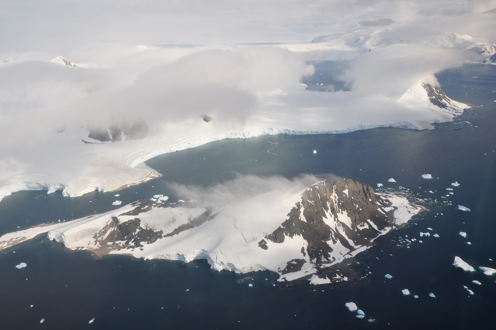
This picture is from the SW Antarctic Peninsula region. It's an aerial view from a position over Laubeuf Fjord, looking to the NW. In the foreground is Webb Island with its summit of 398 m. Behind it is a part of the Wright Peninsula on Adelaide Island's east coast. This coast's high ice cliffs are from the Wormald Ice Piedmont that covers most of the Wright Peninsula's east coast. The cloud-covered mountains on the left are the Stokes Peaks. The lone cloud-covered mountain at the right -at the NE extremity of the Wright Peninsula-is Sighing Peak; behind it is Stonehouse Bay. The maritime channel right of Sighing Peak is called Cole Channel (and is actually a part of Laubeuf Fjord). In the upper right hand corner of the picture is the Mount Bouvier Massif. At the foot of these mountains the Shambles Glacier can just be seen through a hole in the clouds. It is Adelaide Island's largest glacier and is heavily crevassed.
Lizenz:
Bild teilen:


Relevante Bilder

.svg)
.svg)


.svg)
.svg)


.svg)


.svg)
.svg)


,_Adelaide_Island,_Webb_Island.JPG?uselang=de)
Relevante Artikel
AntarktikaAntarktika ist der Südkontinent der Erde, auf dem auch der Südpol selbst liegt. Es liegt inmitten der Antarktis, mit der er umgangssprachlich oft identifiziert wird. Weitere Bezeichnungen sind Südkontinent und antarktischer Erdteil. Antarktika hat eine Fläche von etwa 14 Millionen Quadratkilometern und ist nahezu vollständig vom antarktischen Eisschild bedeckt. Geografisch unterscheidet man die Regionen Westantarktika und Ostantarktika. .. weiterlesen