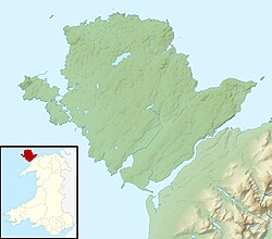
Angleseymôncloseup
(c) Kelisi aus der englischsprachigen Wikipedia, CC BY-SA 3.0
Autor/Urheber:
Kelisi in der Wikipedia auf Englisch
Shortlink:
Quelle:
Größe:
541 x 522 Pixel (14004 Bytes)
Beschreibung:
A map showing the Isle of Anglesey/Ynys Môn and nearby areas. This map's source is here, with the uploader's modifications, and the GMT homepage says that the tools are released under the GNU General Public License.
Lizenz:
Credit:
Übertragen aus en.wikipedia nach Commons.
Relevante Bilder

Contains Ordnance Survey data © Crown copyright and database right, CC BY-SA 3.0

Contains Ordnance Survey data © Crown copyright and database right (year), OS OpenData

(c) alan smethurst, CC BY-SA 2.0

(c) Geoff Barber, CC BY-SA 2.0

(c) Mat Fascione, CC BY-SA 2.0
Relevante Artikel
Holy Island (Anglesey)Holy Island ist eine Insel westlich von Anglesey im Norden von Wales. Der Name Heilige Insel beruht auf dem Umstand, dass sich auf der Insel eine Anzahl an Menhiren, Dolmen und anderen religiösen Stätten befindet. Der andere, historische Name der Insel ist Holyhead Island. Nach dem Census von 2011 hat die Insel 13.659 Bewohner. .. weiterlesen
