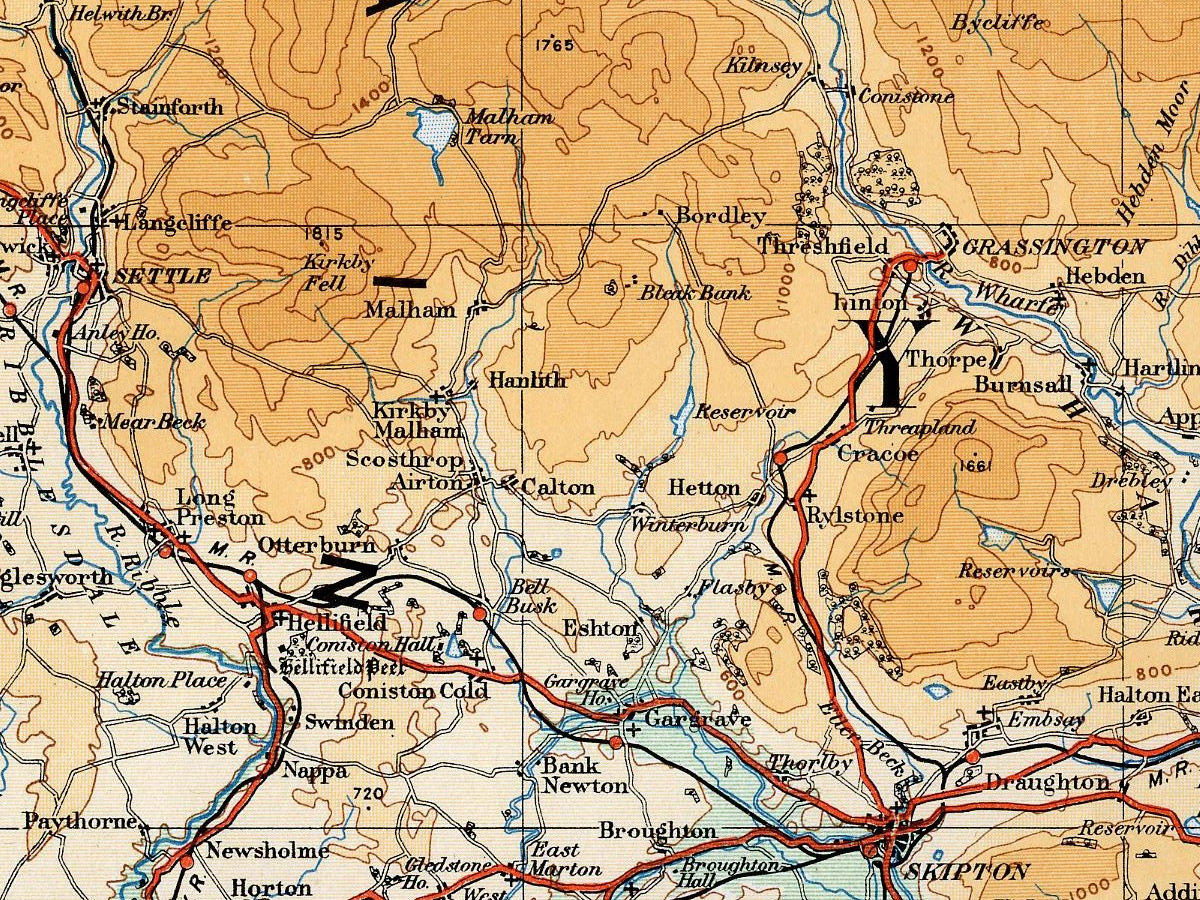
Airedale 1922 OS Map
Autor/Urheber:
JD554
Shortlink:
Quelle:
Größe:
1200 x 900 Pixel (2653621 Bytes)
Beschreibung:
Map of the Airedale area taken from the 1922 Ordnance Survey Atlas of England and Wales
Lizenz:
Public domain
Bild teilen:


Relevante Bilder
Contains Ordnance Survey data © Crown copyright and database right, CC BY-SA 3.0

Relevante Artikel
Malham TarnDer Malham Tarn ist ein See in der britischen Grafschaft North Yorkshire. .. weiterlesen