Abele dec 1 2010
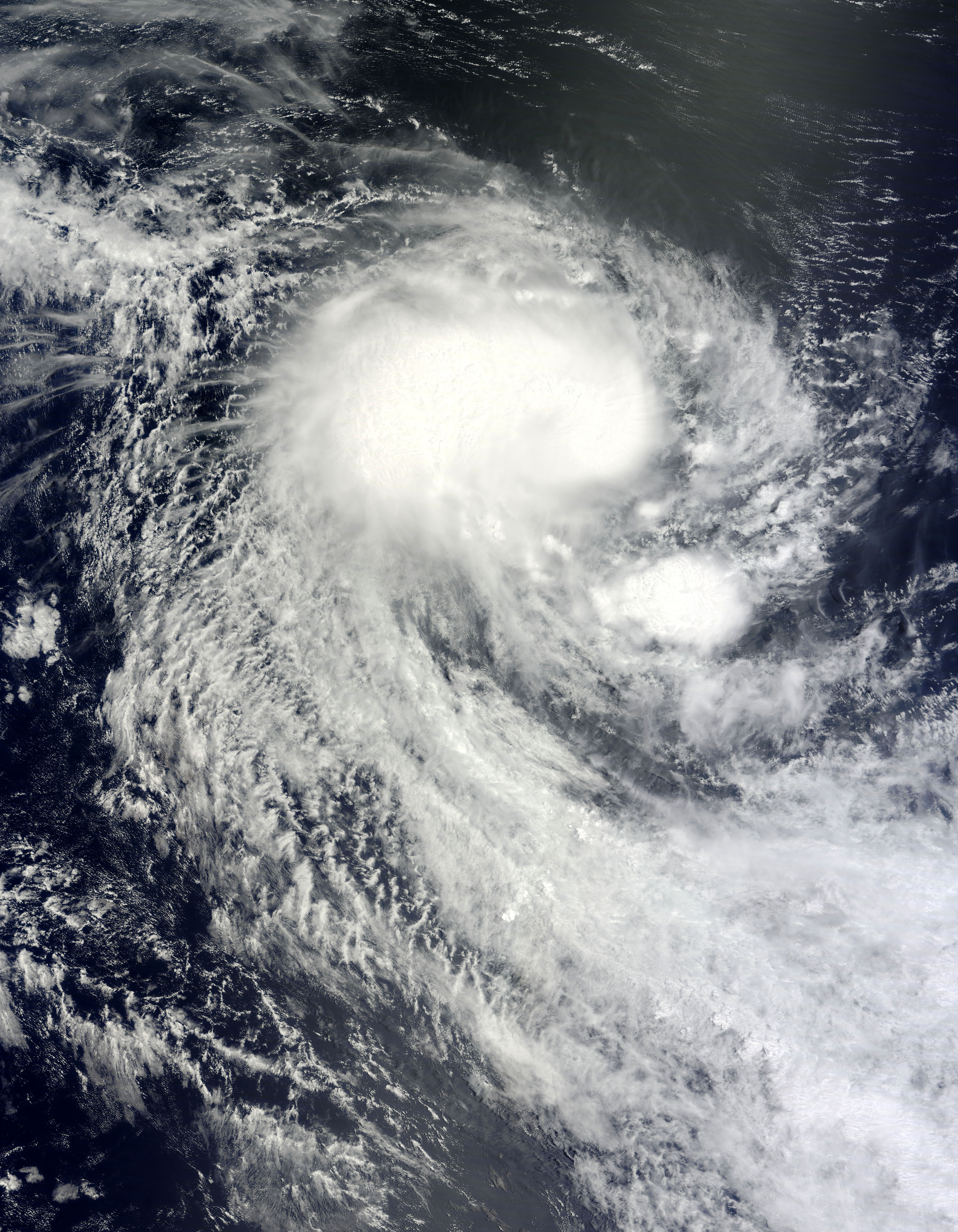
The Moderate Resolution Imaging Spectroradiometer (MODIS) on NASA’s Terra satellite captured this natural-color image of Abele on December 1, 2010. Abele spans hundreds of kilometers over the open ocean. The storm lacks a distinct eye, but sports the apostrophe shape characteristic of tropical cyclones.
Over the past two centuries, tropical cyclones have killed nearly two million people, and forecasters worldwide continually strive to improve storm forecasts. In less developed parts of the globe, a dearth of data has historically hampered predictions. A new tool in forecasters’s arsenal, however, is the Pleiades supercomputer at NASA’s Ames Research Center. Relying on Pleiades’ computing muscle, researchers have been able to model storm formation by feeding the computer data about wind speed, temperature, and mositure. In the case of Cyclone Nargis, which struck in 2008, researchers were able to replicate the tropical cyclone’s formation five days in advance. The project offered hope for improving future predictions worldwide.


Relevante Bilder


Relevante Artikel
Australische Zyklonsaison 2010–2011Die Australische Zyklonsaison 2010–2011 begann offiziell am 1. November 2010 und dauerte bis zum 30. April 2011. .. weiterlesen
Zyklonsaison im Südwestindik 2010–2011Die Zyklonsaison im Südwestindik 2010–2011 begann offiziell am 15. November 2010 und endete am 30. April 2011, mit Ausnahme von Mauritius und den Seychellen, wo sie erst am 15. Mai 2011 endete. Diese Daten begrenzen konventionell die Zeit des meteorologischen Jahres der Südhalbkugel, in denen sich im südwestlichen Indik die meisten tropischen Wirbelstürme bilden. Das erste tropische System bildete sich jedoch bereits am 25. Oktober 2010. Die tropischen Wirbelstürme in diesem Becken werden durch das Regional Specialized Meteorological Centre (RSMC) in La Réunion, Frankreich überwacht. Das Verantwortungsgebiet von Météo-France umfasst den Indischen Ozean südlich des Äquators und westlich von 90° östlicher Länge. Tropische Wirbelstürme in diesem Bereich werden Zyklone genannt. Das Joint Typhoon Warning Center (JTWC) in Honolulu beobachtet ebenfalls das Wettergeschehen in diesem Seegebiet; es gibt Sturmwarnungen aus, die sich primär an Einrichtungen der Streitkräfte der Vereinigten Staaten im Indischen Ozean richten. .. weiterlesen