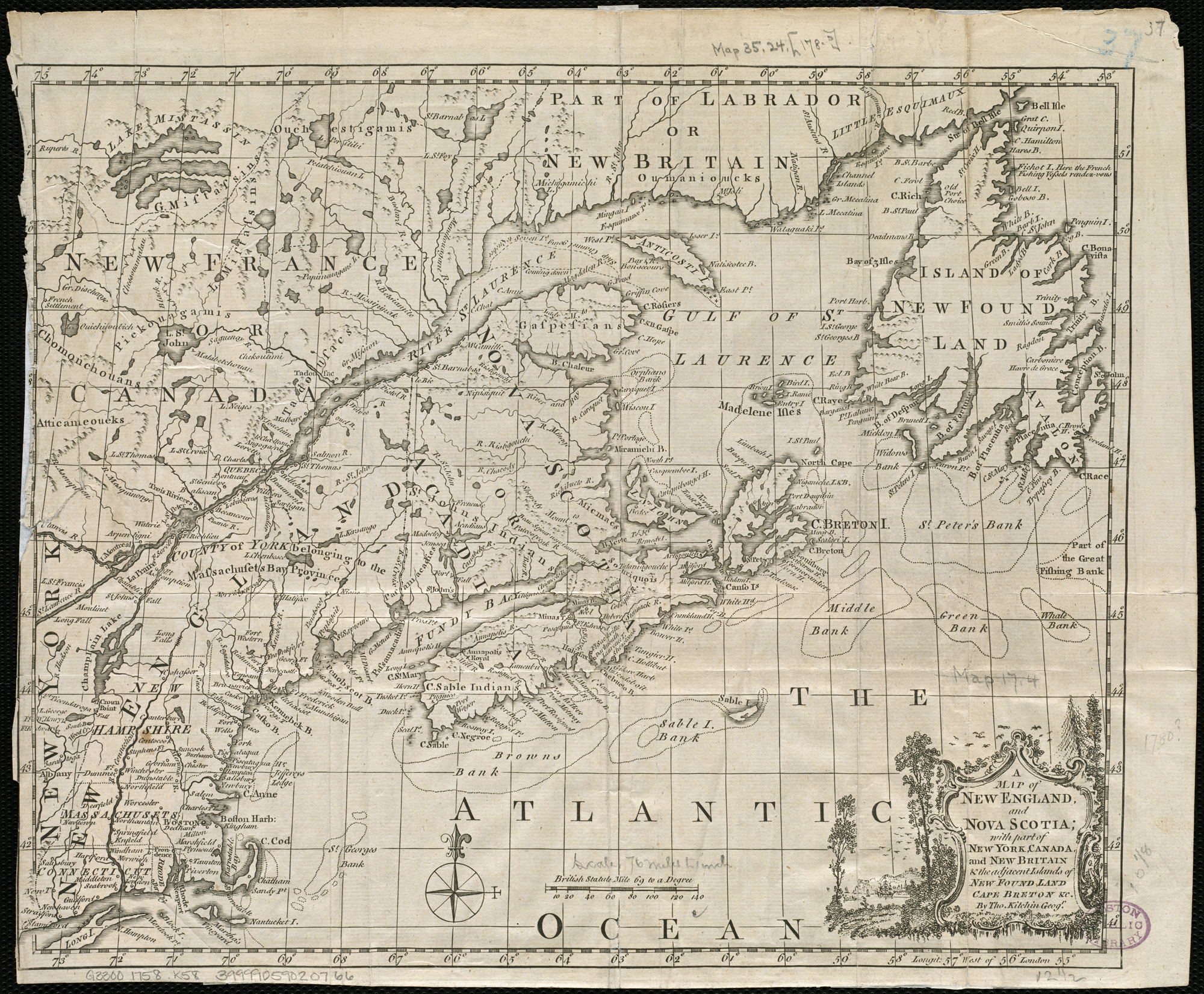
A map of New England, and Nova Scotia, with part of New York, Canada, and New Britain & the adjacent islands of New Found Land, Cape Breton &c. (4231924992)
.jpg?uselang=de)
Zoom into this map at maps.bpl.org.
Author: Kitchin, Thomas Date: 1758 Location: Canada, Eastern, Cape Breton Island (N.S.), Labrador, New England, New Foundland, North America, Nova Scotia
Dimension: 26x33cm Scale: ca. 1:4,800,000
Call Number: G3300 1758 .K58


Relevante Bilder

Relevante Artikel
Kolonie NeufundlandDie Kolonie Neufundland war eine englische und später britische Kolonie auf dem Gebiet der heutigen kanadischen Provinz Neufundland und Labrador. Sie wurde 1610 etabliert, nachdem es zuvor schon mehrere Jahrzehnte lang eine sporadische Siedlungstätigkeit auf der Insel Neufundland gegeben hatte. 1854 wurde sie eine selbstregierende Kronkolonie im Britischen Empire und erhielt 1907 den Status eines Dominions. Das Dominion Neufundland schloss sich schließlich 1949 als zehnter Bundesstaat der kanadischen Konföderation an. .. weiterlesen