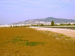
AN AERIAL PHOTO OF Afula
Autor/Urheber:
Shortlink:
Quelle:
Größe:
1955 x 938 Pixel (415093 Bytes)
Beschreibung:
AN AERIAL PHOTO OF THE SETTLEMENT AFULA. צילום אויר של היישוב עפולה. On the bottom left is the great synagogue of Afula. Beyond it is the wter tower of Afula, now on Rabbi Levin street 10, Afula. The straight road coming out of Afula is the B60 road to Nazereth. Far away are the mountains of Nazereth. To the right of the road is Balfouria and farther away is Tel Adashim. Kfar Gideon is also seen on both sides of B60.
Lizenz:
Public domain
Credit:
This is available from National Photo Collection of Israel, Photography dept. Government Press Office (link), under the digital ID D332-060.
This tag does not indicate the copyright status of the attached work. A normal copyright tag is still required. See Commons:Licensing for more information.
This tag does not indicate the copyright status of the attached work. A normal copyright tag is still required. See Commons:Licensing for more information.
Relevante Bilder


(c) Photographer: Israel Press and Photo Agency (I.P.P.A.) / Dan Hadani collection, Israelische Nationalbibliothek / CC BY 4.0

(c) Heritage Conservation Project - Trains Pikiwiki Israel, CC BY 2.5


(c) Karte: NordNordWest, Lizenz: Creative Commons by-sa-3.0 de


Relevante Artikel
AfulaAfula ist eine Stadt in Israel. .. weiterlesen
