Zyklonsaison im Nordindik 2014
 Alle Stürme der Saison | |
| Aktive Systeme | – |
|---|---|
| Bildung des ersten Sturms | 4. Januar 2014 |
| Auflösung des letzten Sturms | |
| Stärkster Sturm | Nilofar – 950 hPa (mbar), 110 kn (205 km/h) (3-minütig) |
| Depressions | 8 |
| Deep Depressions | 5 |
| Zyklonische Stürme | 3 |
| Schwere zyklonische Stürme | 3 |
| Opferzahl gesamt | 132 total |
| Gesamtschaden | Mindestens 11 Milliarden $ (2014) |
| Nordindik-Zyklonsaison 2012, 2013, 2014, 2015, 2016 | |
Die Zyklonsaison im Nordindik 2014 hat keine offiziellen Grenzen wie in anderen Becken üblich, sondern läuft das ganze Jahr hindurch. Die tropischen Wirbelstürme bilden sich allerdings in diesem Becken in der Regel zwischen April und Dezember, wobei die Monate vor und nach der Monsunsaison, also April/Mai und Oktober/November die aktivsten sind. Einen tropischen Wirbelsturm im Indischen Ozean bezeichnet man als Zyklon.
Das zuständige Regional Specialized Meteorological Centre (RSMC) ist das India Meteorological Department in Neu-Delhi. Dieses vergibt für diejenigen tropischen Wirbelstürme, die mindestens den Status eines Zyklons erreichen, einen Namen. Tiefdruckgebiete (je nach Windgeschwindigkeit depressions oder deep depressions) werden fortlaufend nummeriert, wobei die Buchstabenkombination BOB anzeigt, dass sich das System im Golf von Bengalen bildete. Die Buchstaben ARB stehen sinngemäß für das Arabische Meer.
Durch das Joint Typhoon Warning Center (JTWC) in Honolulu werden für die US-amerikanischen Einrichtungen im Indischen Ozean eigenständige Warnungen und Prognosen ausgegeben. Durch das JTWC erfolgt die Einstufung nach der Saffir-Simpson-Hurrikan-Windskala, das RSMC wendet für die Einstufung eigene Kriterien an, denen unter anderem die Messung der andauernden Windgeschwindigkeit auf Basis einer dreiminütigen Beobachtung zugrunde liegt.
Sturmnamen
Tropische Wirbelstürme im Indischen Ozean werden durch das RSMC des India Meteorological Department benannt. Die Namen werden jeweils nur einmal verwendet, es werden also keine Namen verheerender Stürme nach Ende der Saison von der Liste der Namen tropischer Wirbelstürme gestrichen. Die folgenden Namen wurden für benannte Stürme benutzt:
- Nanauk, Hudhud, Nilofar
Stürme
Depression BOB 01 (01B)
| Depression (IMD) | |||
|---|---|---|---|
| Tropischer Sturm | |||
| |||
| Dauer | 4. Januar – 7. Januar | ||
| Intensität | 25 kn (45 km/h) (3-minütig), 1004 hPa | ||
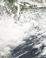
Früh am 4. Januar meldete das India Meteorological Department (IMD) die Bildung einer Depression über dem südwestlichen Golf von Bengalen, etwa 250 km östlich von Trincomalee, Sri Lanka.[1][2] Zur selben Zeit begann auch das Joint Typhoon Warning Center (JTWC) das System zu beobachten und gab diesem die Bezeichnung 01B.[3] Am Abend desselben Tages bewegte sich die Depression nur sehr langsam Richtung Westen-Nordwesten und befand sich nun etwa 150 km ost-nordöstlich von Trincomalee.[4] Auch früh am 5. Januar konnte das System sich nicht signifikant intensivieren und blieb bei dem Status als Depression.[5] 24 Stunden später ging sie in der Nähe von Mullaitivu, Sri Lanka an Land.[6] Am Morgen des 7. Januar gab das India Meteorological Department die letzte Warnung heraus.[7][8]
Depression BOB 02
| Depression (IMD) | |||
|---|---|---|---|
| |||
| Dauer | 21. Mai – 23. Mai | ||
| Intensität | 25 kn (45 km/h) (3-minütig), 1000 hPa | ||
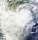
Am Morgen des 21. Mai begann das India Meteorological Department (IMD) mit der Beobachtung einer Depression, die sich etwa 490 km nord-nordwestlich von Port Blair, Indien und 620 km west-südwestlich von Rangun, Myanmar befand.[9] Bereits zwei Tage später wurde die letzte Warnung zu dem System herausgegeben, als es über dem zentralen Golf von Bengalen analysiert wurde.[10]
Zyklonischer Sturm Nanauk (02A)
| Zyklonischer Sturm (IMD) | |||
|---|---|---|---|
| Tropischer Sturm | |||
| |||
| Dauer | 10. Juni – 14. Juni | ||
| Intensität | 45 kn (85 km/h) (3-minütig), 986 hPa | ||
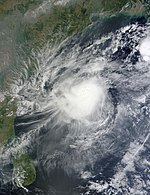
Am frühen Morgen des 10. Juni meldete das Joint Typhoon Warning Center (JTWC), dass sich etwa 600 km südwestlich von Mumbai, Indien über dem Arabischen Meer ein tropischer Sturm gebildet hat, der die Bezeichnung 02A bekam.[11] Im Verlauf des Tages begann auch das India Meteorological Department (IMD) mit der Beobachtung des Systems und aktualisierte es zu einer Depression.[12] Sie bewegte sich Richtung Nordwesten und intensivierte sich am Abend desselben Tages in eine Deep Depression.[13] In der Nacht zum 11. Juni erkannte das India Meteorological Department, dass das Tiefdruckgebiet Sturmstärke erreicht hat und stufte es deshalb zu einem zyklonischen Sturm herauf, der den Namen Nanauk erhielt.[14]
Land Depression 01
| Depression (IMD) | |||
|---|---|---|---|
| |||
| Dauer | 21. Juli – 22. Juli | ||
| Intensität | 25 kn (45 km/h) (3-minütig) | ||
Früh am 21. Juli begann das India Meteorological Department (IMD) eine Land Depression zu beobachten, die sich über dem nordöstlichen Odisha, Indien befand.[15]
Land Depression 02
| Deep Depression (IMD) | |||
|---|---|---|---|
| |||
| Dauer | 4. August – 7. August | ||
| Intensität | 30 kn (55 km/h) (3-minütig) | ||
Sehr schwerer zyklonischer Sturm Hudhud (03B)
| Extrem schwerer zyklonischer Sturm (IMD) | |||
|---|---|---|---|
| Kategorie-4-Zyklon | |||
| |||
| Dauer | 7. Oktober – 14. Oktober | ||
| Intensität | 100 kn (185 km/h) (3-minütig), 950 hPa | ||
Am Morgen des 7. Oktober meldete das India Meteorological Department (IMD), dass sich über der nördlichen Andamanensee, etwa 250 km ost-südöstlich von Long Island, eine Depression gebildet hat.[16] Wenige Stunden später intensivierte sich das System in eine Deep Depression, während es sich in eine west-nordwestliche Richtung bewegte.[17]
Hudhud erreichte das Festland nahe der Millionenstadt Visakhapatnam mit andauernden Windgeschwindigkeiten von rund 175 km/h und zog dann Richtung Norden.[18]
Durch die Auswirkungen des Sturmes sind in Indien mindestens 66 Menschen ums Leben gekommen: 46 in Andhra Pradesh,[19] 2 in Odisha[20] und 18 in Uttar Pradesh.[21] Außerdem sind in Nepal bei einem Schneesturm, der wahrscheinlich mit dem Zyklon im Zusammenhang steht, mindestens 43 Menschen getötet worden.[22]
Sehr schwerer zyklonischer Sturm Nilofar (04A)
| Extrem schwerer zyklonischer Sturm (IMD) | |||
|---|---|---|---|
| Kategorie-4-Zyklon | |||
| |||
| Dauer | 25. Oktober – 31. Oktober | ||
| Intensität | 110 kn (205 km/h) (3-minütig), 950 hPa | ||
Am frühen Morgen des 25. Oktober begann das India Meteorological Department (IMD) mit der Beobachtung einer Depression, die sich etwa 940 km ost-südöstlich von Salala, Oman über dem zentralen Arabischen Meer befand.[23] Später am selben Tag stufte das Joint Typhoon Warning Center (JTWC) das System zu einem tropischen Sturm herauf, der daraufhin die Identifikation 04A erhielt.[24]
Deep Depression BOB 04 (05B)
| Deep Depression (IMD) | |||
|---|---|---|---|
| Tropischer Sturm | |||
| |||
| Dauer | 5. November – 8. November | ||
| Intensität | 30 kn (55 km/h) (3-minütig), 1000 hPa | ||
Saisonüberblick
Siehe auch
- Zyklonsaisons im Südwestindik: 2013–2014, 2014–2015
- Australische Zyklonsaisons: 2013–2014, 2014–2015
- Pazifische Hurrikansaison 2014
- Atlantische Hurrikansaison 2014
- Pazifische Taifunsaison 2014
- Südpazifische Zyklonsaisons: 2013–2014, 2014–2015
Weblinks
- India Meteorological Department. In: mausam.imd.gov.in. 27. Mai 2023 (englisch).
- Joint Typhoon Warning Center (JTWC). Naval Meteorology & Oceanography Command (englisch).
Einzelnachweise
- ↑ Special Tropical Weather Outlook for North Indian Ocean, Issued at 0600 UTC on 4 January 2014. India Meteorological Department, 4. Januar 2014, archiviert vom ; abgerufen am 4. Januar 2014 (englisch).
- ↑ CWIND Bulletin Number 01 for Depression BOB 01. India Meteorological Department, 4. Januar 2014, archiviert vom ; abgerufen am 4. Januar 2014 (englisch).
- ↑ Tropical Cyclone 01B (One) Warning Number 001. Joint Typhoon Warning Center, 4. Januar 2014, archiviert vom ; abgerufen am 4. Januar 2014 (englisch).
- ↑ CWIND Bulletin Number 04 for Depression BOB 01. India Meteorological Department, 4. Januar 2014, archiviert vom ; abgerufen am 5. Januar 2014 (englisch).
- ↑ Special Tropical Weather Outlook for North Indian Ocean, Issued at 0600 UTC on 5 January 2014. India Meteorological Department, 5. Januar 2014, archiviert vom ; abgerufen am 5. Januar 2014 (englisch).
- ↑ CWIND Bulletin Number 12 for Depression BOB 01. India Meteorological Department, 6. Januar 2014, archiviert vom ; abgerufen am 6. Januar 2014 (englisch).
- ↑ Special Tropical Weather Outlook for North Indian Ocean, Issued at 0600 UTC on 7 January 2014. India Meteorological Department, 7. Januar 2014, archiviert vom ; abgerufen am 7. Januar 2014 (englisch).
- ↑ CWIND Bulletin Number 15 for Depression BOB 01. India Meteorological Department, 7. Januar 2014, archiviert vom ; abgerufen am 7. Januar 2014 (englisch).
- ↑ CWIND Bulletin Number 01 for Depression BOB 02. India Meteorological Department, 21. Mai 2014, archiviert vom am 13. Mai 2014; abgerufen am 21. Mai 2014 (englisch).
- ↑ CWIND Bulletin Number 11 for Depression BOB 02. India Meteorological Department, 23. Mai 2014, archiviert vom ; abgerufen am 23. Mai 2014 (englisch).
- ↑ Tropical Cyclone 02A (Two) Warning Number 001. Joint Typhoon Warning Center, 10. Juni 2014, archiviert vom ; abgerufen am 10. Juni 2014 (englisch).
- ↑ Special Tropical Weather Outlook for North Indian Ocean, Issued at 1200 UTC on 10 June 2014. India Meteorological Department, 10. Juni 2014, archiviert vom ; abgerufen am 10. Juni 2014 (englisch).
- ↑ Special Tropical Weather Outlook for North Indian Ocean, Issued at 2100 UTC on 10 June 2014. India Meteorological Department, 10. Juni 2014, archiviert vom ; abgerufen am 11. Juni 2014 (englisch).
- ↑ CWIND Bulletin Number 04 for Cyclonic Storm Nanauk. India Meteorological Department, 11. Juni 2014, archiviert vom ; abgerufen am 11. Juni 2014 (englisch).
- ↑ Tropical Weather Outlook for North Indian Ocean, Issued at 0600 UTC on 21 July 2014. India Meteorological Department, 21. Juli 2014, archiviert vom ; abgerufen am 21. Juli 2014 (englisch).
- ↑ Special Tropical Weather Outlook for North Indian Ocean, Issued at 0600 UTC on 7 October 2014. India Meteorological Department, 7. Oktober 2014, archiviert vom ; abgerufen am 7. Oktober 2014 (englisch).
- ↑ Special Tropical Weather Outlook for North Indian Ocean, Issued at 1500 UTC on 7 October 2014. India Meteorological Department, 7. Oktober 2014, archiviert vom ; abgerufen am 8. Oktober 2014 (englisch).
- ↑ Cyclone Hudhud LIVE updates: Storm damages railway tracks in Andhra Pradesh. India Today, 13. Oktober 2014, abgerufen am 16. Oktober 2014 (englisch).
- ↑ Hudhud killed 46 in Andhra Pradesh, 21 lakh families hit. The Times of India, 25. Oktober 2014, abgerufen am 30. Oktober 2014 (englisch).
- ↑ Cyclone Hudhud: 2 killed in Odisha, 68,000 people moved to safer places. The Times of India, 12. Oktober 2014, abgerufen am 15. Oktober 2014 (englisch).
- ↑ Cyclone Hudhud impact: Heavy rain kills 18 in Uttar Pradesh. India Today, 15. Oktober 2014, abgerufen am 15. Oktober 2014 (englisch).
- ↑ Storm toll jumps to 43 in Nepal's worst trekking disaster. The Times of India, 18. Oktober 2014, abgerufen am 26. Oktober 2014 (englisch).
- ↑ Special Tropical Weather Outlook for North Indian Ocean, Issued at 0300 UTC on 25 October 2014. India Meteorological Department, 25. Oktober 2014, archiviert vom ; abgerufen am 25. Oktober 2014 (englisch).
- ↑ Tropical Cyclone 04A (Four) Warning Number 001. Joint Typhoon Warning Center, 25. Oktober 2014, archiviert vom ; abgerufen am 25. Oktober 2014 (englisch).
Auf dieser Seite verwendete Medien
Track map of Depression BOB 02 of the 2014 North Indian Ocean cyclone season. The points show the location of the storm at 6-hour intervals. The colour represents the storm's maximum sustained wind speeds as classified in the (see below), and the shape of the data points represent the nature of the storm, according to the legend below.
Storm type
Track map of Deep Depression BOB 04 of the 2014 North Indian Ocean cyclone season. The points show the location of the storm at 6-hour intervals. The colour represents the storm's maximum sustained wind speeds as classified in the (see below), and the shape of the data points represent the nature of the storm, according to the legend below.
Storm type
Land Depression over the Indian state of Odisha on 21 July 2014.
Tropical Cyclone Giri (04B) over Myanmar
The Visible Infrared Imaging Radiometer Suite (VIIRS) sensor on Suomi-NPP captured this image of Very Severe Cyclonic Storm Nilofar shortly before peak intensity on October 28, 2014, at 09:39 Universal Time.
Depression BOB 02 over the Bay of Bengal on May 22, 2014 near peak intensity,
Cyclonic Storm Nanauk near peak intensity on June 12, 2014 over the Bay of Bengal
Track map of Cyclonic Storm Nanauk of the 2014 North Indian Ocean cyclone season. The points show the location of the storm at 6-hour intervals. The colour represents the storm's maximum sustained wind speeds as classified in the (see below), and the shape of the data points represent the nature of the storm, according to the legend below.
Storm type
Tropical Cyclone Hudhud (03B) over India
This map shows the tracks of all tropical cyclones in the 2014 North Indian Ocean cyclone season. The points show the location of each storm at 6-hour intervals. The colour represents the storm's maximum sustained wind speeds as classified in the Saffir-Simpson Hurricane Scale (see below), and the shape of the data points represent the type of the storm. Map generation parameters: --xmin 45 --xmax 100
Satellite image, taken by the MODIS instrument aboard NASA's TERRA satellite, of the first tropical depression in the North Indian Ocean in 2014.
Tropical Cyclone Five (05B) in the Bay of Bengal
Track map of Extremely Severe Cyclonic Storm Hudhud of the 2014 North Indian Ocean cyclone season. The points show the location of the storm at 6-hour intervals. The colour represents the storm's maximum sustained wind speeds as classified in the (see below), and the shape of the data points represent the nature of the storm, according to the legend below.
Storm type
Track map of Depression BOB 01 of the 2014 North Indian Ocean cyclone season. The points show the location of the storm at 6-hour intervals. The colour represents the storm's maximum sustained wind speeds as classified in the (see below), and the shape of the data points represent the nature of the storm, according to the legend below.
Storm type
Track map of Extremely Severe Cyclonic Storm Nilofar of the 2014 North Indian Ocean cyclone season. The points show the location of the storm at 6-hour intervals. The colour represents the storm's maximum sustained wind speeds as classified in the (see below), and the shape of the data points represent the nature of the storm, according to the legend below.
Storm type
LAND 02, a deep depression over the India on 5 August 2014.


