Ziegler-Insel
| Ziegler-Insel | ||
|---|---|---|
 | ||
| Gewässer | Arktischer Ozean | |
| Inselgruppe | Franz-Josef-Land | |
| Geographische Lage | 81° 0′ N, 57° 15′ O | |
| ||
| Länge | 45 km | |
| Breite | 18 km | |
| Fläche | 448 km² | |
| Höchste Erhebung | 554 m | |
| Einwohner | unbewohnt | |
 | ||
Die Ziegler-Insel (russisch Остров Циглера) ist eine unbewohnte Insel des zu Russland gehörenden arktischen Franz-Josef-Landes.
Geographie

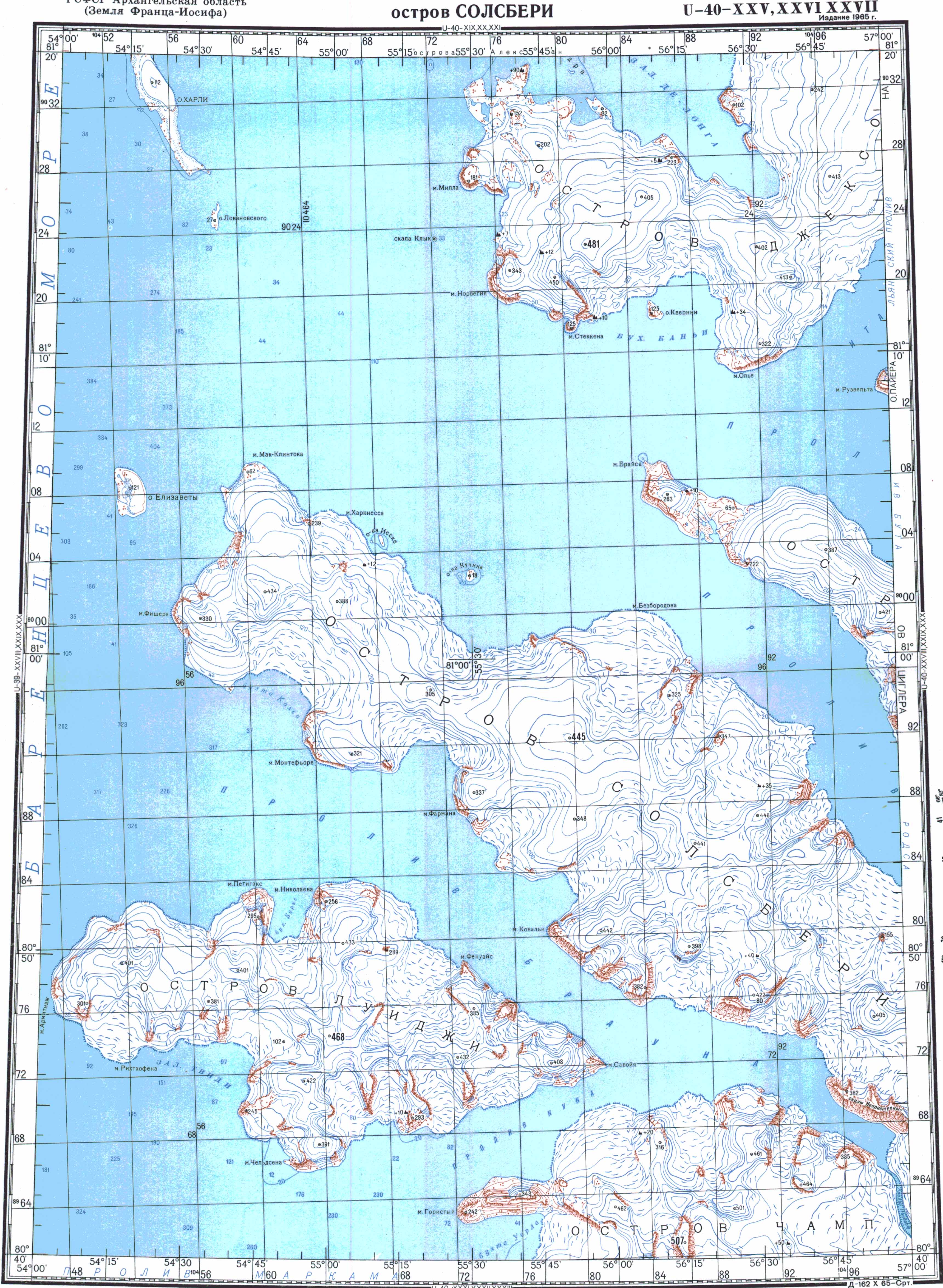
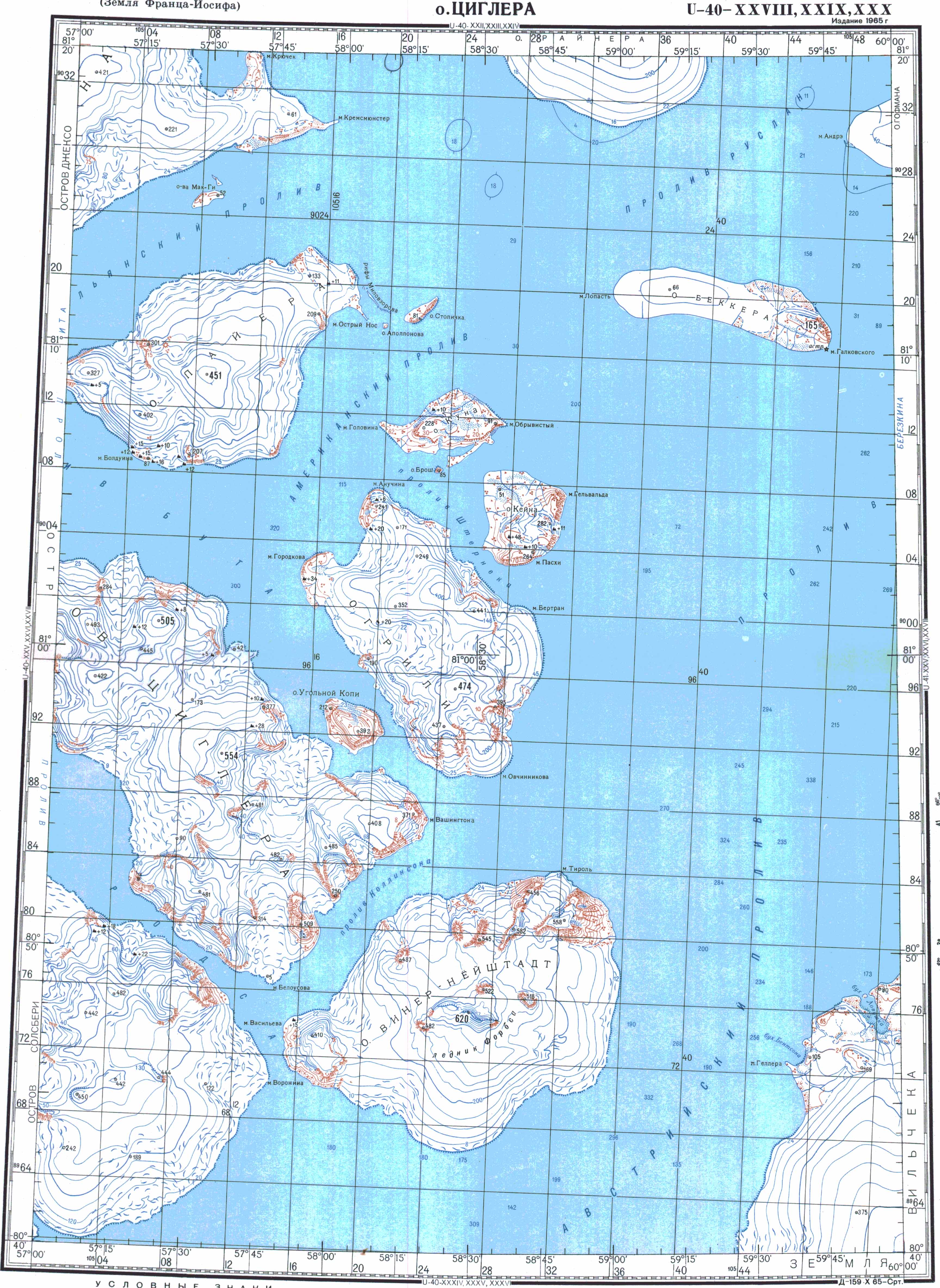
Die Ziegler-Insel liegt im zentralen Teil Franz-Josef-Lands. Die Insel ist langgestreckt und von Nordwesten nach Südosten orientiert. Sie ist etwa 45 Kilometer lang und an ihrem südöstlichen Ende bis zu 18 Kilometer breit. Mit einer Fläche von 448 km²[1] ist sie die elftgrößte des Archipels. Von ihren Nachbarinseln ist die Ziegler-Insel durch nur wenige Kilometer breite Meerengen getrennt, die auch im Sommer oft zugefroren bleiben. Im Südwesten liegt hinter dem Rhodes-Kanal die Salisbury-Insel, im Südosten hinter dem Collinson-Kanal die Wiener-Neustadt-Insel. Der Booth-Kanal im Nordosten trennt die Ziegler-Insel von der Jackson-, der Payer- und der Greely-Insel. Zwischen Ziegler- und Greely-Insel liegt die kleine Insel Ostrow Ugolnoi Kopi (so viel wie „Kohlemineninsel“). Bis auf steile Bergflanken und ein kleines Gebiet eisfreien Tieflands im Nordwesten ist die Insel von Gletschern bedeckt, aus denen vereinzelt Felsen aufragen.
Geschichte
Der Süden der Insel wurde bereits von der Österreich-Ungarischen Nordpolexpedition im Frühjahr 1874 gesichtet. Julius von Payer hielt sie und ihre Nachbarinseln für Teile einer größeren Landmasse, die er nach einem Sponsor seiner Expedition „Zichy-Land“ nannte. Die Jackson-Harmsworth-Expedition von 1894 bis 1897 entdeckte Kap Brice, das Nordwestkap der Insel. Erst durch die Fiala-Ziegler-Expedition von 1903 bis 1905 wurde die Eigenständigkeit der Insel erkannt und diese kartiert. Benannt wurde sie nach dem Sponsor dieser Expedition, William Ziegler (1843–1905).[2]
Von 1992 bis 1996 drehte der ORF an der Nordküste der Ziegler-Insel Szenen seiner dreiteiligen Dokumentation Arktis Nordost über die Österreichisch-Ungarische Nordpolexpedition. Dazu brachte der Atomeisbrecher Taymyr einen Nachbau des Expeditionsschiffs Admiral Tegetthoff nach Franz-Josef-Land. Parallel zu den Filmarbeiten wurde eine österreichische Forschungsstation aus Wohn- und Arbeitscontainern aufgebaut, die aber letztlich nicht genutzt und an Russland übereignet wurde.[2]
Weblinks
- Topografische Karte U-40-XXV,XXVI,XXVII Ostrow Solsberi 1:200.000, 1965
- Topografische Karte U-40-XXVIII,XXIX,XXX Ostrow Ziglera 1:200.000, 1965
- Andreas Umbreit: Ziegler Insel – Franz-Joseph-Land (Memento vom 28. Januar 2021 im Internet Archive)
Einzelnachweise
- ↑ Umweltprogramm der Vereinten Nationen (Memento vom 4. Februar 2012 im Internet Archive)
- ↑ a b Andreas Umbreit: Ziegler Insel – Franz-Joseph-Land
Aagaard-Insel | Adelaide-Insel | Alexandraland | Alger-Insel | Apollonow-Insel | Arthur-Insel | Becker-Insel | Bell-Insel | Berghaus-Insel | Bliss-Insel | Borisjak-Insel | Brady-Insel | Brosch-Insel | Brice-Insel | Bromwich-Insel | Brown-Inseln | Bruce-Insel | Champ-Insel | Coburg-Insel | David-Insel | Davis-Insel | Derewjanny-Insel | Dicks-Insel | Eaton-Insel | Etheridge-Inseln | Elizabeth-Insel | Eva-Liv-Insel | Freeden-Insel | Geddes-Insel | Gorbunow-Insel | Graham-Bell-Insel | Greely-Insel | Hall-Insel | Harley-Insel | Hayes-Insel | Hochstetter-Inseln | Hoffmann-Insel | Hohenlohe-Insel | Hooker-Insel | Houen-Insel | Iwanow-Insel | Jackson-Insel | Jefferson-Insel | Kane-Insel | Karl-Alexander-Insel | Klagenfurt-Insel | Kling-Insel | Knospe-Insel | Koettlitz-Insel | Koldewey-Insel | Komsomol-Inseln | Kupolok-Insel | Kutschin-Inseln | Kuhn-Insel | La-Ronciere-Insel | Lamont-Insel | Leigh-Smith-Insel | Lewanewski-Insel | Luigi-Insel | Lütke-Insel | Mabel-Insel | MacGee-Inseln | May-Insel | Maly-Insel | Marley-Insel | Mathilda-Insel | McClintock-Insel | McNulty-Insel | Nansen-Insel | Newcomb-Insel | Newton-Insel | Nitsch-Insel | Northbrook-Insel | Nowy-Insel | Ommanney-Insel | Payer-Insel | Perlmutt-Insel | Pontremoli-Inseln | Prinz-Georg-Land | Querini-Insel | Rainer-Insel | Robinson-Insel | Royal-Society-Insel | Rudolf-Insel | Salisbury-Insel | Salm-Insel | Schönau-Insel | Scott-Keltie-Insel | Solowjow-Insel | Stoliczka-Insel | Sub-Insel | Tillo-Insel | Torup-Insel | Tom-Insel | Trjochlutschewoi-Insel | Tschitschagow-Inseln | Udatschny-Insel | Ugolnoi-Kopi-Insel | Weyprecht-Insel | Windward-Insel | Wiener-Neustadt-Insel | Wilczek-Insel | Wilczek-Land | Ziegler-Insel
Auf dieser Seite verwendete Medien
Autor/Urheber: User:Mysid, Lizenz: CC BY-SA 3.0
Map of central Franz Josef Land

Autor/Urheber: Nzeemin, Lizenz: CC BY-SA 3.0
Физическая карта -- Земля Франца-Иосифа, Россия.
- Проекция: Lambert Azimuthal Equal-Area
- Longitude and latitude of the projection center: 55 / 80.8
- Инструменты: GMT

Autor/Urheber: Oona Räisänen (übersetzt durch Thariama), Lizenz: CC BY 3.0
Karte des russischen Franz-Josef-Land.
Autor/Urheber: BorisSolovyev, Lizenz: CC BY-SA 4.0
Cape Brice, Ziegler Island, Franz Josef Land
Autor/Urheber: NASA's Earth Observatory, Lizenz: CC BY 2.0
To download the full resolution and other files go to: earthobservatory.nasa.gov/IOTD/view.php?id=76883&src=...
Located just 600 miles (970 kilometers) from the North Pole, Franz Josef Land is perpetually coated with ice. Glaciers cover roughly 85 percent of the archipelago’s land masses, and sea ice floats in the channels between islands even in the summertime.
The Advanced Spaceborne Thermal Emission and Reflection Radiometer (ASTER) on NASA’s Terra satellite observed the islands of central Franz Josef Land on August 16 and 19, 2011. (Another sensor on Terra captured a wider view on August 17, 2011.)
The image above was made from a combination of visible and near-infrared wavelengths, and ice appears in shades of white and pale blue. The amount of sea ice filling the channels between the islands of Franz Josef Land varies from summer to summer. Captured toward the end of the Northern Hemisphere melt season, this shot shows a modest amount of sea ice on the ocean surface. Some of the ice has accumulated in bays like the one near northeastern Zieger Island.
Most of the ice in this scene is anchored to land, as large glaciers blanket the islands. Yet today’s glaciers are tiny compared to the ice sheet that dominated the region about 20,000 years ago. Studies of Franz Josef Land have actually contributed to a larger understanding of when that massive ice sheet began its slow retreat. Raised beaches, which preserve evidence of land rising as the crushing weight of overlying glaciers eases (known as isostatic rebound), were first recognized on the islands in the late nineteenth century. Researchers estimate that the giant ice sheet had retreated by about 10,000 years ago.
NASA image created by Jesse Allen, using data provided courtesy of NASA/GSFC/METI/ERSDAC/JAROS, and U.S./Japan ASTER Science Team. Caption by Michon Scott with information from Walt Meier and Ted Scambos, National Snow and Ice Data Center.
The Earth Observatory's mission is to share with the public the images, stories, and discoveries about climate and the environment that emerge from NASA research, including its satellite missions, in-the-field research, and climate models.
Like us on Facebook
Follow us on Twitter
Add us to your circles on Google+