Young Head
| Young Head | ||
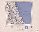
 Topografische Karte (1:250.000) mit dem Young Head | ||
| Geographische Lage | ||
| Koordinaten | 81° 29′ S, 161° 24′ O | |
| Lage | Transantarktisches Gebirge | |
| Küste | Shackleton-Küste | |
| Gewässer | Ross-Schelfeis | |
| Gewässer 2 | Beaumont Bay | |
Das Young Head ist eine markante, felsige Landspitze in Form eines bis zu 350 m hohen Kliffs an der Shackleton-Küste in der antarktischen Ross Dependency. Es markiert die Nordseite der Einfahrt zur Beaumont Bay.
Das Advisory Committee on Antarctic Names benannte es 1965 nach Chief Warrant Officer Victor Young, der als Gruppenmitglied des mobilen Aufbaubattalions der United States Navy im antarktischen Winter 1956 auf der Forschungsstation Little America V tätig war.
Weblinks
- Young Head im Geographic Names Information System des United States Geological Survey (englisch)
- Young Head auf geographic.org (englisch)
Auf dieser Seite verwendete Medien
Autor/Urheber: Alexrk2, Lizenz: CC BY-SA 3.0
Physische Positionskarte Antarktis, Mittabstandstreue Azimutalprojektion
Map of Antarctica by the United States Antarctic Resource Center of the US Geological Survey.


