Yakima Research Station
Koordinaten: 46° 40′ 56,3″ N, 120° 21′ 25,2″ W
Die Yakima Research Station nordöstlich von Yakima, Washington, ist ein Standort der NSA, von dem aus im Rahmen des ECHELON-Programms die Intelsat-Kommunikation über dem Pazifik abgehört wird. Durch das militärisch genutzte Gelände führt der historische John Wayne Pioneer Trail.
Die Station soll in den nächsten Jahren in die wesentlich größere Aerospace Data Facility auf der Buckley Air Force Base in Aurora, Colorado verlagert werden.[1][2]
Weblinks
- http://www.thelivingmoon.com/45jack_files/03files/ECHELON_Yakima.html
- http://world-information.org/wio/infostructure/100437611746/100438659207/?ic=100446325802
Einzelnachweise
- ↑ NSA Closing the Yakima Research Station SIGINT Intercept Site
- ↑ OPNAV Notice 5400 (Memento vom 2. Mai 2013 im Internet Archive) (PDF; 84 kB) ()
Auf dieser Seite verwendete Medien
Autor/Urheber: TUBS
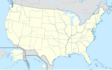
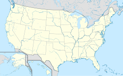
Location map of the USA (Hawaii and Alaska shown in sidemaps).
Main map: EquiDistantConicProjection : Central parallel :
* N: 37.0° N
Central meridian :
* E: 96.0° W
Standard parallels:
* 1: 32.0° N
* 2: 42.0° N
Made with Natural Earth. Free vector and raster map data @ naturalearthdata.com.
Formulas for x and y:
x = 50.0 + 124.03149777329222 * ((1.9694462586094064-({{{2}}}* pi / 180))
      * sin(0.6010514667026994 * ({{{3}}} + 96) * pi / 180))
y = 50.0 + 1.6155950752393982 * 124.03149777329222 * 0.02613325650382181
      - 1.6155950752393982  * 124.03149777329222 *
     (1.3236744353715044  - (1.9694462586094064-({{{2}}}* pi / 180))
      * cos(0.6010514667026994 * ({{{3}}} + 96) * pi / 180))
Hawaii side map: Equirectangular projection, N/S stretching 107 %. Geographic limits of the map:
- N: 22.4° N
- S: 18.7° N
- W: 160.7° W
- E: 154.6° W
Alaska side map: Equirectangular projection, N/S stretching 210.0 %. Geographic limits of the map:
- N: 72.0° N
- S: 51.0° N
- W: 172.0° E
- E: 129.0° W
Photo taken from the John Wayne Pioneer Trail in Eastern Washington State in the United States of America. It was taken on the U.S.Army Yamika Training Center facing east and shows the western mouth of the Boylston tunnel on the former Milwaukee Road with the Saddle Mountains|Saddle Mountains to the right of the photo. It will be used in the John Wayne Trail & Saddle Mountain articles.
Photo taken on May 9th and edited (size reduced) by uploader. All rights released by the uploader/author/originator into the public domain.
And just to make it clear, since a recent upload was tagged & subsequently challenged by the ubiquitous, mindless bot scanning of photos.
- I took this photo
- I edited this photo
- I'm putting this image into the public domain.
| Ich, der Urheberrechtsinhaber dieses Werkes, veröffentliche es als gemeinfrei. Dies gilt weltweit. In manchen Staaten könnte dies rechtlich nicht möglich sein. Sofern dies der Fall ist: Ich gewähre jedem das bedingungslose Recht, dieses Werk für jedweden Zweck zu nutzen, es sei denn, Bedingungen sind gesetzlich erforderlich. |


