Wurrumiyanga
| Wurrumiyanga | |||||||||
|---|---|---|---|---|---|---|---|---|---|
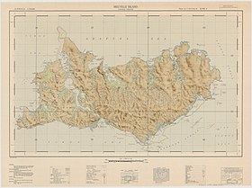
 Bathurst Island Mission auf dem topographischen Kartenblatt von 1944 | |||||||||
| |||||||||
| |||||||||
| |||||||||
| |||||||||
Wurrumiyanga (früher Nguiu genannt) ist eine Siedlungsgemeinschaft der Aborigines an der Südostspitze von Bathurst Island im Northern Territory, Australien[2]. Er ist mit 1.421 Einwohnern[1] der größte Ort auf der Insel.
Erreichbarkeit
Die Insel ist ein Teil der Tiwi-Inseln und befindet sich in der Arafurasee. Der Ort auf Bathurst Island ist vom australischen Festland durch die Apsley Strait getrennt und etwa 80 Kilometer von Darwin entfernt. Erreicht werden kann er mit Flugzeugen auf dem etwa einen Kilometer entfernten Flughafen[3] oder mit Booten. Ein Zutritt ist aufgrund eines Vertrages aus dem Jahre 1976 zwischen der australischen Regierung und den australischen Ureinwohnern nur noch mit Erlaubnis möglich[4].
Geschichte
Nguiu wurde 1911 als katholische Aborigines-Missionsstation von Francis Xavier Gsell gegründet.[5]
Das Nguiu-Postbüro wurde am 3. Juni 1974 auf Bathurst Island eröffnet; es ist das erste und einzige auf der Insel[6].
Heute
2010 wurde Nguiu durch das Tiwi Land Council in Wurrumiyanga umgewidmet, was bedeutet der Ort, auf dem Brotpalmfarne wachsen (engl.: the place where the cycads grow).[7]
In der Siedlung befinden sich Sportanlagen wie ein Footballstadion, Basketballfeld und Schwimmbecken, eine katholische Schule[8], ein Gesundheitszentrum und Supermarkt.[9]
Weblinks
- Eintrag im Place Names Register des Northern Territory
- Polizei auf Nguiu ( vom 21. März 2012 im Internet Archive)
Einzelnachweise
- ↑ a b Wurrumiyanga (Nguiu). 2021 Census Quickstat. Australian Bureau of Statistics, 28. Juni 2022, abgerufen am 26. Februar 2023 (englisch).
- ↑ Wurrumiyanga Indigenous Population. Australian Government, abgerufen am 26. Februar 2022 (australisches Englisch).
- ↑ Wurrumiyanga Bathurst Island Airport (Wurrumiyanga, Australia) - reviews, photo, video, flight arrival and departure information. Abgerufen am 26. Februar 2022 (englisch).
- ↑ COMMONWEALTH OF AUSTRALIA Aboriginal Land Rights (Northern Territory) Act 1976 NOTICE TO ESTABLISH AN ABORIGINAL LAND COUNCIL. In: Commonwealth of Australia Gazette. Special. National 18. August 1978 (gov.au [abgerufen am 26. Februar 2022]).
- ↑ F. X. Gsell: The Bishop with 150 Wives, Angus and Robertson, Sydney 1956, Ch. 3.
- ↑ Post Office Nguiu (Bathurst Island), Wurrumiyanga LPO, 397. Abgerufen am 26. Februar 2022.
- ↑ NT Place Names Register. Northern Territory Government, abgerufen am 7. April 2011.
- ↑ HOME: Xavier Catholic College. Abgerufen am 26. Februar 2022 (englisch).
- ↑ ntmojos.indigenous.gov.au ( vom 9. April 2013 im Internet Archive): MOJOs from Wurrumiyanga, in englischer Sprache, abgerufen am 23. Februar 2013
Auf dieser Seite verwendete Medien
Flag of Australia, when congruence with this colour chart is required (i.e. when a "less bright" version is needed).
See Flag of Australia.svg for main file information.The flag of the Northern Territory (adopted on July 1, 1978 on the first day of self-government) was designed by the Australian artist Robert Ingpen, of Drysdale Victoria, after consultation with members of the community at the invitation of the Northern Territory Government. The flag incorporates the three official Territorian colours of black, white and ochre and is divided into two panels, black at the hoist side taking up one third the length of the flag while the remainder is equal to two third the length of the flag in ochre. The black panel display the five white stars that form the constellation of the Southern Cross, using the Victorian configuration of the Southern Cross with stars having between five to eight points. The flag also features the official Northern Territory floral emblem on the red ochre panel, a stylisation of the Sturt's Desert Rose, which uses seven petals encircling a seven-pointed black star of the federation in the centre. The seven petals symbolises the six Australian states plus the Northern Territory. The Northern Territory Flag was the first official flag that did not contain the Union Jack.
Map of Tiwi Islands (Melville, Bathurst Islands), Northern Territory, Australia
Autor/Urheber: NordNordWest, Lizenz: CC BY-SA 3.0 de
Positionskarte des Northern Territory, Australien


