Wood Bay
| Wood Bay | ||
|---|---|---|
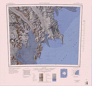
 Topographisches Kartenblatt Mount Melbourne (1:250.000) mit der Wood Bay | ||
| Gewässer | Rossmeer | |
| Landmasse | Viktorialand, Ostantarktika | |
| Geographische Lage | 74° 13′ 0″ S, 165° 30′ 0″ O | |
| Inseln | Kay-Insel | |
| Zuflüsse | Tinker-Gletscher | |
Die Wood Bay ist eine große Bucht an der südlichen Borchgrevink-Küste im Osten des ostantarktischen Viktorialands. sie liegt zwischen Kap Johnson und der Aviator-Gletscherzunge im Norden sowie Kap Washington im Süden.
Entdeckt wurde sie im Jahr 1841 durch James Clark Ross bei dessen Antarktisexpedition (1839–1843). Benannt ist sie nach Leutnant James Frederick Lewis Wood (1820–1864) von der HMS Erebus, einem der beiden Forschungsschiffe der Expedition.[1] Im nördlichen Teil der Wood Bay liegt die Kay-Insel.
Weblinks
- Wood Bay. In: Geographic Names Information System. United States Geological Survey, United States Department of the Interior, archiviert vom (englisch).
- Wood Bay auf geographic.org (englisch)
Einzelnachweise
- ↑ John Stewart: Antarctica – An Encyclopedia. Bd. 2, McFarland & Co., Jefferson und London 2011, ISBN 978-0-7864-3590-6, S. 1723 (englisch).
Auf dieser Seite verwendete Medien
Autor/Urheber: Alexrk2, Lizenz: CC BY-SA 3.0
Physische Positionskarte Antarktis, Mittabstandstreue Azimutalprojektion
1:250,000-scale topographic reconnaissance map of the Mount Melbourne area from 162°-166°30'E to 74°-75°S in Antarctica. Mapped, edited and published by the U.S. Geological Survey in cooperation with the National Science Foundation.


