Welterbe in Gambia
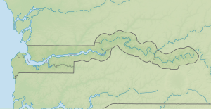
(c) Karte: NordNordWest, Lizenz: Creative Commons by-sa-3.0 de |
Welterbestätten in Gambia |
Zum Welterbe in Gambia gehören (Stand 2016) zwei UNESCO-Welterbestätten, beide Stätten des Weltkulturerbes. Der westafrikanische Staat Gambia hat die Welterbekonvention 1987 ratifiziert, die erste Welterbestätte wurden 2003 eingetragen. Die bislang letzte Welterbestätte in Gambia wurde 2006 in die Welterbeliste aufgenommen.[1]
Welterbestätten
Diese Tabelle listet die UNESCO-Welterbestätten in Gambia in chronologischer Reihenfolge nach dem Jahr ihrer Aufnahme in die Welterbeliste (K – Kulturerbe, N – Naturerbe, K/N – gemischt, (G) – auf der Liste des gefährdeten Welterbes).
![]() Karte mit allen Koordinaten von Welterbestätten: OSM
Karte mit allen Koordinaten von Welterbestätten: OSM
| Bild | Bezeichnung | Jahr | Typ | Ref. | Beschreibung |
|---|---|---|---|---|---|
| Kunta Kinteh Island und zugehörige Stätten (Lage) | 2003 | K | 761 | Besteht aus Kunta Kinteh Island (ehem. James Island) mit dem Fort James, dem Fort Bullen bei Barra, den Ruinen von San Domingo, den Überresten der Portugiesischen Kapelle, dem CFAO-Gebäude, dem Gebäude von Maurel Frères in Albreda/Juffure sowie der Sechs-Kanonen-Batterie in Banjul (ehem. Bathurst). | |
| Steinkreise von Senegambia | 2006 | K | 1226 | Die grenzüberschreitende Welterbestätte umfasst in Gambia die Steinkreise von Kerr Batch (Lage) und Wassu (Lage) sowie zwei weitere Steinkreise in Senegal. |
Tentativliste
In der Tentativliste sind die Stätten eingetragen, die für eine Nominierung zur Aufnahme in die Welterbeliste vorgesehen sind. Derzeit (2016) sind zwei Stätten in der Tentativliste von Gambia eingetragen.[2]
![]() Karte mit allen Koordinaten aktueller Welterbekandidaten: OSM
Karte mit allen Koordinaten aktueller Welterbekandidaten: OSM
| Bild | Bezeichnung | Jahr | Typ | Ref. | Beschreibung |
|---|---|---|---|---|---|
| Abbaustätte der Steinkreise von Wassu (Lage) | 2016 | K | 6063 | Erweiterung der bestehenden Welterbestätte ‘Senegambische Steinkreise’ um die Abbaustätte der Steinkreise von Wassu | |
| Historisches Georgetown (Lage) | 2016 | K | 6064 | Erweiterung der bestehenden Welterbestätte ‘Kunta Kinteh Island und zugehörige Stätten’ um die historischen Gebäude und Ruinen in Janjanbureh (ehem. Georgetown) |
Weblinks
Einzelnachweise
- ↑ Gambia. In: whc.unesco.org. UNESCO World Heritage Centre, abgerufen am 27. Mai 2017 (englisch).
- ↑ Tentativliste von Gambia. In: whc.unesco.org. UNESCO World Heritage Centre, abgerufen am 2. Juni 2007 (englisch).
Auf dieser Seite verwendete Medien
(c) OOjs UI Team and other contributors, MIT
An icon from the OOjs UI MediaWiki lib.
Autor/Urheber: tjabeljan, Lizenz: CC BY 2.0
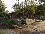
GambiaGeorgeTown074
Autor/Urheber: Leonora (Ellie) Enking from East Preston, United Kingdom, Lizenz: CC BY-SA 2.0
James Island is an island in the Gambia River, 30km from the river mouth and near Juffureh in the country of The Gambia. It contains a fort known as Fort James. It is less than two miles from Albreda on the river's northern bank that served a similar purpose for the French.
History The first European settlers on the island were Baltic Germans from the Duchy of Courland and Semigallia, who also had other colonial possessions in the area. They called it St. Andrews Island, though the British Crown had previously granted the island to two separate companies in 1588 and 1618. In 1651, the settlers built a fort that they named Jacob Fort after Jacob Kettler, the Duke of Courland, and used it as a trade base. The Dutch briefly held the fort from 1659 until the British captured it in 1661; the Dutch formally ceded the fort to the British in 1664.
The British renamed the island James Island and the fort Fort James after James, the Duke of York, later King James II of England. The chartered Royal Adventurers in Africa Company administered the territory, which initially used it for the gold and ivory trade, and later in the slave trade. On 1 August 1669, the Company sublet the administration to Gambia Adventurers. In 1684, the Royal African Company took over Gambia's administration.
In 1695, the French captured Fort James after a battle with English sailors. They returned it in 1697 but then captured it again in 1702. The fort was destroyed and rebuilt several times in this period, both in conflicts between the British and French and by pirates. On 13 June 1750 the Company of Merchants Trading in Africa assumed the administration of The Gambia. Between 25 May 1765 - 11 February 1779, The Gambia was part of British Senegambia.
The Six-Gun Battery (1816) and Fort Bullen (1826), now included in the James Island UNESCO World Heritage Site and located on both sides of the mouth of the River Gambia, were built with the specific intent of thwarting the slave trade once it had become illegal in the British Empire after the passing of the Abolition Act in 1807. These sites along with the island itself were abandoned in 1870.
Legacy As an important historical site in the West African slave trade, it is now listed as a UNESCO World Heritage Site, together with related sites including Albreda, Juffureh and Fort Bullen. James Island is suffering heavy erosion, and is now approximately 1/6th of its size during the times of the fort. Ruins of several of the British administrative buildings (including a single cell, apparently used to house the most troublesome captives), a small jetty and a number of skeletal baobab trees remain. The ruins have been stabilised, and protected by a capping. Due to the low land of the island, some structures are at times beaten by the waves during high tide and storms.
Kunta Kinte, author Alex Haley's Mandingo ancestor, described in the book and TV series Roots, was probably shipped through James Island.Autor/Urheber: Ikiwaner, Lizenz: CC BY-SA 3.0
Ein Steinkreis der Anlage Kerr Batch in Gambia
(c) Karte: NordNordWest, Lizenz: Creative Commons by-sa-3.0 de
Positionskarte von Gambia


