WIMZ-FM-Sendemast
WIMZ-FM-Sendemast | ||
|---|---|---|
| Basisdaten | ||
| Ort: | Knoxville | |
| Bundesstaat: | Tennessee | |
| Staat: | Vereinigte Staaten | |
| Höhenlage: | 327 m | |
| Koordinaten: 36° 8′ 5,5″ N, 83° 43′ 28″ W | ||
| Verwendung: | Rundfunksender | |
| Besitzer: | South Central Communications | |
| Daten des Mastes | ||
| Bauzeit: | 1963 | |
| Betriebszeit: | seit 1963 | |
| Gesamthöhe: | 534,01 m | |
| Daten zur Sendeanlage | ||
| Wellenbereich: | UKW-Sender | |
| Rundfunk: | UKW-Rundfunk | |
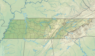
| Positionskarte | ||
Der WIMZ-FM-Sendemast ist ein 534,01 Meter hoher abgespannter Sendemast zur Verbreitung von UKW und TV-Programmen in Knoxville, Tennessee, USA. Der WIMZ-FM-Sendemast wurde 1963 fertiggestellt und ist Eigentum von South Central Communications.
Der WIMZ-FM Sendemast war zwei Monate lang bis zur Fertigstellung des KVLY-Sendemasten in Blanchard, North Dakota, USA das höchste Bauwerk der Erde.
Weblinks
Auf dieser Seite verwendete Medien
Autor/Urheber: SANtosito, Lizenz: CC BY-SA 4.0
Relief location map of Tennessee, USA
Geographic limits of the map:
- N: 38.1° N
- S: 33.6° N
- W: 90.5° W
- E: 81.4° W
Autor/Urheber: Uwe Dedering, Lizenz: CC BY-SA 3.0
Relief location map of the USA (without Hawaii and Alaska).
EquiDistantConicProjection : Central parallel :
* N: 37.0° N
Central meridian :
* E: 96.0° W
Standard parallels:
* 1: 32.0° N
* 2: 42.0° N
Made with Natural Earth. Free vector and raster map data @ naturalearthdata.com.
Formulas for x and y:
x = 50.0 + 124.03149777329222 * ((1.9694462586094064-({{{2}}}* pi / 180))
      * sin(0.6010514667026994 * ({{{3}}} + 96) * pi / 180))
y = 50.0 + 1.6155950752393982 * 124.03149777329222 * 0.02613325650382181
      - 1.6155950752393982  * 124.03149777329222 *
     (1.3236744353715044  - (1.9694462586094064-({{{2}}}* pi / 180))
      * cos(0.6010514667026994 * ({{{3}}} + 96) * pi / 180))
Autor/Urheber: AmmuNation, Lizenz: CC BY-SA 4.0
WIMZ 103.5 Knoxville radio station tower


