Vysočina (Ort)
| Vysočina | ||||
|---|---|---|---|---|
| ||||
| Basisdaten | ||||
| Staat: | ||||
| Region: | Pardubický kraj | |||
| Bezirk: | Chrudim | |||
| Fläche: | 1787 ha | |||
| Geographische Lage: | 49° 46′ N, 15° 50′ O | |||
| Höhe: | 567 m n.m. | |||
| Einwohner: | 704 (1. Jan. 2023)[1] | |||
| Postleitzahl: | 539 01 | |||
| Verkehr | ||||
| Straße: | Hlinsko – Trhová Kamenice | |||
| Struktur | ||||
| Status: | Gemeinde | |||
| Ortsteile: | 7 | |||
| Verwaltung | ||||
| Bürgermeister: | Tomáš Dubský (Stand: 2009) | |||
| Adresse: | Dřevíkov 12 539 01 Hlinsko | |||
| Gemeindenummer: | 572551 | |||
| Website: | www.obecvysocina.cz | |||
Vysočina ist eine Gemeinde im Okres Chrudim, Tschechien. Zum 31. Dezember 2008 lebten hier 698 Einwohner.
Geographie

Vysočina liegt am Fluss Chrudimka zwischen Trhová Kamenice und Hlinsko auf der böhmisch-mährischen Höhe, an der Grenze zwischen dem Eisengebirge und den Saarer Bergen. Durch den Ort verläuft die Straße II/343.
Geschichte
Die älteste Erwähnung des Ortes Sankt Niklas war um 1350. Rwatschow war Anfang des 19. Jahrhunderts zu Kamnitz eingepfarrt. Es gab 1837 dort 31 Häuser mit 230 Einwohnern und eine Schule.[2]
Die Allodialgüter Freihammer und Drschewikau wurden 1801 von Johann Norbert Maria von Pötting und Persing an Franz Xaver Pfundheller verkauft.
Sehenswürdigkeiten
- Freilichtmuseum Veselý Kopec
- Jüdischer Friedhof in Dřevíkov
Gemeindegliederung
Zur Gemeinde gehören die Ortsteile:
- Dřevíkov (Drschewikau)
- Možděnice (Moschdienitz)
- Petrkov 1. díl (Peterkau 1. Teil)
- Rváčov (Rwatschow)
- Svatý Mikuláš (Sankt Niklas)
- Svobodné Hamry (Freihammer)
- Veselý Kopec (Wesely Kopetz)
Einzelnachweise
- ↑ Český statistický úřad – Die Einwohnerzahlen der tschechischen Gemeinden vom 1. Januar 2023 (PDF; 602 kB)
- ↑ Johann Gottfried Sommer: Das Königreich Böhmen: bd. Chrudimer kreis. 1837. J.G. Calve, 1837, S. 272. eingeschränkte Vorschau in der Google-Buchsuche
Weblinks
- Galileo Corporation s.r.o. - www.profesionalita.: Soubor lidových staveb Vysočina - Soubor lidových staveb Vysočina. In: vesely-kopec.eu. 21. Dezember 2014, abgerufen am 29. Dezember 2014.
Auf dieser Seite verwendete Medien
(c) Karte: NordNordWest, Lizenz: Creative Commons by-sa-3.0 de
Positionskarte von Tschechien
Autor/Urheber: Josef Kreuz (PEPan), Lizenz: CC BY-SA 4.0
Winter eve in the landscape above a hamlet of "Dřevíkov". View from the top On the Merry Hill (578.5 m), trees under the slope near the road connecting the settlement sites "Dřevíkov" and "Veselý Kopec" (Merry Hill), on the horizon "Zuberský" hill (651 m, below is a lookout tower). The setlement locality of "Dřevíkov" lies in the top part of hill (no name) with an altitude of 571.5 m in the "Stružinecká" Highlands, about 2.5 km southeast of small town Trhová Kamenice and 6 km west of town Hlinsko. Village with folk buildings monuments (a wooden small bell tower, a timbered cottage, a former Jewish Lane and a Graveyard). In the cadastral territory there is also a small hamlet "Veselý Kopec" with a significant exposition of the museum in nature with name of the Set of folk buildings "Vysočina". "Dřevíkovská" village green is information point No. 10 on the Homeland trail the Region of Chrudimka River. "Dřevíkov" is settlement locality of the type of small hamlet and the name of the cadastral area with an area of 226.58 ha with a range of approximately 534 to 579 meters above sea level in the landscape area of the Iron Mountains, within the administrative is part municipality of Vysočina in the district of Chrudim belonging to the Pardubice Region in the territory of the Czech Republic. Photo location: Czechia, Pardubice Region, municipality Vysočina, hamlet of "Dřevíkov", "Stružinecká" knoll hill.
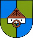
Vysočina (okres Chrudim), znak obce. V modro-zeleně čtvrceném štítě stříbrný mlýn se dvěma černými okny, s dřevěnou střechou a kolem přirozené barvy.


