Vesconte Maggiolo

Vesconte Maggiolo (alte Schreibweise Vesconte de Maiolo[2]; * 1475; † nach 1549[3]) war ein genuesischer Kartograf.[4] Einige Historiker behaupten, er sei 1530 an Malaria gestorben; Archivdokumente zeigen jedoch, dass er zumindest 1549 noch in Genua lebte, obwohl er 1561 sicherlich schon tot war.[5] Seine Familie besaß über 150 Jahre lang das Monopol auf die Kartenproduktion in der Republik Genua. Er fertigte Karten des Mittelmeeres, des Schwarzen Meeres sowie Afrikas, der Neuen Welt und Asiens.
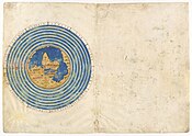
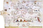
Der berühmte Seeatlas[6] des Vesconte Maggiolo besteht aus vier Karten (Pergament), welche im Jahre 1512 in Parma gefertigt wurden. Das Original befindet sich in der Biblioteca Palatina in Parma.
Es gibt zahlreiche Portolankarten, Atlanten und mindestens zwei weitere Weltkarten von Vesconte Maggiolo: eine aus Genua, 1531;[7] Eine andere, die in einer öffentlichen Bibliothek in Treviso aufbewahrt wird (in italienischer Sprache), ist datiert auf Genua, 1549.
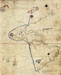
Obwohl er sich auf die Kartierung des Mittelmeers, des Schwarzen Meeres und der Ägäis spezialisiert hatte, war Maggiolo der erste, der in seinem Atlas von 1548 den südamerikanischen Fluss Rio de Amaxones als Toponym angab.
Kartengalerie
Literatur
- Astengo, Corradino: Der genuesische Kartograph Vesconte Maggiolo und sein Werk. In: Cartographica Helvetica Heft 13 (1996) S. 9–17. doi:10.5169/seals-8240
- Astengo, Corradino: La cartografia nautica mediterranea dei secoli XVI e XVII, Genova 2000, pp. 80-88 e 149-192.
- Corradino Astengo: Il planisfero di Vesconte Maggiolo di Fano (1504). Collezione inFolio, Ancona 2004, ISBN 88-7663-398-7.
- Astengo, Corradino: The Renaissance Chart Tradition in the Mediterranean, in The History of Cartography, Volume Three (Part 1): Cartography in the European Renaissance, Bearbeitet von David Woodward, Chicago, University of Chicago Press, 2007, S. 174–262.
- Astengo, Corradino: Vesconte Maggiolo (alias Vesconte de Maiolo, Vesconte de Maiollo), in Cartografi in Liguria (secoli XIV-XIX) a cura di Massimo Quaini, Genova, Brigati, 2007, S. 72–75.
Weblinks
- Weltkarte von 1511
- Portolan atlas/Vesconte de Maiolo ciuis Janue conposuy, 1511 in der John Carter Brown Library.
- Portolan Chart, 1516 in The Huntington Library
- Karte der Welt von Viconte di Maiollo, 1527, 1905 facsimile aus der Old Maps Collection
Einzelnachweise
- ↑ 16th Century Pennsylvania Maps
- ↑ Peter Mesenburg: Zur Genauigkeit der Portolane im Seeatlas des Vesconte Maggiolo (1512)
- ↑ Kartengeschichte: Der genuesische Kartograph Vesconte Maggiolo und sein Werk: Zusammenfassung
- ↑ https://web.archive.org/web/20170302105543/http://cartographic-images.net/Cartographic_Images/316_Maggiolo.html
- ↑ Astengo: Vesconte Maggiolo (alias Vesconte de Maiolo, Vesconte de Maiollo), 2007, S. 72
- ↑ Bayerische Staatsbibliothek Digitalatlas
- ↑ Astengo, 2007, p. 73: 14: "Vesconte de maiollo [SIC] composuit hanc cartam In Janua anno dominy 1531 die VIII novembri".
| Personendaten | |
|---|---|
| NAME | Maggiolo, Vesconte |
| ALTERNATIVNAMEN | Maiolo, Vesconte de |
| KURZBESCHREIBUNG | genuesischer Kartograf |
| GEBURTSDATUM | 1475 |
| STERBEDATUM | nach 1549 |
Auf dieser Seite verwendete Medien
Maggiolo Map of the Western Hemisphere
Autor/Urheber: Visconte Maggiolo, Lizenz: CC BY-SA 4.0
Map made by Visconte Maggiolo depicting Italy as far as the mouth of the Tiber River, western Sicily, and the Adriatic coast
Map made by Visconte Maggiolo depicting Greek Islands and the Aegean Sea.
Autor/Urheber: Visconte Maggiolo, Lizenz: CC BY-SA 4.0
Map made by Visconte Maggiolo depicting Cosmographical planisphere, with Africa, Asia, and Europe in the center
Image of manuscript map in the Ambrosian Library in Milan by Vesconte Maggiolo
Autor/Urheber: Visconte Maggiolo, Lizenz: CC BY-SA 4.0
Map by Visconte Maggiolo depicting western Meditarranean.
Autor/Urheber: Visconte Maggiolo, Lizenz: CC BY-SA 4.0
Map made by Visconte Maggiolo depicting North Africa, Europe, and part of Asia.
Autor/Urheber: Visconte Maggiolo, Lizenz: CC BY-SA 4.0
Dedication leaf of book adjacent to map depicting the island of Corsica, made by Visconte Maggiolo.
Autor/Urheber: Visconte Maggiolo, Lizenz: CC BY-SA 4.0
Map made by Visconte Maggiolo depicting Africa, Asia, Europe, and the northeast extremity of the New World.
Autor/Urheber: Visconte Maggiolo, Lizenz: CC BY-SA 4.0
Map made by Visconte Maggiolo depicting Atlantic coast of Africa and Europe, the British Isles, and Iceland, including the Canary Islands, Madeira, and the Azores
Autor/Urheber: Visconte Maggiolo, Lizenz: CC BY-SA 4.0
Map made by Visconte Maggiolo depicting west coast of Africa from the Tropic of Cancer to 17⁰ south, including the Cape Verde Islands, and the Atlantic islands of São Tomé, Príncipe, and Annobón.
Vesconte Maggiolo, Portolankarte (1541)


