Vastitas Borealis
| Ebene auf dem Mars | ||
|---|---|---|
| Hadriacus Mons / Hadriaca Patera | ||
 | ||
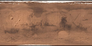
| Vastitas Borealis ist die große Ebene oben auf dem Bild der topographischen Karte. | ||
| Position | 88° N, 33° O | |
| Ausdehnung | 2000 km | |
Vastitas Borealis (vastitas, Latein, Wüste, in der IAU-Mars-Nomenklatur für große Ebene verwendet; borealis, Latein, nördlich) ist die größte Flachebene auf dem Planeten Mars.[1] Sie befindet sich in den nördlichen Breitengraden des Planeten und umgibt die nördliche Polarregion, genannt Planum Boreum. Vastitas Borealis wird oft auch einfach als nördliche Ebene des Mars bzw. als Borealis-Becken[2] bezeichnet. Die Ebene liegt etwa 4–5 km unterhalb des durchschnittlichen Radius des Planeten.
Im Jahre 2005 fotografierte die Marssonde Mars Express der European Space Agency eine beachtliche Menge an Wassereis in einem Krater der Region. Die Umgebungsbedingungen in der Region ermöglichen, dass Wassereis sich dort stabil halten kann. Es wurde entdeckt, als darüber liegendes Kohlendioxideis während des Marssommers verdampfte.[3]
Im August 2007 startete die NASA die Marssonde Phoenix, die am 25. Mai 2008 in der Vastitas Borealis landete, also während des Frühsommers auf der Mars-Nordhalbkugel.[4] Es handelte sich um eine stationäre Sonde, die u. a. Bodenproben entnahm. Unter anderem wurden verschiedene Mineralstoffe, jedoch auch Perchlorate gefunden. Phoenix sendete bis zum 2. November 2008 wissenschaftliche Daten. Erneute Versuche der Kontaktaufnahme 2010 waren nicht erfolgreich. Ein aus dem Orbit aufgenommenes Bild zeigte Anzeichen schwerer Schäden durch Vereisung.[5]
Beschreibung


Der nördliche Teil von Vastitas Borealis ist von großen und kleinen Dünenfeldern bedeckt. Das größte Dünenfeld des Mars, Olympia Undae (81° 10′ N, 178° 29′ O), ist über 1500 km lang. Hier wurden Ablagerungen von Gips entdeckt. Es könnte durch einen Abfluss von Schmelzwasser aus dem nördlich gelegenen Graben Chasma Boreale entstanden sein.[6]
Beobachtet werden konnten auch Moränen (Ablagerungen, die von Gletschern bei ihrer Bewegung mitbewegt oder aufgehäuft werden) (74° 40′ N, 95° 16′ O), möglicherweise entstanden durch Kohlenstoffdioxid-Gletscher.[7]
Weblinks
- Martel, L.M.V. (July, 2003) Ancient Floodwaters and Seas on Mars. Planetary Science Research Discoveries. http://www.psrd.hawaii.edu/July03/MartianSea.html
- DLR: Krater mit Wassereis am Mars-Nordpol 28/07/2005
Einzelnachweise
- ↑ Vastitas Borealis im Gazetteer of Planetary Nomenclature der IAU (WGPSN) / USGS
- ↑ Computersimulation: Gigantischer Crash formte den Mars. In: Spiegel Online. 25. Juni 2008, abgerufen am 10. Juni 2018.
- ↑ Water ice in crater at Martian north pole. European Space Agency, abgerufen am 4. August 2007.
- ↑ Raumfahrer net Redaktion: Mars Phoenix Lander – Die ersten Resultate (Teil 1) – Raumfahrer.net. Abgerufen am 20. Juni 2022 (deutsch).
- ↑ Phoenix Mars Lander is Silent, New Image Shows Damage, NASA, 24. Mai 2010
- ↑ Lunar and Planetary Science XXXVII (2006): K. E. Fishbaugh, F. Poulet, Y. Langevin, V. Chevrier, und J-P. Bibring: The origin of gypsum in the Mars north polar region
- ↑ IAG Planetary Geomorphology Working Group: Moraines Left by Carbon Dioxide Glaciers on Mars, Februar 2012
Auf dieser Seite verwendete Medien
Olympia Planitia Dunes, as seen by hirise. Location is 80.2 degrees north latitude and 191.2 degrees east longitude. Image was taken by HiRISE on the Mars Reconnaissance Orbiter. Photo credit is Image NASA/JPL/University of Arizona.
Mars Global Digital Dune Database; MC-1: U.S. Geological Survey Open-File Report 2010-1170. The Mars Global Digital Dune Database presents data and describes the methodology used in creating the global database of moderate- to large-size dune fields on Mars. The database is being released in a series of U.S. Geological Survey (USGS) Open-File Reports. The MC-1 release encompasses ~ 845,000 km2 of mapped dune fields from 65° N to 90° N latitude.
Carte de Mars reconstituée à partir des mesures de Mars Global Surveyor (MOLA) et des observations de Viking.
Maps of Mars' global topography. The projections are Mercator to 70° latitude and stereographic at the poles with the south pole at left and north pole at right. Note the elevation difference between the northern and southern hemispheres. The Tharsis volcano-tectonic province is centered near the equator in the longitude range 220° E to 300° E and contains the vast east-west trending Valles Marineris canyon system and several major volcanic shields including Olympus Mons (18° N, 225° E), Alba Patera (42° N, 252° E), Ascraeus Mons (12° N, 248° E), Pavonis Mons (0°, 247° E), and Arsia Mons (9° S, 239° E). Regions and structures discussed in the text include Solis Planum (25° S, 270° E), Lunae Planum (10° N, 290° E), and Claritas Fossae (30° S, 255° E). Major impact basins include Hellas (45° S, 70° E), Argyre (50° S, 320° E), Isidis (12° N, 88° E), and Utopia (45° N, 110° E). This analysis uses an areocentric coordinate convention with east longitude positive.


