Usarp Mountains
| Usarp Mountains | ||
|---|---|---|
| Lage | Viktorialand, Ostantarktika | |
| Teil des | Transantarktischen Gebirges | |
| Koordinaten | 71° 10′ S, 160° 0′ O | |
Nordteil, Karte von 1968 | ||
Südteil, Karte von 1968 | ||
Die Usarp Mountains sind ein fast 200 km langer Gebirgszug, der in nord-südlicher Ausrichtung an der Westflanke des Rennick-Gletschers im Norden des ostantarktischen Viktorialands verläuft. Er steht im Norden in Verbindung mit dem Pryor-Gletscher und den Wilson Hills und besteht im Wesentlichen aus dem Pomerantz-Tafelland, der Daniels Range, den Emlen Peaks, den Helliwell Hills und der Morozumi Range.
Erste Luftaufnahmen dieses Gebirges entstanden im Rahmen der Operation Highjump (1946–1947). Die geodätische Vermessung erfolgte durch den United States Geological Survey und mithilfe von Luftaufnahmen der United States Navy von 1960 bis 1963. Das Advisory Committee on Antarctic Names benannte die Usarp Mountains 1964 nach dem Akronym für das United States Antarctic Research Program.
Weblinks
- Usarp Mountains im Geographic Names Information System des United States Geological Survey (englisch)
- Usarp Mountains auf geographic.org (englisch)
Auf dieser Seite verwendete Medien
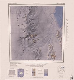
1:250,000-scale topographic reconnaissance map of the Daniels Range area from 159°-162°E to 71°-72°S in Antarctica, including the central parts of Usarp Mountains and the Gressitt Glacier. Mapped, edited and published by the U.S. Geological Survey in cooperation with the National Science Foundation.
Autor/Urheber: Alexrk2, Lizenz: CC BY-SA 3.0
Physische Positionskarte Antarktis, Mittabstandstreue Azimutalprojektion
1:250,000-scale topographic reconnaissance map of the Pomerantz Tableland area from 159°-162°E to 70°-71°S in Antarctica, including parts of the Usarp Mountains and the Rennick Glacier. Mapped, edited and published by the U.S. Geological Survey in cooperation with the National Science Foundation.


