UTC−7
| UTC−7 | ||
| Zonenmeridian | 105° W | |
| NATO DTG | T (Tango) | |
| Zeitzonen |
| |
UTC−7 ist eine Zonenzeit, sie hat den Längenhalbkreis 105° West als Bezugsmeridian. Auf Uhren mit dieser Zonenzeit ist es sieben Stunden früher als die koordinierte Weltzeit (UTC), acht Stunden früher als die mitteleuropäische Zeit (MEZ) und neun Stunden früher als die mitteleuropäische Sommerzeit (MESZ).
Am Meridian 105° W (−105°) wird der tägliche Sonnenhöchststand erst sieben Stunden später (7 · −15° = −105°) erreicht als am Nullmeridian.
Geltungsbereich (ohne Sommerzeiten)
 Kanada:
 Alberta
 British Columbia (teilweise)
 Nordwest-Territorien mit Ausnahme von Tungsten
 Nunavut (teilweise)
 Yukon ganzjährig seit 2020
 Baja California Sur
 Chihuahua
 Nayarit (teilweise)
- Revillagigedo-Inseln (teilweise)
 Sinaloa
 Sonora
 Vereinigte Staaten:
 Arizona
 Colorado
 Idaho (Südhälfte)
 Kansas (Die sieben Counties an der Grenze zu Colorado)
 Montana
 Nebraska (westliches Drittel)
 Nevada (West Wendover)
 New Mexico
 North Dakota (südwestliches Viertel)
 South Dakota (westliche Hälfte)
 Oklahoma (Die Stadt Kenton)
 Oregon (Großteil des Malheur County)
 Texas (Die beiden westlichsten Counties (Hudspeth, El Paso) und ein Teil von Culberson County)
 Utah
Utah Wyoming
Einzelnachweise
Auf dieser Seite verwendete Medien
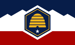
The flag of Utah (2024-present). This is the final design submitted for consideration to be adopted as a new state flag of Utah. The design evokes images of snowy mountains and red rocks to represent the geography of Utah, the beehive represents "Industry" (the state's slogan) and Utah's nickname as "the Beehive State".
World map of time zones as of 2008, on the Miller Cylindrical Projection and with highlighted UTC-7 zone.
- Dark Blue - UTC-7 during Northern Winter / Southern Summer
- Orange - UTC-7 during Northern Summer / Southern Winter
- Yellow - UTC-7 all year round
- Light Blue - UTC-7 sea areas
Flag of Oregon (obverse): The flag was adopted by the state on February 26, 1925.[1] The state seal was decided in 1903.[2][3]
Flag of Chihuahua
Flag of the Northwest Territories.
Flag of Nunavut
Flag of Baja California Sur. Shades on the coat of arms are as follows:
- PANTONE 534 C
- PANTONE 485 C
- PANTONE YELLOW C
- PANTONE 429 C
Flag of Sinaloa
Flag of the State of Nevada. The flag is described in Nevada Revised Statutes Chapter 235, Sec. 20 as follows: The body of the flag must be of solid cobalt blue. On the field in the upper left quarter thereof must be two sprays of Sagebrush with the stems crossed at the bottom to form a half wreath. Within the sprays must be a five-pointed silver star with one point up. The word “Nevada” must also be inscribed below the star and above the sprays, in a semicircular pattern with the letters spaced apart in equal increments, in the same style of letters as the words “Battle Born.” Above the wreath, and touching the tips thereof, must be a scroll bearing the words “Battle Born.” The scroll and the word “Nevada” must be golden-yellow. The lettering on the scroll must be black-colored sans serif gothic capital letters.
Flag of Sonora
Flag of Nayarit
Autor/Urheber:
- World map blank gmt.svg: Muellercrtp
- Stock_alarm.svg: David Vignoni
- Nuvola_apps_kworldclock.png: David Vignoni
- derivative work: Beao
From GNOME version of Nuvola. Not included in the KDE PNG version.
Flag of British Columbia.
ᎡᏩᏐᎾ ᎦᏓᏘ
Flagge von Yukon.
Flag of Alberta.


