U.S. Highway 36
| Karte | |
|---|---|
 | |
| Basisdaten | |
| Gesamtlänge: | 1414 mi / 2276 km[1] |
| Eröffnung: | 1926 |
| Bundesstaaten: | Colorado Kansas Missouri Illinois Indiana Ohio |
| Anfangspunkt: | |
| Endpunkt: | |
| Wichtige Städte: | Boulder, CO Denver, CO Saint Joseph, MO Hannibal, MO Springfield, IL Indianapolis, IN Piqua, OH Delaware, OH |
Der U.S. Highway 36 ist ein 2276 km langer in West-Ost-Richtung verlaufender Highway durch die Mitte der USA. Der westliche Endpunkt befindet sich an der Einmündung in den U.S. Highway 34 im Rocky-Mountain-Nationalpark unweit von Denver in Colorado, der östliche an der Einmündung in den U.S. Highway 250 in Uhrichsville im östlichen Ohio.
Verlauf
Die wichtigsten Kreuzungen und Einmündungen
 Interstate 25 bei Welby, Colorado
 Interstate 270 von Welby nach Denver – 8 km gemeinsamer Verlauf
 Interstate 76 bei Welby
 Interstate 70 von Denver nach Byers, Colorado – 60 km gemeinsamer Verlauf
 Interstate 225 in Aurora, Colorado
 U.S. Highway 81 bei Belleville, Kansas
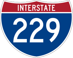
 Interstate 229 in St. Joseph, Missouri
 Interstate 29 in St. Joseph
 Interstate 35 in Cameron, Missouri
 U.S. Highway 61 in Missouri, Missouri
 Interstate 72 von Hannibal nach Decatur, Illinois – 217 km gemeinsamer Verlauf
 U.S. Highway 67 bei Jacksonville, Illinois
 Interstate 55 bei Springfield, Illinois
 U.S. Highway 51 in Decatur, Illinois
 U.S. Highway 45 bei Tuscola, Illinois
 Interstate 57 bei Tuscola
 U.S. Highway 41 bei Rockville, Indiana
 Interstate 65 in Indianapolis, Indiana
 Interstate 70 in Indianapolis
 Interstate 74 in Indianapolis
 U.S. Highway 31 in Indianapolis
 U.S. Highway 40 in Indianapolis
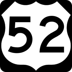
 U.S. Highway 52 in Indianapolis
 U.S. Highway 127 /
  Ohio State Route 571 bei Greenville, Ohio
 Interstate 75 in Piqua, Ohio
 U.S. Highway 68 in Urbana, Ohio
 U.S. Highway 33 bei Marysville (Ohio), Ohio
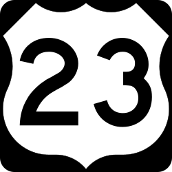
 U.S. Highway 23 /
  U.S. Highway 42 in Delaware, Ohio
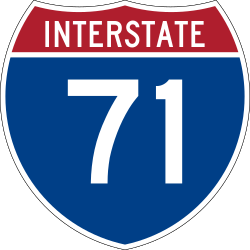
 Interstate 71 bei Sunbury, Ohio
 U.S. Highway 62 bei Millwood, Ohio
 Interstate 77 bei Newcomerstown, Ohio
Colorado

In Colorado ist der 100 km lange Abschnitt von Boulder durch den Großraum Denver bis Byers autobahnähnlich ausgebaut.
Wenige Kilometer nach dem Beginn des Highway 36 führt dieser durch die Kleinstadt Estes Park und führt dort in südöstlicher Richtung nach Lyons. Danach geht es geradewegs nach Süden und erreicht in Boulder den ausgebauten Abschnitt. Dieser gliedert sich in vier Teile:
- den 29 km langen früheren gebührenpflichtigen Denver-Boulder Turnpike von Boulder nach Westminster,
- den 3,2 km langen früheren Colorado State Highway 382 von Westminster nach Welby,
- den auf 8 km deckungsgleich mit der Interstate 270 verlaufenden Abschnitt von Welby nach Denver und
- den auf 60 km deckungsgleich mit der Interstate 70 verlaufenden Abschnitt von Denver nach Byers.
Seit 2005 sind die auf der Interstate 70 und Interstate 270 überlappend verlaufenden Abschnitte nicht mehr als U.S. Highway 36 markiert.
Der restliche Teil Highways im östlichen Colorado, der durch die Great Plains führt, ist wieder einzig als Highway 36 markiert. Durch das dünn besiedelte Gebiet führt die Straße als konventionelle zweispurige Landstraße. Wenige Kilometer östlich der Kreuzung mit dem U.S. Highway 385 passiert der Highway 36 die Grenze zwischen den Bundesstaaten Colorado und Kansas.
Kansas
Durch Kansas führt der Highway auf dem gesamten Streckenabschnitt durch sehr dünn besiedeltes Gebiet entlang der Nordgrenze zum Nachbarstaat Nebraska.
Die erste Stadt in Kansas ist St. Francis von wo der Highway 36 in gerader Linie nach Osten führt. In Oberlin kreuzt der U.S. Highway 83, in Norton der U.S. Highway 283 und in Phillipsburg der U.S. Highway 183, bevor in Smith Center von Süden einmündet. Dieser verläuft nun gemeinsam mit dem Highway 36 gemeinsam nach Osten, um nach 19 km nach Norden abzubiegen.
Nachdem der Highway nun weiter gerade in östlicher Richtung verlief, kreuzt nun in Belleville der U.S. Highway 81, die nach Salina und Wichita, der größten Stadt von Kansas, führt. Der Highway 36 verläuft weiter in gerader Richtung nach Osten und trifft in Fairview auf den kreuzenden U.S. Highway 75. Weiter östlich kreuzt bei Hiawatha der U.S. Highway 73
Östlich von Wathena wird die Straße vierspurig und nähert sich dem Missouri River. Hinter Elwood quert eine Brücke den Fluss, der die Grenze zwischen Kansas und Missouri bildet.
Missouri

Der Highway 36 führt über die Städte St. Joseph, Cameron, Monroe City und Hannibal durch Missouri. Diese Strecke wurde von 1922 bis 1926 als Route 8 bezeichnet. Es ist geplant, den gesamten Abschnitt des Highway 36 durch Missouri vierspurig auszubauen.[2]
Nach Missouri führt der Highway 36 über die Pony Express Bridge, die den Missouri River quert und in die Stadt St. Joseph führt. Wegen der Anbindung an die Hannibal and St. Joseph Railroad führte früher von hier aus der Pony-Express als Postlinie nach Westen.[3]
Im Zentrum von St. Joseph kreuzt die Interstate 229 und der U.S. Highway 59. Wenig später führt eine Brücke über den U.S. Highway 169. Am Westrand der Stadt wird der gemeinsam mit der Interstate 29 verlaufende U.S. Highway 71 unterquert.
Wenige Kilometer weiter östlich endet die vierspurig ausgebaute Strecke. Der Highway 36 führt weiterhin geradewegs nach Osten und kreuzt in Cameron den U.S. Highway 69 und am östlichen Stadtrand die Interstate 35. Weiter östlich kreuzt bei Chillicothe der U.S. Highway 65. Die Straße führt am südlichen Rand des Long Branche State Park vorbei und kreuzt wenige Kilometer östlich bei Macon den U.S. Highway 63.
Bei Monroe City mündet der U.S. Highway 24 ein und verläuft ab hier gemeinsam mit dem Highway 36 weiter nach Osten. Wenige Kilometer vor Hannibal biegt der Highway 24 wieder nach Norden ab.
Weiter östlich passiert der Highway 36 den Regionalflughafen von Hannibal. Nördlich des Stadtzentrums verläuft der Highway 36 nach der Kreuzung mit dem U.S. Highway 61 gemeinsam mit der in Ausbau befindlichen Interstate 72. Über die Mark Twain Memorial Bridge, die den Mississippi River überspannt, verlässt der Highway 36 gemeinsam mit der Interstate 72 den Staat Missouri in Richtung des am gegenüberliegenden Flussufer gelegenen Staates Illinois.
Illinois
Durch den Staat Illinois verläuft der Highway 36 größtenteils gemeinsam mit der Interstate 72.
Die Straße führt auch weiterhin geradewegs nach Osten. 19 km nordöstlich von Pittsfield überquert die Straße den Illinois River. Südwestlich von Jacksonville kreuzt der U.S. Highway 67. Weiter östlich erreicht der Highway 36 und die Interstate 72 gemeinsam Springfield, die Hauptstadt von Illinois. Die Straße führt an der Stadt vorbei und kreuzt die Interstate 55. Nach 60 km in östlicher Richtung verlässt der Highway 36 die Interstate 72 und führt durch die Innenstadt von Decatur, wo der U.S. Highway 51 kreuzt.
Der Highway 36 passiert den Flughafen von Decatur und verlässt die Stadt in südöstlicher Richtung. Später ändert sich der Verlauf wieder nach Osten. Vor Tuscola kreuzt der U.S. Highway 45, östlich der Stadt die Interstate 57. Bei Chrisman kreuzt der U.S. Highway 150 und nach weiteren 12 km in östlicher Richtung befindet sich die Grenze zwischen den Bundesstaaten Illinois und Indiana.
Indiana
In Dana führt der Highway durch den ersten Ort in Indiana. Östlich davon überquert der Highway 36 in Montezuma den Wabash River. Im weiter östlich gelegenen Rockville kreuzt der U.S. Highway 41, der U.S. Highway 231 einige Kilometer nach dem Passieren des Cecil M. Harden Lake.
Nachdem der Highway 36 weiter geradewegs nach Osten führte, wird die Stadt Indianapolis erreicht, die Hauptstadt des Bundesstaates Indiana. Hier ist der Highway 36 Teil der Umgehungsstraße und führt südlich um die Stadt herum. Die Umgehungsstraße führt am Flughafen Indianapolis vorbei und trifft auf die Interstates 65, 70 und 74 sowie die U.S. Highways 31, 40, 52 und 421.
Bei Lawrence verlässt der Highway 36 die Umgehungsstraße und führt in nordöstlicher Richtung aus dem Ballungsraum von Indianapolis hinaus. Bei Pendleton biegt die Straße wieder nach Osten ab. Bei Losantville kreuzt der U.S. Highway 35 und bei Lynn der U.S. Highway 27, bevor nach weiteren 11 km die Grenze zwischen den Bundesstaaten Indiana und Ohio erreicht wird.
Ohio
Nachdem der Highway 36 zuerst durch einige kleinere Ortschaften führte, wird Greenville als erste größere Stadt in Ohio erreicht. Dort trifft der Highway 36 auf den U.S. Highway 127 und eine ganze Reihe untergeordnete Straßen. Die Straße verläuft weiter nach Osten und kreuzt bei Piqua die Interstate 75. Im Zentrum von Urbana kreuzt der U.S. Highway 68. Weiter in ostnordöstlicher Richtung führt der Highway 36 gemeinsam mit dem U.S. Highway 33 als Umgehungsstraße nördlich um Marysville herum. In Delaware trifft der Highway 36 auf U.S. Highways 23 und 42.
Nachdem der Highway 36 durch den Alum Creek State Park führte, kreuzt die Interstate 71. Nach anfänglich südöstlichen Verlauf schwenkt die Richtung wieder auf einen ostnordöstlichen Verlauf und erreicht Mount Vernon, wo die Straße durch das Stadtzentrum führt. In Millwood kreuzt der U.S. Highway 62. Die Straße verläuft nun in südöstlicher Richtung und führt am nördlichen Stadtrand von Coshocton vorbei, wo sich die Richtung wieder nach Osten ändert. Hinter Newcomerstown kreuzt die Interstate 77 und die Straße führt wieder in nordöstlicher Richtung. In Uhrichsville ist an der Kreuzung mit dem U.S. Highway 250 und der Ohio State Route 800 der östliche Endpunkt des Highway 36 erreicht.
Siehe auch
Weblinks
Einzelnachweise
- ↑ US-Highways ( des vom 13. Mai 2007 im Internet Archive) Info: Der Archivlink wurde automatisch eingesetzt und noch nicht geprüft. Bitte prüfe Original- und Archivlink gemäß Anleitung und entferne dann diesen Hinweis.
- ↑ Missouri Department of Transportation
- ↑ Pony Express History
Auf dieser Seite verwendete Medien
600 mm × 600 mm (24 in × 24 in) U.S. Highway shield, made to the specifications of the 2004 edition of Standard Highway Signs. (Note that there is a missing "J" label on the left side of the diagram.) Uses the Roadgeek 2005 fonts. (United States law does not permit the copyrighting of typeface designs, and the fonts are meant to be copies of a U.S. Government-produced work anyway.)
600 mm × 600 mm (24 in × 24 in) U.S. Highway shield, made to the specifications of the 2004 edition of Standard Highway Signs. (Note that there is a missing "J" label on the left side of the diagram.) Uses the Roadgeek 2005 fonts. (United States law does not permit the copyrighting of typeface designs, and the fonts are meant to be copies of a U.S. Government-produced work anyway.)
600 mm × 600 mm (24 in × 24 in) U.S. Highway shield, made to the specifications of the 2004 edition of Standard Highway Signs. (Note that there is a missing "J" label on the left side of the diagram.) Uses the Roadgeek 2005 fonts. (United States law does not permit the copyrighting of typeface designs, and the fonts are meant to be copies of a U.S. Government-produced work anyway.)
600 mm × 600 mm (24 in × 24 in) U.S. Highway shield, made to the specifications of the 2004 edition of Standard Highway Signs. (Note that there is a missing "J" label on the left side of the diagram.) Uses the Roadgeek 2005 fonts. (United States law does not permit the copyrighting of typeface designs, and the fonts are meant to be copies of a U.S. Government-produced work anyway.)
600 mm × 600 mm (24 in × 24 in) U.S. Highway shield, made to the specifications of the 2004 edition of Standard Highway Signs. (Note that there is a missing "J" label on the left side of the diagram.) Uses the Roadgeek 2005 fonts. (United States law does not permit the copyrighting of typeface designs, and the fonts are meant to be copies of a U.S. Government-produced work anyway.)
750 mm by 600 mm (30 in by 24 in) Ohio State Route shield, made to the specifications existing photos found on [Dan Garnell’s http://www.state-ends.com/ohio/ Ohio Highway Ends]. Uses the Roadgeek 2005 fonts. (United States law does not permit the copyrighting of typeface designs, and the fonts are meant to be copies of a U.S. Government-produced work anyway.)
600 mm × 600 mm (24 in × 24 in) U.S. Highway shield, made to the specifications of the 2004 edition of Standard Highway Signs. (Note that there is a missing "J" label on the left side of the diagram.) Uses the Roadgeek 2005 fonts. (United States law does not permit the copyrighting of typeface designs, and the fonts are meant to be copies of a U.S. Government-produced work anyway.)
Uses the Roadgeek 2005 fonts. (United States law does not permit the copyrighting of typeface designs, and the fonts are meant to be copies of a U.S. Government-produced work anyway.) Colors are from [1] (Pantone Red 187 and Blue 294), converted to RGB by [2]. The outside border has a width of 1 (1 mm) and a color of black so it shows up; in reality, signs have no outside border.
600 mm × 600 mm (24 in × 24 in) U.S. Highway shield, made to the specifications of the 2004 edition of Standard Highway Signs. (Note that there is a missing "J" label on the left side of the diagram.) Uses the Roadgeek 2005 fonts. (United States law does not permit the copyrighting of typeface designs, and the fonts are meant to be copies of a U.S. Government-produced work anyway.)
750 mm by 600 mm (30 in by 24 in) Ohio State Route shield, made to the specifications existing photos found on [Dan Garnell’s http://www.state-ends.com/ohio/ Ohio Highway Ends]. Uses the Roadgeek 2005 fonts. (United States law does not permit the copyrighting of typeface designs, and the fonts are meant to be copies of a U.S. Government-produced work anyway.)
600 mm × 600 mm (24 in × 24 in) U.S. Highway shield, made to the specifications of the 2004 edition of Standard Highway Signs. (Note that there is a missing "J" label on the left side of the diagram.) Uses the Roadgeek 2005 fonts. (United States law does not permit the copyrighting of typeface designs, and the fonts are meant to be copies of a U.S. Government-produced work anyway.)
600 mm × 600 mm (24 in × 24 in) U.S. Highway shield, made to the specifications of the 2004 edition of Standard Highway Signs. (Note that there is a missing "J" label on the left side of the diagram.) Uses the Roadgeek 2005 fonts. (United States law does not permit the copyrighting of typeface designs, and the fonts are meant to be copies of a U.S. Government-produced work anyway.)
600 mm × 600 mm (24 in × 24 in) U.S. Highway shield, made to the specifications of the 2004 edition of Standard Highway Signs. (Note that there is a missing "J" label on the left side of the diagram.) Uses the Roadgeek 2005 fonts. (United States law does not permit the copyrighting of typeface designs, and the fonts are meant to be copies of a U.S. Government-produced work anyway.)
750 mm × 600 mm (30 in × 24 in) U.S. Highway shield, made to the specifications of the 2004 edition of Standard Highway Signs. (Note that there is a missing "J" label on the left side of the diagram.) Uses the Roadgeek 2005 fonts. (United States law does not permit the copyrighting of typeface designs, and the fonts are meant to be copies of a U.S. Government-produced work anyway.)
600 mm × 600 mm (24 in × 24 in) U.S. Highway shield, made to the specifications of the 2004 edition of Standard Highway Signs. (Note that there is a missing "J" label on the left side of the diagram.) Uses the Roadgeek 2005 fonts. (United States law does not permit the copyrighting of typeface designs, and the fonts are meant to be copies of a U.S. Government-produced work anyway.)
600 mm × 600 mm (24 in × 24 in) U.S. Highway shield, made to the specifications of the 2004 edition of Standard Highway Signs. (Note that there is a missing "J" label on the left side of the diagram.) Uses the Roadgeek 2005 fonts. (United States law does not permit the copyrighting of typeface designs, and the fonts are meant to be copies of a U.S. Government-produced work anyway.)
Autor/Urheber: Tim Kiser (w:User:Malepheasant), Lizenz: CC BY-SA 2.5
w:Saint Joseph, Missouri as viewed from the south, from King Hill Overlook. The w:Missouri River and the w:Pony Express Bridge can be seen at left.
Intersection of Colorado State Highway 7 and U.S. Route 36 in Lyons, Colorado
600 mm × 600 mm (24 in × 24 in) U.S. Highway shield, made to the specifications of the 2004 edition of Standard Highway Signs. (Note that there is a missing "J" label on the left side of the diagram.) Uses the Roadgeek 2005 fonts. (United States law does not permit the copyrighting of typeface designs, and the fonts are meant to be copies of a U.S. Government-produced work anyway.)
600 mm by 600 mm (24 in by 24 in) Interstate shield, made to the specifications of the 2004 edition of Standard Highway Signs (sign M1-1). Uses the Roadgeek 2005 fonts. (United States law does not permit the copyrighting of typeface designs, and the fonts are meant to be copies of a U.S. Government-produced work anyway.) Colors are from [1] (Pantone Red 187 and Blue 294), converted to RGB by [2]. The outside border has a width of 1 (1 mm) and a color of black so it shows up; in reality, signs have no outside border.
600 mm × 600 mm (24 in × 24 in) U.S. Highway shield, made to the specifications of the 2004 edition of Standard Highway Signs. (Note that there is a missing "J" label on the left side of the diagram.) Uses the Roadgeek 2005 fonts. (United States law does not permit the copyrighting of typeface designs, and the fonts are meant to be copies of a U.S. Government-produced work anyway.)
750 mm × 600 mm (30 in × 24 in) U.S. Highway shield, made to the specifications of the 2004 edition of Standard Highway Signs. (Note that there is a missing "J" label on the left side of the diagram.) Uses the Roadgeek 2005 fonts. (United States law does not permit the copyrighting of typeface designs, and the fonts are meant to be copies of a U.S. Government-produced work anyway.)
600 mm × 600 mm (24 in × 24 in) U.S. Highway shield, made to the specifications of the 2004 edition of Standard Highway Signs. (Note that there is a missing "J" label on the left side of the diagram.) Uses the Roadgeek 2005 fonts. (United States law does not permit the copyrighting of typeface designs, and the fonts are meant to be copies of a U.S. Government-produced work anyway.)
600 mm × 600 mm (24 in × 24 in) U.S. Highway shield, made to the specifications of the 2004 edition of Standard Highway Signs. (Note that there is a missing "J" label on the left side of the diagram.) Uses the Roadgeek 2005 fonts. (United States law does not permit the copyrighting of typeface designs, and the fonts are meant to be copies of a U.S. Government-produced work anyway.)
600 mm × 600 mm (24 in × 24 in) U.S. Highway shield, made to the specifications of the 2004 edition of Standard Highway Signs. (Note that there is a missing "J" label on the left side of the diagram.) Uses the Roadgeek 2005 fonts. (United States law does not permit the copyrighting of typeface designs, and the fonts are meant to be copies of a U.S. Government-produced work anyway.)


