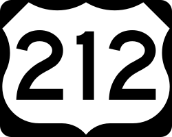
U.S. Highway 212
| Karte | |||||||||||||||||||||||||||||||||||||||||||||||||||||||||||||||||||||||||||||||||||||||||||||||||||||||||||||||||||||||||||||||||||||
|---|---|---|---|---|---|---|---|---|---|---|---|---|---|---|---|---|---|---|---|---|---|---|---|---|---|---|---|---|---|---|---|---|---|---|---|---|---|---|---|---|---|---|---|---|---|---|---|---|---|---|---|---|---|---|---|---|---|---|---|---|---|---|---|---|---|---|---|---|---|---|---|---|---|---|---|---|---|---|---|---|---|---|---|---|---|---|---|---|---|---|---|---|---|---|---|---|---|---|---|---|---|---|---|---|---|---|---|---|---|---|---|---|---|---|---|---|---|---|---|---|---|---|---|---|---|---|---|---|---|---|---|---|---|
| Basisdaten | |||||||||||||||||||||||||||||||||||||||||||||||||||||||||||||||||||||||||||||||||||||||||||||||||||||||||||||||||||||||||||||||||||||
| Gesamtlänge: | 949 mi. / 1527 km | ||||||||||||||||||||||||||||||||||||||||||||||||||||||||||||||||||||||||||||||||||||||||||||||||||||||||||||||||||||||||||||||||||||
| Eröffnung: | 1926 | ||||||||||||||||||||||||||||||||||||||||||||||||||||||||||||||||||||||||||||||||||||||||||||||||||||||||||||||||||||||||||||||||||||
| Bundesstaaten: | Minnesota South Dakota Wyoming Montana | ||||||||||||||||||||||||||||||||||||||||||||||||||||||||||||||||||||||||||||||||||||||||||||||||||||||||||||||||||||||||||||||||||||
| Anfangspunkt: | MN 62 bei Edina (Minnesota) | ||||||||||||||||||||||||||||||||||||||||||||||||||||||||||||||||||||||||||||||||||||||||||||||||||||||||||||||||||||||||||||||||||||
| Endpunkt: | Tower Junction im Yellowstone-Nationalpark | ||||||||||||||||||||||||||||||||||||||||||||||||||||||||||||||||||||||||||||||||||||||||||||||||||||||||||||||||||||||||||||||||||||
Verlauf
| |||||||||||||||||||||||||||||||||||||||||||||||||||||||||||||||||||||||||||||||||||||||||||||||||||||||||||||||||||||||||||||||||||||

Der U.S. Highway 212 (auch U.S. Route 212) ist eine Fernstraße im Mittleren Westen der USA, die vom Großraum Minneapolis-Saint Paul in Minnesota nach Westen führt und im Yellowstone-Nationalpark in Wyoming endet. Dabei durchquert die Straße die US-Bundesstaaten South Dakota und Montana. Die Gesamtlänge beträgt 1527 km. Der U.S. Highway 212 wurde 1926 eröffnet.
Streckenverlauf
Der U.S. Highway 212 war ursprünglich ein südlicher Ableger des U.S. Highway 12. Er begann früher als Abzweig des U.S. Highway 12 in Saint Paul. Heute bildet sein östliches Ende einen Abzweig vom Minnesota State Highway 62 östlich der Kreuzung mit dem U.S. Highway 169 im Stadtgebiet von Edina.
Der U.S. Highway 212 verläuft in überwiegend westlicher Richtung. Er kreuzt bei Eden Prairie die Interstate 494. Die Fernstraße passiert die Orte Norwood Young America, Glencoe, Brownton und Hector. Bei Olivia kreuzt der U.S. Highway 71 die Straße. Der Highway verläuft zwischen Granite Falls und Montevideo entlang dem Minnesota River. Bei Montevideo kreuzt der U.S. Highway 59 die Straße. Der U.S. Highway 212 setzt seinen Kurs nach Westen fort. Er passiert die Ortschaft Dawson und kreuzt südlich von Madison den U.S. Highway 75. Der U.S. Highway 212 überquert die Grenze nach South Dakota. Bei der Kleinstadt Watertown kreuzt er die Interstate 29 sowie kurz darauf den U.S. Highway 81. Später, bei Redfield, kreuzt der U.S. Highway 212 den U.S. Highway 281. Westlich von Gettysburg befindet sich die Kreuzung mit dem U.S. Highway 83. Der U.S. Highway 212 überquert bei Forest City den zum Lake Oahe aufgestauten Missouri River. In South Dakota passiert die Fernstraße die Orte Newell und Belle Fourche. Bei Belle Fourche kreuzt der U.S. Highway 85 den U.S. Highway 212. Dieser verläuft nun in westnordwestlicher Richtung und etwa 30 km durch den äußersten Nordosten des Bundesstaates Wyoming, bevor er den Südosten von Montana erreicht. Bei Broadus überquert der U.S. Highway 212 den Powder River. Bei der Siedlung Crow Agency trifft die Interstate 90 von Süden kommend auf die Fernstraße. Auf den folgenden 125 Kilometern bis nach Laurel ist der Streckenverlauf der beiden Straßen identisch. Bei Hardin wird der Bighorn River überquert. In Lockwood, einem östlichen Vorort von Billings, trifft die Interstate 94 von Nordosten kommend sowie der U.S. Highway 87 von Norden kommend auf die Fernstraße. Diese umfährt südlich das Stadtzentrum von Billings. Bei Laurel trennt sich der U.S. Highway 212 von der Interstate 90 und verläuft nun nach Süden. Bei Rockvale zweigt der U.S. Highway 310 nach Süden ab, während der U.S. Highway 212 in südwestlicher Richtung entlang dem Rock Creek nach Red Lodge führt. Südlich von Red Lodge überquert der Highway die Beartooth Mountains. Der Straßenabschnitt von Red Lodge nach Cooke City heißt auch Beartooth Highway. Der höchste Punkt der Strecke liegt auf 3336 m Höhe am Beartooth Pass. Der Beartooth Highway ist aufgrund der starken Schneefälle im Winter nur zwischen Mai und Oktober geöffnet. Der U.S. Highway 212 erreicht den Nordost-Eingang des Yellowstone-Nationalparks. Er verläuft noch knapp 45 km innerhalb des Nationalparks und endet im Norden des Nationalparks im Lamar Valley an der Kreuzung mit der Grand Loop Road in Tower Junction.
Weblinks
Auf dieser Seite verwendete Medien
Sinnbild innerorts
Wellenlinie als Gewässersymbol für die Formatvorlage Autobahn
600 mm × 600 mm (24 in × 24 in) U.S. Highway shield, made to the specifications of the 2004 edition of Standard Highway Signs. (Note that there is a missing "J" label on the left side of the diagram.) Uses the Roadgeek 2005 fonts. (United States law does not permit the copyrighting of typeface designs, and the fonts are meant to be copies of a U.S. Government-produced work anyway.)
750 mm × 600 mm (30 in × 24 in) U.S. Highway shield, made to the specifications of the 2004 edition of Standard Highway Signs. (Note that there is a missing "J" label on the left side of the diagram.) Uses the Roadgeek 2005 fonts. (United States law does not permit the copyrighting of typeface designs, and the fonts are meant to be copies of a U.S. Government-produced work anyway.)
600 mm × 600 mm (24 in × 24 in) U.S. Highway shield, made to the specifications of the 2004 edition of Standard Highway Signs. (Note that there is a missing "J" label on the left side of the diagram.) Uses the Roadgeek 2005 fonts. (United States law does not permit the copyrighting of typeface designs, and the fonts are meant to be copies of a U.S. Government-produced work anyway.)
600 mm × 600 mm (24 in × 24 in) U.S. Highway shield, made to the specifications of the 2004 edition of Standard Highway Signs. (Note that there is a missing "J" label on the left side of the diagram.) Uses the Roadgeek 2005 fonts. (United States law does not permit the copyrighting of typeface designs, and the fonts are meant to be copies of a U.S. Government-produced work anyway.)
600 mm × 600 mm (24 in × 24 in) U.S. Highway shield, made to the specifications of the 2004 edition of Standard Highway Signs. (Note that there is a missing "J" label on the left side of the diagram.) Uses the Roadgeek 2005 fonts. (United States law does not permit the copyrighting of typeface designs, and the fonts are meant to be copies of a U.S. Government-produced work anyway.)
600 mm × 600 mm (24 in × 24 in) U.S. Highway shield, made to the specifications of the 2004 edition of Standard Highway Signs. (Note that there is a missing "J" label on the left side of the diagram.) Uses the Roadgeek 2005 fonts. (United States law does not permit the copyrighting of typeface designs, and the fonts are meant to be copies of a U.S. Government-produced work anyway.)
750 mm × 600 mm (30 in × 24 in) U.S. Highway shield, made to the specifications of the 2004 edition of Standard Highway Signs. (Note that there is a missing "J" label on the left side of the diagram.) Uses the Roadgeek 2005 fonts. (United States law does not permit the copyrighting of typeface designs, and the fonts are meant to be copies of a U.S. Government-produced work anyway.)
750 mm × 600 mm (30 in × 24 in) U.S. Highway shield, made to the specifications of the 2004 edition of Standard Highway Signs. (Note that there is a missing "J" label on the left side of the diagram.) Uses the Roadgeek 2005 fonts. (United States law does not permit the copyrighting of typeface designs, and the fonts are meant to be copies of a U.S. Government-produced work anyway.)
600 mm × 600 mm (24 in × 24 in) U.S. Highway shield, made to the specifications of the 2004 edition of Standard Highway Signs. (Note that there is a missing "J" label on the left side of the diagram.) Uses the Roadgeek 2005 fonts. (United States law does not permit the copyrighting of typeface designs, and the fonts are meant to be copies of a U.S. Government-produced work anyway.)
600 mm × 600 mm (24 in × 24 in) U.S. Highway shield, made to the specifications of the 2004 edition of Standard Highway Signs. (Note that there is a missing "J" label on the left side of the diagram.) Uses the Roadgeek 2005 fonts. (United States law does not permit the copyrighting of typeface designs, and the fonts are meant to be copies of a U.S. Government-produced work anyway.)
Autor/Urheber: Lpangelrob, Lizenz: CC BY-SA 3.0
U.S. Route 212 at the Montana-Wyoming state line, looking southeast into Wyoming.
600 mm × 600 mm (24 in × 24 in) U.S. Highway shield, made to the specifications of the 2004 edition of Standard Highway Signs. (Note that there is a missing "J" label on the left side of the diagram.) Uses the Roadgeek 2005 fonts. (United States law does not permit the copyrighting of typeface designs, and the fonts are meant to be copies of a U.S. Government-produced work anyway.)
750 mm × 600 mm (30 in × 24 in) U.S. Highway shield, made to the specifications of the 2004 edition of Standard Highway Signs. (Note that there is a missing "J" label on the left side of the diagram.) Uses the Roadgeek 2005 fonts. (United States law does not permit the copyrighting of typeface designs, and the fonts are meant to be copies of a U.S. Government-produced work anyway.)


