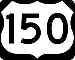
U.S. Highway 150
| Karte | |
|---|---|
| Basisdaten | |
| Gesamtlänge: | 571 mi/919 km |
| Eröffnung: | 1926 |
| Bundesstaaten: | Illinois Indiana Kentucky |
| Anfangspunkt: | |
| Endpunkt: | |
Der U.S. Highway 150 (kurz US 150) ist ein United States Highway in den Vereinigten Staaten, der am U.S. Highway 6 in Moline im Bundesstaat Illinois beginnt und am U.S. Highway 25 in Mount Vernon in Kentucky endet.
Verlauf
Illinois
Im Bundesstaat Illinois führt die US 150 vom Quad City International Airport an dem U.S. Highway 6 nach Vermilion. Zwischen Moline und Danville verläuft der Highway parallel zur Interstate 74.
Indiana
Der U.S. Highway 150 führt im Bundesstaat Indiana südlich an Terre Haute vorbei. Von Vincennes verläuft der Highway zusammen mit dem U.S. Highway 50 bis Shoals. Danach führt er in östliche Richtung nach New Albany, bevor er mit der Interstate 64 den Bundesstaat Kentucky erreicht.
Kentucky
In Kentucky überquert der US 150 zusammen mit der I-64 den Ohio River an der Sherman Minton Bridge. In der Innenstadt von Louisville bildet der Highway eine wichtige Hauptverkehrsstraße, die auch Bardstown Road genannt wird. Später kreuzt der er noch die Interstates 65, 264 und 265. Durch Louisville verläuft der Highway zusammen mit dem U.S. Highway 31. Sie trennen sich in Bardstown in der Nähe des Martha Layne Collins Blue Grass Parkway wieder. Der U.S Highway 150 führt danach weiter in Richtung Südosten nach Danville, bevor er in Mount Vernon endet.
Weblink
- Endpunkte des U.S Highways (englisch)
Auf dieser Seite verwendete Medien
600 mm × 600 mm (24 in × 24 in) U.S. Highway shield, made to the specifications of the 2004 edition of Standard Highway Signs. (Note that there is a missing "J" label on the left side of the diagram.) Uses the Roadgeek 2005 fonts. (United States law does not permit the copyrighting of typeface designs, and the fonts are meant to be copies of a U.S. Government-produced work anyway.)
600 mm × 600 mm (24 in × 24 in) U.S. Highway shield, made to the specifications of the 2004 edition of Standard Highway Signs. (Note that there is a missing "J" label on the left side of the diagram.) Uses the Roadgeek 2005 fonts. (United States law does not permit the copyrighting of typeface designs, and the fonts are meant to be copies of a U.S. Government-produced work anyway.)
750 mm × 600 mm (30 in × 24 in) U.S. Highway shield, made to the specifications of the 2004 edition of Standard Highway Signs. (Note that there is a missing "J" label on the left side of the diagram.) Uses the Roadgeek 2005 fonts. (United States law does not permit the copyrighting of typeface designs, and the fonts are meant to be copies of a U.S. Government-produced work anyway.)
600 mm × 600 mm (24 in × 24 in) U.S. Highway shield, made to the specifications of the 2004 edition of Standard Highway Signs. (Note that there is a missing "J" label on the left side of the diagram.) Uses the Roadgeek 2005 fonts. (United States law does not permit the copyrighting of typeface designs, and the fonts are meant to be copies of a U.S. Government-produced work anyway.)


