U-Bahn-Linien N und W (New York City)
  Broadway Express • Broadway Local Sea Beach – Fourth Avenue – Broadway – Astoria | |||||||||||||||||||||||||||||||||||||||||||||||||||||||||||||||||||||||||||||||||||||||||||||||||||||||||||||||||||||||||||||||||||||||||||||||||||||||||||||||||||||||||||||||||||||||||||||||||
|---|---|---|---|---|---|---|---|---|---|---|---|---|---|---|---|---|---|---|---|---|---|---|---|---|---|---|---|---|---|---|---|---|---|---|---|---|---|---|---|---|---|---|---|---|---|---|---|---|---|---|---|---|---|---|---|---|---|---|---|---|---|---|---|---|---|---|---|---|---|---|---|---|---|---|---|---|---|---|---|---|---|---|---|---|---|---|---|---|---|---|---|---|---|---|---|---|---|---|---|---|---|---|---|---|---|---|---|---|---|---|---|---|---|---|---|---|---|---|---|---|---|---|---|---|---|---|---|---|---|---|---|---|---|---|---|---|---|---|---|---|---|---|---|---|---|---|---|---|---|---|---|---|---|---|---|---|---|---|---|---|---|---|---|---|---|---|---|---|---|---|---|---|---|---|---|---|---|---|---|---|---|---|---|---|---|---|---|---|---|---|---|---|---|
 U-Bahn der Linie N in Manhattan (2016) | |||||||||||||||||||||||||||||||||||||||||||||||||||||||||||||||||||||||||||||||||||||||||||||||||||||||||||||||||||||||||||||||||||||||||||||||||||||||||||||||||||||||||||||||||||||||||||||||||
 Geographischer Plan New Yorks mit Verlauf der Linie N. | |||||||||||||||||||||||||||||||||||||||||||||||||||||||||||||||||||||||||||||||||||||||||||||||||||||||||||||||||||||||||||||||||||||||||||||||||||||||||||||||||||||||||||||||||||||||||||||||||
| Spurweite: | 1435 mm (Normalspur) | ||||||||||||||||||||||||||||||||||||||||||||||||||||||||||||||||||||||||||||||||||||||||||||||||||||||||||||||||||||||||||||||||||||||||||||||||||||||||||||||||||||||||||||||||||||||||||||||||
.jpg) U-Bahn der Linie W in Queens (2017) | |||||||||||||||||||||||||||||||||||||||||||||||||||||||||||||||||||||||||||||||||||||||||||||||||||||||||||||||||||||||||||||||||||||||||||||||||||||||||||||||||||||||||||||||||||||||||||||||||
 Geographischer Plan New Yorks mit Verlauf der Linie W. | |||||||||||||||||||||||||||||||||||||||||||||||||||||||||||||||||||||||||||||||||||||||||||||||||||||||||||||||||||||||||||||||||||||||||||||||||||||||||||||||||||||||||||||||||||||||||||||||||
| Spurweite: | 1435 mm (Normalspur) | ||||||||||||||||||||||||||||||||||||||||||||||||||||||||||||||||||||||||||||||||||||||||||||||||||||||||||||||||||||||||||||||||||||||||||||||||||||||||||||||||||||||||||||||||||||||||||||||||
u
| |||||||||||||||||||||||||||||||||||||||||||||||||||||||||||||||||||||||||||||||||||||||||||||||||||||||||||||||||||||||||||||||||||||||||||||||||||||||||||||||||||||||||||||||||||||||||||||||||
| Erklärung | |||||||||||||||||||||||||||||||||||||||||||||||||||||||||||||||||||||||||||||||||||||||||||||||||||||||||||||||||||||||||||||||||||||||||||||||||||||||||||||||||||||||||||||||||||||||||||||||||
| Es werden ausschließlich Knotenpunkte und Endpunkte dargestellt. Kursiv geschriebene Stationen werden von der Linie N nur von Mitternacht bis morgens früh um 6 bedient.[1][2] | |||||||||||||||||||||||||||||||||||||||||||||||||||||||||||||||||||||||||||||||||||||||||||||||||||||||||||||||||||||||||||||||||||||||||||||||||||||||||||||||||||||||||||||||||||||||||||||||||
Die Linie N „Broadway Express“ und die Linie W „Broadway Local“ sind U-Bahn-Linien der New York City Subway, die in New York durch die Stadtbezirke Queens, Manhattan und Brooklyn fahren. Ihre Stammstrecke ist die BMT Broadway Line, eine der sechs Stammstrecken der Division B. Beide Linien haben die Kennfarbe Gelb. Sie verkehren außerdem auf der BMT Astoria Line. Die BMT Fourth Avenue Line und die BMT Sea Beach Line werden von der Linie N befahren, im Berufsverkehr auch von wenigen Zügen der Linie W.
Die Linie N fährt jeden Tag rund um die Uhr zwischen dem Bahnhof Astoria–Ditmars Boulevard in Astoria im Nordwesten von Queens und dem Bahnhof Coney Island–Stillwell Avenue im Süden von Brooklyn. Nachts nutzt sie dafür nicht den kürzeren Weg über die Manhattan Bridge, sondern fährt abweichend durch Lower Manhattan und die Innenstadt Brooklyns. Sie hält nachts an allen Stationen, die sie tagsüber als Express ohne Halt passiert und die an Wochentagen von der Linie W bedient werden. Die Linie W verstärkt über die werktägliche Bedienung der von der Linie N ausgelassenen Stationen hinaus das Angebot von Astoria bis zum U-Bahnhof Whitehall Street–South Ferry.
Vorläufer der Linie N boten ab 1915 unter der Bezeichnung „Sea Beach Express“ über die Sea Beach Line die seinerzeit schnellste U-Bahn-Verbindung von den Innenstädten Manhattans und Brooklyns zu Stränden an der Lower New York Bay und den Vergnügungsvierteln Coney Islands. In den folgenden Jahrzehnten wurden andere, direktere Verbindungen zwischen Stadt und Küste geschaffen, so dass der Verkehr auf der BMT Sea Beach Line vorrangig örtliche Bedeutung bekam. Das Liniensignal „N“ wurde für diese Verbindung ab 1961 verwendet. Die Linie W wurde erstmals 2001 eingerichtet, 2010 aus Kostengründen eingestellt und 2016 erneut eingerichtet. Sie deckt Verkehrsbeziehungen ab, die zuvor als Varianten der Linie N bezeichnet worden waren.
Die U-Bahn-Betriebsabteilung der New York City Transit Authority behandelt die Linie W und die Linie N bei der Bestückung mit U-Bahn-Wagen gemeinsam[3]:3 und führt die Fahrten durch Personal im gleichen Dienstplan durch. Weil die Linie W nur werktags verkehrt und auf ganzer Länge von anderen Linien begleitet wird, kann sie bei Störungen oder Personalmangel entfallen.[4]
Verlauf
Verlauf der Linie N
Die Linie N beginnt in Astoria und führt über die als Hochbahn angelegte BMT Astoria Line zur Queensboro Plaza, fährt über eine Rampe neben der Queensboro Bridge in den 60th Street Tunnel unter dem East River und auf die anschließende BMT Broadway Line durch Manhattan. Von Canal Street in Manhattan aus quert sie auf der Manhattan Bridge abermals den East River und folgt dann in Brooklyn der BMT Fourth Avenue Line bis zur 56th Street, wo sie auf die BMT Sea Beach Line abzweigt und an deren Ende Coney Island erreicht.
Von Mitternacht bis morgens um sechs Uhr verkehrt die Linie N ab Canal Street nicht über die Manhattan Bridge, sondern durch den Financial District, und benutzt den Montague-Street-Tunnel, um den East River zu unterqueren. Ab Atlantic Avenue–Barclays Center in Brooklyn sind beide Linienwege wieder deckungsgleich, wenngleich mit je nach Tageszeit abweichenden Systemhalten.
Während der Hauptverkehrszeiten wird die Linie als Express geführt, der südlich vom Times Square in Manhattan nur die Stationen 34th Street–Herald Square, 14th Street–Union Square und Canal Street bedient. In Brooklyn sind es dann bis 59th Street nur die Bahnhöfe Atlantic Avenue–Barclays Center, wo zum Bahnhof Atlantic Terminal der Long Island Rail Road (LIRR) umgestiegen werden kann, und 36th Street.
Verlauf der Linie W
Die Linie W beginnt ebenfalls in Astoria, führt über die BMT Astoria Line zur Queensboro Plaza, in den 60th-Street-Tunnel unter dem East River und auf die BMT Broadway Line durch Manhattan.
Dort bedient sie, im Unterschied zur Linie N, von 34th Street–Herald Square bis Canal Street alle Zwischenhalte, und fährt nicht nach Brooklyn, sondern endet nach Bedienung des Financial District im U-Bahnhof Whitehall Street–South Ferry an der Südspitze Manhattans.
Abweichend von dieser Regel werden im Berufsverkehr einzelne Fahrten der Linie W durch den Montague Street Tunnel geführt und folgen so dem Weg der Linie N in Brooklyn, wo sie von und nach Gravesend–86th Street, dem letzten Bahnhof vor der Endstation Coney Island–Stillwell Avenue, verkehren.
Zusammenfassung
Beide Linien bedienen die BMT Astoria Line in Queens, queren den East River nach Manhattan im 60th-Street-Tunnel und bedienen dort die BMT Broadway Line. Während der Betriebszeiten der Linie W hält diese an allen Stationen der BMT Broadway Line und die Linie N nur an ausgewählten Stationen.
Die Linie N quert den East River ein zweites Mal, um nach Brooklyn zu fahren. Die Linie W hingegen endet gewöhnlich an der Südspitze Manhattans. Der East River wird nachts durch den Montague-Street-Tunnel und zu allen übrigen Zeiten auf der Manhattan Bridge gequert.
In Downtown Brooklyn vereinigen sich diese zwei möglichen Linienwege im Knotenbahnhof DeKalb Avenue. Die Linie N fährt in Brooklyn entlang der BMT Fourth Avenue Line als Express und entlang der BMT Sea Beach Line als Local bis Coney Island–Stillwell Avenue.
Im Berufsverkehr bedienen einzelne Fahrten der Linie N zur Verstärkung der Linie Q die IND Second Avenue Line bis 96th Street anstelle der BMT Astoria Line. Diese Fahrten werden im Fahrplan des Jahres 2022 bereits ab Coney Island als Linie Q beschildert, in Gegenrichtung von 96th Street nach Coney Island als Linie N.[5]
Geschichte
_(14577324020).jpg)

In Brooklyn
Als Ausflugsbahn nach Coney Island
Die U-Bahn-Linie N hat ihren Ursprung auf der BMT Sea Beach Line.
Die Züge der 1876 als Ausflugsbahn nach Coney Island gegründeten New York and Sea Beach Railroad fuhren nicht ins Stadtzentrum von Brooklyn, sondern blieben außerhalb der damaligen Stadtgrenze und fuhren zu einem Fähranleger an der Upper New York Bay.
Nach Übernahme durch die Brooklyn Rapid Transit Company (BRT) wurde die Strecke elektrifiziert und an die klassische Hochbahn Fifth Avenue Line und an die West End Line, die an der Oberfläche verlief, angeschlossen.[m 2] Die Züge fuhren fortan von der Sea Beach Line über die West End Line bis 9th Avenue, weiter nach Downtown Brooklyn und über die Brooklyn Bridge bis Park Row im Financial District Manhattans.
Als Linie der BRT
Im Jahr 1907 gab die Stadt New York in Brooklyn den innerstädtischen U-Bahn-Abschnitt mit dem Knotenbahnhof DeKalb Avenue und der Fourth Avenue Line in Auftrag. Der Plan umfasste auch die Verbindung zur am Jahresende 1909 eröffneten städtischen Manhattan Bridge sowie die Anschlussstrecke in Lower Manhattan. Diese Abschnitte wurden 1908 in den Triborough-Plan überführt und, nach dessen Scheitern, als Teil des Vertrags Nummer 4 der Doppelverträge von 1913 für den Betrieb durch die BRT vergeben.
DeKalb Avenue ist seitdem der Mittelpunkt des U-Bahn-Netzes der BRT. Er wurde am 22. Juni 1915 an die Manhattan Bridge angeschlossen. Die Strecke endete anfangs im großen U-Bahnhof Chambers Street in Manhattan. In Brooklyn wurde die BRT Fourth Avenue Line als neue U-Bahn-Hauptstrecke von DeKalb Avenue nach Süd-Brooklyn gebaut.
Im Rahmen der Doppelverträge verlegte die BRT die Sea Beach Line von der Straßenoberfläche in einen, zum Teil oberflächennahen und flachen, Einschnitt und verbreiterte sie auf vier Gleise. Dabei wurde 1913 die vorherige Gleisverbindung zur West End Line aufgelöst, an der gleichen Stelle besteht seitdem durch die Station New Utrecht Avenue eine Umsteigemöglichkeit zur Hochbahn-Station 62nd Street der erneuerten West End Line.
Der Einschnitt der Sea Beach Line führt nach Westen parallel zur Güterzugstrecke LIRR Bay Ridge Branch bis zur BRT Fourth Avenue Line an Brooklyns 59. Straße. Dort wurden die äußeren Local-Gleise der Sea Beach Line an die inneren Express-Gleise der neuen U-Bahn-Tunnelstrecke angeschlossen. Die inneren Express-Gleise der Sea Beach Line hingegen unterquerten den U-Bahn-Tunnel und führten, wie schon die ursprüngliche Sea Beach Line, zum Fähranleger mit Trajekt und Rangierbahnhof 65th Street Yard in Bay Ridge und Sunset Park. Für Passagiere wurde diese Fährverbindung nach Eröffnung der neuen U-Bahn-Strecke überflüssig, allein für betriebliche Zwecke könnte sie noch bis in die 1920er Jahre genutzt worden sein. Beim Bau des Gowanus Expressway wurde die Verbindung abgerissen.[6]
Spätere Jahre
Obwohl im Knotenbahnhof DeKalb Avenue alle vier Brückengleise und die zwei Tunnelgleise nebeneinander liegen, gibt es nur vier Bahnsteigkanten und müssen im Berufsverkehr viele Züge ohne Halt durchfahren, um einen möglichst hohen Durchsatz an Zügen und damit Fahrgästen zu erzielen. Die von der BMT Fourth Avenue Line kommenden Expressgleise führen zur Manhattan Bridge und berühren keine Bahnsteige, so dass die auf dieser Relation fahrenden Expresszüge keinen Systemhalt in diesem Knotenpunkt haben.[7]
Infolge der schweren Haushaltskrise der Stadt New York wurden in den Jahren 1976 und 1977 in erheblichem Umfang Zugfahrten bei der U-Bahn gestrichen. Die Linie N in Brooklyn wurde im Nachtverkehr auf die BMT Sea Beach Line eingekürzt und fuhr nur zwischen Coney Island–Stillwell Avenue und 36th Street, wo in die Linie R umgestiegen werden musste.
In Manhattan
Nach Chambers Street
Das nördliche Ende der „Sea-Beach-Linie“ befand sich von 1915 bis 1917 in Lower Manhattan. Ab dem 22. Juni 1915 fuhren die Züge der Brooklyn Rapid Transit Company (BRT) als U-Bahnen von Coney Island durch Brooklyn und über die Manhattan Bridge bis zum neuen U-Bahnhof Chambers Street unter dem Municipal Building gegenüber dem Rathaus im Stadtviertel Civic Center.
Die dafür benötigte Gleisverbindung mit den südlichen (westlichen) Gleisen der Manhattan Bridge nach Chambers Street existierte von Juni 1915 bis zu den Umbauten für die Chrystie Street Connection 1967, war aber nach 1960 praktisch bedeutungslos.[8][9] Mit der Erweiterung der Strecke südlich über den U-Bahnhof Chambers Street hinaus zum Montague-Street-Tunnel entstand in Lower Manhattan eine durchgängig befahrbare Strecke, die seit 1931 als BMT Nassau Street Line bezeichnet wird.
Auf der Broadway Line
Die Züge von der Sea Beach Line wurden 1917 auf die BMT Broadway Line verlagert und in den folgenden Jahren und Jahrzehnten schrittweise nordwärts bis ins neue Geschäftszentrum Midtown Manhattan verlängert: Ab 1917 endeten sie im U-Bahnhof 14th Street–Union Square, ab 1918 Times Square‒42nd Street und ab 1957 57th Street–Seventh Avenue.
Die Linie N wurde am 30. August 1976 nach Queens verlängert. Sie durchfuhr an Wochentagen die 60th Street Tunnel Connection auf die IND Queens Boulevard Line und endete im U-Bahnhof Forest Hills–71st Avenue.[Anm. 1][m 3] Dies war Teil einer umfassenden Reduktion von Zugfahrten durch die MTA infolge der schweren Haushaltskrise der Stadt New York. Hatten zuvor seit 1967 die Linie N und Linie EE gemeinsam den betreffenden Abschnitt der BMT Broadway Line befahren, fanden durch den Wegfall der Linie EE dort insgesamt weniger Fahrten statt.
In Queens

Unter dem Queens Boulevard
Die Linie N wurde am 30. August 1976 nach Queens verlängert. Sie durchfuhr an Wochentagen die 1955 eingeweihte 60th Street Tunnel Connection auf die IND Queens Boulevard Line und endete bis 1987 im U-Bahnhof Forest Hills–71st Avenue.[Anm. 1][m 3]
Nach Astoria
Ab 1949 fuhren nur noch U-Bahnen der BMT-Division, nicht mehr der IRT-Division, auf die 1917 eröffnete Strecke nach Astoria. Waren dies zunächst Fahrten der ab den 1960er Jahren als Linie R bezeichneten Linie, fährt seit 1987 die Linie N nach Astoria und an ihrer Stelle die Linie R nach Forest Hills–71st Avenue.[Anm. 1]
Obwohl die BMT Astoria Line dreigleisig ist, wird nach 2001 dort kein regelmäßiger Expressbetrieb angeboten. Die im Rahmen der Sperrung der Manhattan Bridge im August 2001 neu eingeführte Linie W fuhr dort im Berufsverkehr als relativ schwach genutzter Express in Lastrichtung. Da zugleich die Linie N stark genutzt wurde, sah sich die MTA dazu veranlasst, ab Januar 2002 auch die Linie W über die Local-Gleise zu führen und dadurch einen für Fahrgäste dichteren Takt bei im Durchschnitt etwas längerer Fahrzeit anzubieten.
Linienbezeichnungen und Chrystie Street Connection
.svg)

Im Jahr 1961 gab die New York City Transit Authority den Linien der BMT-Division Buchstaben statt der vorherigen Zahlen. Die Bezeichnung von Linien mit Buchstaben geschah nach dem Vorbild des Linienschemas der IND-Division, das die Buchstaben A bis H verwendete. Dabei kennzeichneten Liniensignale, die aus einem Buchstaben bestanden, Express-Linien, und solche, die aus zwei Buchstaben bestanden, Local-Linien. Den Linien der BMT-Division wurden Buchstaben beginnend bei „J“ zugewiesen. Die Expresslinie auf der BMT Sea Beach Line bekam das Liniensignal N.
Im zeitlichen Zusammenhang mit der Eröffnung der Chrystie Street Connection in den Jahren 1967 und 1968 erhielt die Linie N ein rundes Emblem in der Kennfarbe Gelb. Ergänzend wurde im Berufsverkehr die Linie NX eingeführt. Sie fuhr nur vom 27. November 1967 bis zum 12. April 1968. Ihre fünf werktäglichen Fahrten wurden ab 15. April 1968 in die Linie N integriert.
Die Haushaltskrise der Stadt New York führte 1976 zur Kürzung des Fahrtenangebots. Am 30. August 1976 wurde die Linie EE gestrichen und von der Linie N als ein Local auf der Queens Boulevard Line und als ein „Broadway Local“ ersetzt.[m 3]
Im Berufsverkehr gab es zeitweise eine Linie N mit Rautenemblem für Fahrten, die in Manhattan als „Broadway Local“ nur bis Whitehall Street fuhren und insofern ein Vorläufer der Linie W waren. Die Praxis, Rautenembleme für jedwede im Berufsverkehr von der Stammlinie abweichende Linienführung zu verwenden, begann 1979 und wurde ab Mitte der 1980er Jahre wieder aufgegeben.
Sanierung der Manhattan Bridge
Die Sanierung der U-Bahn-Gleise auf der Manhattan Bridge mit wechselseitigen, mehrjährigen Sperrungen führte in den Jahren 1986 bis 2004 zu Änderungen bei den betroffenen Linien. Die Linie N wurde generell als „Broadway Local“ durch den Montague-Street-Tunnel geführt. Ausnahme waren in den Jahren 1986 bis 1987 die Wochenenden, Abend- und Nachtstunden, in denen sie die Brücke nutzen konnte.
Im Mai 1987 tauschte die Linie N Teile ihres Linienwegs mit der Linie R: In Queens fährt sie seitdem nach Astoria, nicht mehr nach Forest Hills-71st Avenue.[Anm. 1] Sie wurde zum festen „Broadway Local“ – mit Ausnahme wieder der Wochenenden, Abend- und Nachtstunden, zu denen sie über die Brücke und als „Broadway Express“ fuhr.
Nach dem Einsturz des World Trade Centers am 11. September 2001 waren der U-Bahnhof Cortlandt Street und der Abschnitt der BMT Broadway Line durch den Financial District gesperrt. Der Montague-Street-Tunnel hingegen blieb von der BMT Nassau Street Line aus benutzbar. Die Linie N entfiel und andere Linien übernahmen vorübergehend die befahrbaren Teile des Linienwegs.[m 4] Am 28. Oktober 2001 war der Streckenabschnitt wieder befahrbar, nur der gesperrte Bahnhof wurde ohne Halt passiert.[m 5]
Im Jahr 2004 war die jahrzehntelange Sanierung der Manhattan Bridge abgeschlossen. Seitdem nutzt die Linie N die Brücke zu allen Zeiten außer nachts.
Auf die Second Avenue Line
Die Linie W wurde am 7. November 2016 wieder eingeführt. Sie ersetzte auf der BMT Astoria Line die Linie Q.
Die Linie Q war seit der ersten Einstellung der Linie W nach Astoria gefahren und wurde nach 57th Street–7th Avenue auf der BMT Broadway Line zurückgezogen. Sie wurde so darauf vorbereitet, auf die IND Second Avenue Line verlängert zu werden, deren Inbetriebnahme dann zum Jahreswechsel 2016/2017 erfolgte.
Die vorhandenen Gleisverbindungen lassen es grundsätzlich zu, dass alle Linien, die die BMT Broadway Line und die IND Sixth Avenue Line befahren, an deren Nordenden auf die IND Second Avenue Line wechseln können.[10] Dies wird im Berufsverkehr sowie bedarfsweise und bei Umleitungen genutzt. Im Berufsverkehr bedienen einzelne Fahrten der Linie N zur Verstärkung der Linie Q die IND Second Avenue Line bis 96th Street anstelle der BMT Astoria Line. Diese Fahrten wurden im Fahrplan des Jahres 2022 bereits ab Coney Island als Linie Q beschildert, in Gegenrichtung von 96th Street nach Coney Island als Linie N.[5]
- Strecken und Betrieb der Linien N und W
 Karte des Streckennetzes der BMT im Jahr 1924. Grün markiert ist die ganze Länge des später als Linie N bezeichneten Linienwegs von Coney Island (rechts) durch Manhattan (unten links) bis Astoria (mittig links).
 Darstellung des Wegs der Linie W in Queens und Manhattan
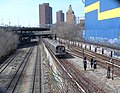 Auf Teil der Trasse der Sea Beach Line liegen U-Bahn und die Güterzugstrecke Bay Ridge Branch nebeneinander (2010)
 Zug der Linie N auf Sea Beach Line bei Schneefall (2020)
 Linie N verlässt 60th-
Street- Tunnel, Blick von Rampe der Queensboro Bridge (2008) 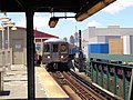 Linie W in Queensboro Plaza (2017)
 (c) Niederkasseler, CC BY-SA 3.0Linie N am Hochbahnhof 30th Avenue in Queens (2011)

Fahrplan
Fahrplan der Linie N

Abhängig von der Tageszeit sind im Fahrplan des N „Broadway Express“ unterschiedliche Fahrzeiten und Linienwege vorgesehen. Der Expressbetrieb existiert in mehreren Abstufungen: In Manhattan, in Brooklyn oder in beiden Bezirken.
Im Detail gibt es in Brooklyn zusätzlich die Unterscheidung zwischen Zügen, die auf der BMT Fourth Avenue Line ab der Einfädelung der BMT Sea Beach Line die Local-Gleise nutzen, an den Local-Stationen 45th Street und 53th Street halten und nördlich von 36th Street zurück auf die Expressgleise wechseln, zwischen solchen, die nördlich von 36th Street auf den Local-Gleisen bleiben, und solchen, die ab der Einfädelung der Sea Beach Line auf den Expressgleisen verkehren.
Im Fahrplan Anfang des Jahres 2023 dauert nachts die Fahrt von Coney Island nach Astoria 87 Minuten. Die letzte Abfahrt, die durch den Montague-Street-Tunnel führt, ist um 04.57 Uhr. Die folgende Abfahrt um 05.19 Uhr an Wochentagen hält noch an allen Stationen in Brooklyn, aber nutzt bereits die Manhattan Bridge, fährt in Manhattan als Express und benötigt so 75 Minuten bis Astoria. Die darauf folgende Abfahrt um 05.30 Uhr an Wochentagen ist auch in Brooklyn ein Express und braucht 71 Minuten bis Astoria.[5]
Tagsüber werden 75 Minuten für Fahrten von Coney Island bis Astoria benötigt. Die letzte Express-Abfahrt ist um 18.24 Uhr, danach wird bis 22.05 Uhr mit allen Halten in Brooklyn gefahren, was 83 bis 92 Minuten dauert. Die Fahrt ab 22.30 Uhr ist die erste auf der nächtlichen Linienführung durch den Montague-Street-Tunnel und benötigt dafür 84 Minuten.[5]
Seit August 2023 finden die Fahrten tagsüber alle 8 statt wie zuvor alle 10 Minuten statt, seit Dezember 2023 gilt das gleiche im Abendverkehr.[11]
Fahrplan der Linie W

Mit Stand Anfang des Jahres 2023 sind Im Fahrplan des W „Broadway Local“ an Werktagen ab Whitehall Street–South Ferry von 07.06 Uhr bis 22.14 Uhr sechs Abfahrten pro Stunde überwiegend in einem 10-Minuten-Takt vorgesehen. In der Verkehrsspitze morgens und nachmittags gibt es einzelne Verdichtungen auf sieben Abfahrten pro Stunde, wobei zwei bzw. drei tägliche Fahrten über Whitehall Street–South Ferry hinaus dem Verlauf der Linie N folgend von und nach 86th Street auf der BMT Sea Beach Line verkehren.[12]
Die Fahrzeit des W „Broadway Local“ beträgt von Whitehall Street nach Astoria ca. 41 bis 44 Minuten.
Im Vergleich der Fahrzeiten der Locals und der Expresse im gemeinsamen Abschnitt Canal Street bis Astoria sind die Expresse je nach Tageszeit dort höchstens fünf Minuten schneller.[5][12] An Wochenenden verkehrt die Linie W nicht, daher hält die Linie N an Wochenenden tagsüber als „Broadway Local“ an allen Halten in Manhattan und fährt über die Manhattan Bridge, während die Halte in Lower Manhattan und durch den Montague-Street-Tunnel allein von der Linie R bedient werden.
Rollmaterial
Ab November 2021 waren die Linien N und W zusammen im gleichen Umlaufplan mit Wagen der Typen R46, R68 und R68A bestückt. Im Berufsverkehr wurden dabei 264 der jeweils 75 Fuß langen Wagen benötigt, die zu 33 Zügen aus je 8 Wagen mit der bei der Division B üblichen Maximallänge von 600 Fuß (ca. 180 Metern) zusammengestellt wurden.[3]:3
In den 1970er Jahren wurden viele Züge außerhalb des Berufsverkehrs auf vier Wagen verkürzt. Dies geschah aufgrund der hohen Ausfallrate der damals unzulänglich instandgehaltenen und generell störungsanfälligen Fahrzeuge, und infolge der Ausgabenreduktionen während der Finanzkrise der Stadt New York.
Ehemalige Linien
Linie NX
.svg)
Anlässlich der Eröffnung des ersten Teils der Chrystie Street Connection Ende des Jahres 1967 veränderte die New York City Transit Authority das Liniennetz der fortan vereinigten BMT- und IND-Divisionen (Linien mit Buchstaben).
Für den Berufsverkehr wurde die Linie NX eingeführt, die mehrere Besonderheiten aufwies: Sie begann im Bahnhof Brighton Beach der BMT Brighton Line, aber fuhr nicht stadteinwärts, sondern als einzige nicht dort endende Linie zunächst durch den Bahnhof Coney Island–Stillwell Avenue hindurch, dann entlang des Wegs der Linie N, dabei auf den Expressgleisen der BMT Sea Beach Line ohne Zwischenhalt. Endstation war 57th Street–7th Avenue in Midtown Manhattan an der BMT Broadway Line.[m 6]
Ihre Kennfarbe war Türkis. Sie fuhr nur vom 27. November 1967 bis zum 12. April 1968. An jenem Tag wurden die später teilweise stillgelegten Expressgleise der BMT Sea Beach Line zum bislang letzten Mal von einer regulären Linie befahren. Die fünf werktäglichen Fahrten hatten gegenüber Linien auf direkter stadteinwärts führenden Strecken keinen Fahrzeitvorteil geboten und wurden ab 15. April 1968 in die Linie N integriert.
Linie W (2001–2010)
Am 21. Juli 2001 begann für eine seit 1986 andauernde Sanierung eine letzte Sperrphase der Manhattan Bridge. Es standen bis 2004 nur deren südliche (westliche) Gleise zur Verfügung, die DeKalb Avenue in Brooklyn mit der BMT Broadway Line verbinden. Die Verbindung zur Chrystie Street Connection auf der nördlichen (östlichen) Brückenseite war gesperrt. Die Linie W wurde an diesem Tag eingerichtet, um die Linie B in Brooklyn zu ersetzen, die aufgrund der Sperrung in Manhattan endete. Die Linie W fuhr durchgängig von Astoria–Ditmars Boulevard an der BMT Astoria Line bis Coney Island–Stillwell Avenue an der BMT Sea Beach Line.[m 7]
Während des Neubaus des Bahnhofs Coney Island–Stillwell Avenue in den Jahren 2002 bis 2004 wurden die vier dorthin führenden Strecken zeitweise abgetrennt, die Linien entsprechend verkürzt und ggf. Busersatzverkehre eingerichtet. Die Linie W war im September 2002 die einzige, die noch bis Stillwell Avenue fuhr.[m 8]
Mit Abschluss der Sanierungsarbeiten an der Manhattan Bridge wurden ab dem 22. Februar 2004 die Linien B und D wieder über die nördlichen (östlichen) Brückengleise geleitet und die Linie W auf den Lower-Manhattan-Teil der Broadway Line verlagert und verkürzt. Sie fuhr nicht mehr nach Brooklyn, sondern endete fortan im U-Bahnhof Whitehall Street.[m 9]
Die MTA strich zum 27. Juni 2010 die Linie W. Zugleich wurde auch die Linie V gestrichen, die erst am 17. Dezember 2001 im Rahmen der Verlängerung der IND 63rd Street Line zur IND Queens Boulevard Line eingeführt worden war. Grund für die zweifache Streichung war, dass im Nachgang der Finanzkrise 2007 im Haushalt des Verkehrsbetriebs Einnahmen fehlten. Bereits für das Jahr 2009 geplante Kürzungen waren noch durch Hilfszahlungen der Bundesregierung aus dem American Recovery and Reinvestment Act aufgeschoben worden und wurden dann 2010 wirksam. Als Ersatz für die Linie W wurde die Linie Q auf die BMT Astoria Line verlängert.[m 10]
Die Linie W wurde 2016 mit verändertem Linienweg wieder eingeführt. Dies geschah im Vorgriff auf die Eröffnung der IND Second Avenue Line zum Jahreswechsel 2016/2017. Dabei wurde die Linie Q dauerhaft auf die neue Strecke umgelegt und fährt seitdem nicht mehr nach Astoria.
Weiterführende Informationen
Weblinks
- Offizielle Betreiberseite der Linie N (englisch)
- Offizielle Betreiberseite der Linie W (englisch)
- Private Website über die New York City Subway und deren Historie (englisch)
- Übersichtsartikel „BMT Astoria Line“ von Adam Weiss, Peggy Darlington und David Pirmann
- Übersichtsartikel „BMT Broadway Line“
- Übersichtsartikel „BMT Sea Beach Line“ von Mark S. Feinman, Peggy Darlington und David Pirmann
- Sammlung historischer Liniennetzpläne
- Letter, Number, and Color Designation Systems von Joseph Brennan (beschreibt das Schema der Linienbezeichnungen)
- Line By Line History (chronologische Auflistung aller Änderungen an Linienverläufen, englisch)
Anmerkungen
- ↑ a b c d Die vormals als 71st–Continental Avenues, Continental Avenue o. ä. bekannte Zwischenendstelle der Queens Boulevard Line wird seit den 2000er Jahren auf dem Liniennetzplan als Forest Hills-71st Avenue bezeichnet, um das Benennungsschema stadtweit anzugleichen und das Stadtviertel Forest Hills (Queens) zu nennen.
Einzelnachweise
Historische Liniennetzpläne
- ↑ 1924 BMT Subway-Elevated Route Map (B/W). (JPEG; 1,2 MB) In: NYCSubway.org. Abgerufen am 4. Januar 2023 (englisch).
- ↑ 1912 BRT Rapid Transit Prior to its Extension Under the Dual Subway Contracts. (JPEG; 725 kB) In: NYCSubway.org. Abgerufen am 4. Januar 2023 (englisch).
- ↑ a b c 1978 System Map. (GIF; 78 kB) In: NYCSubway.org. Abgerufen am 4. Januar 2023 (englisch).
- ↑ 2001 Subway Service (9/17/2001). (GIF; 114 kB) In: NYCSubway.org. Abgerufen am 7. Januar 2023 (englisch).
- ↑ 2001 Subway Service (10/28/2001). (GIF; 116 kB) In: NYCSubway.org. Abgerufen am 7. Januar 2023 (englisch).
- ↑ 1967 System Map. (GIF; 165 kB) In: NYCSubway.org. Abgerufen am 4. Januar 2023 (englisch).
- ↑ 2001 Subway Service (7/22/2001). (GIF; 115 kB) In: NYCSubway.org. Abgerufen am 7. Januar 2023 (englisch).
- ↑ 2002 Subway Service (9/8/2002). (GIF; 122 kB) In: NYCSubway.org. Abgerufen am 7. Januar 2023 (englisch).
- ↑ 2004 Subway Service (2/22/2004). (GIF; 131 kB) In: NYCSubway.org. Abgerufen am 7. Januar 2023 (englisch).
- ↑ 2010 Subway Service (6/10/2010) [sic]. (JPEG; 725 kB) In: NYCSubway.org. Abgerufen am 7. Januar 2023 (englisch, Dateiformat ist JPEG, nicht GIF. Korrekt im Bild angegeben ist das Datum 2010-06-28.).
Allgemeine Nachweise
- ↑ New York City Subway with airport and railroad connections. (PDF) MTA, abgerufen am 28. März 2020.
- ↑ MTA/New York City Transit Subway Line Information. MTA, abgerufen am 26. März 2020.
- ↑ a b The Bulletin. In: Electric Railroaders’ Association (Hrsg.): The Bulletin. Band 64, Nr. 12. New York Dezember 2021 (englisch, 20 S., erausa.org [PDF; 7,5 MB; abgerufen am 7. Dezember 2022]).
- ↑ Bill Devlin: MTA suspends B, W and Z service over COVID staffing crunch. In: Spectrum News NY1. 30. Dezember 2021, archiviert vom (nicht mehr online verfügbar) am 6. Januar 2022; abgerufen am 25. Dezember 2022 (englisch).
- ↑ a b c d e Subway Timetable N Broadway Local. MTA N subway timetable 20220626 0.pdf. 26. Juni 2022, abgerufen am 14. Januar 2023.
- ↑ Andrew Lynch: Mysteries of the BMT Sea Beach Express. In: vanshnookenraggen. 30. Dezember 2021, archiviert vom am 1. Februar 2022; abgerufen am 18. Juli 2023 (englisch).
- ↑ Joseph Brennan: Myrtle Ave, and De Kalb Ave platforms. In: Abandoned Stations. 2002, abgerufen am 1. Januar 2023 (englisch).
- ↑ Joseph Brennan: Chambers St closed platforms. In: Abandoned Stations. 2002, abgerufen am 1. Januar 2023 (englisch).
- ↑ Of Dust and Tails: an abandoned subway tunnel from a forgotten era. In: LTV Squad. 1. August 2017, archiviert vom am 5. Juni 2023; abgerufen am 18. Juli 2023 (englisch).
- ↑ 63rd Street Tunnel and the Second Avenue Subway. In: nycsubway.org. Abgerufen am 17. Juni 2023 (englisch).
- ↑ MTA Announces Rollout of Subway Service Enhancements Starting This Summer. Metropolitan Transportation Authority, 4. Mai 2023, archiviert vom am 12. Juli 2023; abgerufen am 5. August 2023 (englisch).
- ↑ a b Subway Timetable W Broadway Local. MTA W subway timetable 20220626.pdf. 26. Juni 2022, abgerufen am 14. Januar 2023.
| IRT |
| |
| IND |
| |
| BMT |
| |
| Shuttles Kurzlinien | ||
| Ehemalige (Auswahl) |
|
Auf dieser Seite verwendete Medien
Autor/Urheber: R38R40, Lizenz: CC BY-SA 4.0
This is an R68A W train. It is car 5078 and is at the Broadway station in Astoria, Queens.
Bullet for the 9 Local service of the New York City Subway.
Bullet for the Q Local service of the New York City Subway.
Bullet for the proposed T Local service of the New York City Subway.

Autor/Urheber: L9A8M, Lizenz: CC BY 4.0
New York City Subway W service map
Bullet for the E Local service of the New York City Subway.
Bullet for New York City Subway W service.
Bullet for the 7 Local service of the New York City Subway.
.svg)
Bullet for New York City Subway MJ service, used from 1967-1969.
Bullet for the W Local service of the New York City Subway.
Bullet for the D Local service of the New York City Subway.
Bullet for the M Local service of the New York City Subway.
.svg)
Bullet for New York City Subway EE service, used from 1967-1976.
Bullet for the L Local service of the New York City Subway.
Bullet for the 5 Local service of the New York City Subway.

Autor/Urheber: Jim.henderson, Lizenz: CC0
Loooking northwest from 6th Avenue overpass as N rain approaches on a sunny early afternoon. See File:BR LIRR E fr 5 Av jeh.JPG for same trackage from opposite overpass.
Bullet for the R Local service of the New York City Subway.
Bullet for the F Local service of the New York City Subway.
Bullet for the A Local service of the New York City Subway.
Autor/Urheber: AahdTahar, Lizenz: CC BY-SA 4.0
A normal semi-rare occurrence on Broadway.

Bullet for the C Local service of the New York City Subway.

Bullet for the 2 Local service of the New York City Subway.

Elevated line end, set "u"

Elevated line start, set "u"
Bullet for the 4 Local service of the New York City Subway.
Bullet for the G Local service of the New York City Subway.
Bullet for New York City Subway NX service, used from 1967-1968.
Bullet for New York City Subway N diamond service.

In tunnel accessible station
.svg)
Bullet for New York City Subway AA service, used from 1979-1985.
This is a map showing the New York City Subway's N service. It was created with TIGER/Line GIS data (water and boundaries) and my own data (subway lines and stations, traced on TIGER/Line road data). If you would like a copy of the subway data, email me.

Autor/Urheber: Metropolitan Transportation Authority of the State of New York from United States of America, Lizenz: CC BY 2.0
Winter storm operations on Thu., December 17, 2020.
N train at New Utrecht Av.
Photo: Marc A. Hermann / MTABullet for the 1 Local service of the New York City Subway.
Bullet for the Rockaway Park Shuttle service of the New York City Subway.
SVG version of Image:Aiga railtransportation.gif. This version is not a pixel perfect copy but a proof of concept of simpler code.
.svg)
Bullet for New York City Subway 8 service, used from 1967-1979.
Bullet for the 6 Express service of the New York City Subway.

Autor/Urheber: Tdorante10, Lizenz: CC BY-SA 4.0
An Astoria-bound W train entering the upper level of the Queensboro Plaza subway station, in Long Island City, Queens.
Bullet for the V Local service of the New York City Subway.
Bullet for the B Local service of the New York City Subway.
Bullet for the 3 Local service of the New York City Subway.

Autor/Urheber: Kidfly182, Lizenz: CC BY-SA 4.0
Rollsign for the R68A W Train
Bullet for New York City Subway N service, used from 1967-1979.
This is a map showing the New York City Subway's W service. It was created with TIGER/Line GIS data (water and boundaries) and my own data (subway lines and stations, traced on TIGER/Line road data). If you would like a copy of the subway data, email me.

Autor/Urheber: Metropolitan Transportation Authority of the State of New York from United States of America, Lizenz: CC BY 2.0
2013.12.B8F28_R-32

In tunnel accessible station, line start
Bullet for the 7 Express service of the New York City Subway.
Bullet for the K Local service of the New York City Subway.

Autor/Urheber: Flowizm ..., Lizenz: CC BY 2.0
N train on Queensboro bridge

Icon for railway descriptions
Bullet for the 6 Local service of the New York City Subway.

Autor/Urheber: Tdorante10, Lizenz: CC BY-SA 4.0
A Coney Island-bound N local train stopped at the southbound platform of the 59th Street BMT Fourth Avenue Line station in Sunset Park, Brooklyn. Looking north towards the end of the platform.
.svg)
Bullet for New York City Subway CC service, used from 1967-1979.
Bullet for the Z Local service of the New York City Subway.
Autor/Urheber: Internet Archive Book Images, Lizenz: No restrictions
Identifier: worldalmanacency1899newy (find matches)
Title: The World almanac and encyclopedia
Year: 1899 (1890s)
Authors:
Subjects: Almanacs, American Statistics
Publisher: New York : Press Pub. Co. (The New York World)
Contributing Library: Boston Public Library
Digitizing Sponsor: Boston Public Library
View Book Page: Book Viewer
About This Book: Catalog Entry
View All Images: All Images From Book
Click here to view book online to see this illustration in context in a browseable online version of this book.
Text Appearing Before Image:
Brnollvn Tlanid Transit Company (controls Brooklyn Hpieht; Railroad (ompany Brooklyn City Railroad Company Brooklyn, Qiu-f ns Coimty. and Suburban Sea Beach Railway Company Sea View Railroad Company MT^^OMTC RFAriffFTH) oo^TEY island rwEsr end), brtchton beach, bath jK.j:;cjoir^ii.3 I^^icE^waszm, brach, rrroev beach, bowery bay, fort Hamilton, TJLMEH PARK, AMBROSE PARK. BENSONHURST, EASTERN PARK. PROSPECT PARK,FOREST PARK, NAVY YARD, GLENDALK PARK, AND RIDGEWOOD PARK. N. Y., AND VICINITY. Systems controlled by the TRANSIT COMPANY.
Text Appearing After Image:
265.58mnes>. Railroad Companj - ...» Owns 1.26 204.72 46.03 12.27 2.3 Operates ^^^-^ Executive Offices. Montagrue and ClintonStreets, Brooklyn, N. Y. 2.3 CEMFTFl^TP^ l^PATlFTPn-—^^- JOHNS, calvary, greenwood. EVERaREENS,y*^UMM^M.M^S\kX^^ IVCilirftLCiJ, CYPRESS HTLL«. MOUNT OT-TVTT.T T.TTTTTP.RAN CYPRESS HIIiLS,HOLY CROSa MOUNT OLIVET, LUTHERAN. JUanfiattan (ISlebatrTr) Mail\Bns ^^nttm. FOR POINTS OF INTEREST ON THIS LINE SEE PACE 546.
Note About Images
Bullet for the J Local service of the New York City Subway.
Bullet for the F Express service of the New York City Subway.
Bullet for the N Local service of the New York City Subway.
.svg)
Bullet for New York City Subway KK service, used from 1967-1973.
Bullet for New York City Subway N service.

![2010 Subway Service (6/10/2010) [sic].](https://www.nycsubway.org/perl/show?/img/maps/calcagno-2010-06-28c.gif)
Generic bullet for the Shuttle services of the New York City Subway.
