Trereen Dinas
Das mit Wällen abgeteilte Cliff Castle Trereen Dinas auf dem Gurnard’s Head (dt. Knurrhahn-Kopf; kornisch Ynyal, die Einöde) bei Treen in der Gemeinde Zennor ist eines von nur drei ausgegrabenen Promontory Forts in Cornwall – die beiden anderen sind Maen Castle und Trevelgue Head.
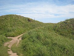
Das 1939 ausgegrabene eisenzeitliche Fort mit einer Größe von etwa drei Hektar liegt auf der Nordseite der Penwith-Halbinsel. Der etwa 60 Meter lange innere Wall ist der größere und etwa fünf Meter breit. Er hat noch zwei Meter Resthöhe. Außen liegt ein zweiter Wallrest mit Gräben auf der Innen- und Außenseite.
Reste von 16 Rundhütten mit bis zu sechs Metern Durchmesser liegen auf der Landseite. Drei wurden teilweise ausgegraben, wobei wenige Funde gemacht wurden. Eine genaue Datierung war unmöglich, aber die Funde, darunter Eisenmesser und -schnallen, Reibsteine, Spinnwirtel und zerscherbte Keramik weisen in die Mitte des 2. Jahrhunderts v. Chr. Der Platz wird vom National Trust betreut und liegt im Aire Point to Carrick Du Site of Special Scientific Interest.
- Trereen Dinas
- (c) Jim Champion, CC BY-SA 2.0
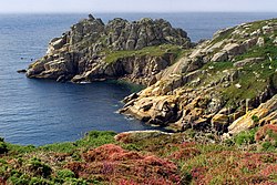
Headland Cribba Head
- (c) Jim Champion, CC BY-SA 2.0
Außenwall
- (c) Rod Allday, CC BY-SA 2.0
Wall und Graben
- (c) Rod Allday, CC BY-SA 2.0
Zugang
Das kanadische Vollschiff Alexander Yeats strandete im September 1896 im Sturm vor Gurnard’s Head und musste aufgegeben werden. Die Besatzung konnte gerettet werden.[1]
Literatur
- J. Ford-Johnston: Hillforts of the Iron Age in England and Wales: A Survey of the Surface Evidence. Liverpool University Press, Liverpool 1976.
- Peter Dudley: Goon, Hal, Cliff and Croft: The Archaeology and Landscape History of West Cornwall’s Rough Ground. Historic Environment Service, Truro 2011. ISBN 1903798728
Einzelnachweise
- ↑ Alexander Yeats auf wrecksite.eu, abgerufen am 4. Februar 2014
Weblinks
Koordinaten: 50° 11′ 29,8″ N, 5° 35′ 57,2″ W
Auf dieser Seite verwendete Medien
(c) Jim Champion, CC BY-SA 2.0
Outer rampart of Treryn Dinas cliff castle. On the right is the bracken-covered outer rampart of the iron-age cliff castle called Treryn Dinas. The south west coast path (headed for Penberth Cove) runs along the partly infilled ditch to the left of the rampart.
(c) Rod Allday, CC BY-SA 2.0
The entrance to Treryn Dinas cliff castle Treryn Dinas Iron Age promontory hill fort is protected by several ramparts of which this, the outer one, is the largest.
Autor/Urheber: Jim Champion, Lizenz: CC BY-SA 3.0
Gurnard's Head promontory from the Coast Path to the east, Cornwall
(c) Rod Allday, CC BY-SA 2.0
Rampart and ditch at Trereen Dinas Trereen Dinas is a C2nd BC cliff castle on Gurnard's Head. Clearly visible are the two ramparts and ditch which span the neck of land which connects the headland to the inland area.
(c) Jim Champion, CC BY-SA 2.0
Logan Rock headland from Cribba Head View across Hall Dinas towards Cripp's Cove on the east side of the Logan Rock headland (also the iron age cliff castle of Treryn Dinas). The chasm of Chough Zawn is on the right.


