Tortuga (Mexiko)
| Isla Tortuga | ||
|---|---|---|
 | ||
| Gewässer | Golf von Kalifornien | |
| Geographische Lage | 27° 26′ 35″ N, 111° 52′ 48″ W | |
| Länge | 4,7 km | |
| Breite | 3,3 km | |
| Fläche | 11,374 km² | |
| Höchste Erhebung | 210 m | |
| Einwohner | unbewohnt | |
 | ||
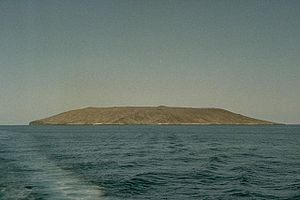
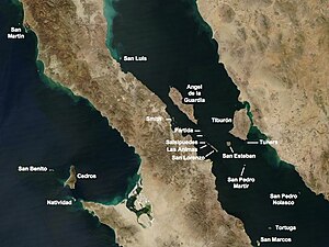
Die Isla Tortuga ist eine kleine mexikanische Insel vulkanischen Ursprungs im Golf von Kalifornien 40 km vor der Küste Niederkaliforniens.
Die Insel ist ein 210 m hoher Schildvulkan mit einer 1 km breiten und 100 m tiefen Caldera, der vor geologisch kurzer Zeit im Holozän auf dem Ostpazifischen Rücken entstand.[1] Die Zeit des letzten Ausbruchs ist unbekannt. Die Insel ist 4,7 km lang und maximal 3,3 km breit, bei einer Fläche von 11,374 km².
Seit 2005 gehört die Insel mit 243 anderen im Golf von Kalifornien zum UNESCO-Welterbe.[2] Der nächste Ort an der Küste ist die alte Bergwerksstadt Santa Rosalía, Verwaltungssitz des Municipios Mulegé.
Auf der Insel ist die Tortuga-Klapperschlange verbreitet.
Weblinks
- Tortuga (Mexiko) im Global Volcanism Program der Smithsonian Institution (englisch)
- Isla Tortuga Volcano
- San Carlos TV: Video
Einzelnachweise
- ↑ Hubert Fabriol, Luis A Delgado-Argote, Juan José Dañobeitia, Diego Córdoba, Antonio González, Juan Garcı́a-Abdeslem, Rafael Bartolomé, Beatriz Martı́n-Atienza, Vı́ctor Frias-Camacho: Backscattering and geophysical features of volcanic ridges offshore Santa Rosalia, Baja California Sur, Gulf of California, Mexico. In: Journal of Volcanology and Geothermal Research. Band 93, Nr. 1–2, 1999, S. 75–92, doi:10.1016/S0377-0273(99)00084-0.
- ↑ Îles et aires protégées du Golfe de Californie
Auf dieser Seite verwendete Medien
Isla Tortuga is 4-km-wide volcanic island located in the Gulf of California, 40 km off the coast of Baja California.
Autor/Urheber: LPLT, Lizenz: CC BY-SA 3.0
Îles de Basse-Californie nord
Autor/Urheber:
- Baja_California_Sur_Location_Map.svg: Addicted04
- derivative work: Spischot (talk)
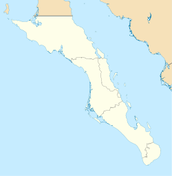
Own work as from the map of municipalities of INEGI and costs taken from OpenStreetMap.org (under Creative Commons Attribution-Share Alike 2.0 Generic Licence). Limits of map:
- West : 115.50' W
- Est : 109.00º W
- North : 28.50° N
- South : 22.50° N


