Torlesse-Inseln
| Torlesse-Inseln | ||
|---|---|---|
 | ||
| Gewässer | Salomonensee | |
| Archipel | Louisiade-Archipel | |
| Geographische Lage | 10° 49′ S, 152° 11′ O | |
| Anzahl der Inseln | 7 | |
| Hauptinsel | Pananiu | |
| Gesamte Landfläche | 2,08 km² | |
| Einwohner | unbewohnt | |
Die Torlesse-Inseln sind eine unbewohnte Inselgruppe in der Salomonensee. Politisch gehören sie zur Provinz Milne Bay im südöstlichen Bereich von Papua-Neuguinea. Sie befinden sich 13 km von Misima und 5 km westlich der Deboyne-Inseln. Die aggregierte Landfläche der sieben Inseln beträgt 2,08 km².
Tabelle der Inseln
| Inselname | Koordinaten | Fläche km² |
|---|---|---|
| Pananiu | 10° 49′ S, 152° 11′ O | 0,86 |
| Bonna Bonnawan | 10° 48′ S, 152° 12′ O | 0,18 |
| südlichste Insel (unbenannt) | 10° 49′ S, 152° 13′ O | 0,03 |
| Insel (unbenannt) | 10° 49′ S, 152° 13′ O | 0,01 |
| Tinolan | 10° 48′ S, 152° 13′ O | 0,80 |
| Insel (unbenannt) | 10° 49′ S, 152° 13′ O | 0,05 |
| Rerihol | 10° 49′ S, 152° 14′ O | 0,15 |
Weblinks
- Deboyne Islands mit Torlesse Islands. (Memento vom 23. Dezember 2010 im Internet Archive) Oceandots.com (englisch); weitere Infos & Bilder
- Torlesse Atoll, Papua New Guinea. Panoramio.
Auf dieser Seite verwendete Medien
(c) OOjs UI Team and other contributors, MIT
An icon from the OOjs UI MediaWiki lib.
This image (Landsat 7) shows the Torlesse islands group, an atoll in the Louisiade Archipelago, Papua New-Guinea.
Autor/Urheber: Carport, Lizenz: CC BY-SA 3.0
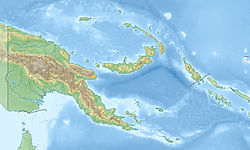
Physische Positionskarte von Papua-Neuguinea


