Toga (Insel)
| Toga | ||
|---|---|---|
| Satellitenbild der Insel | ||
| Gewässer | Korallenmeer | |
| Inselgruppe | Torres-Inseln | |
| Geographische Lage | 13° 24′ 59″ S, 166° 41′ 49″ O | |
| Fläche | 18,8 km² | |
| Höchste Erhebung | Mount Lemeura 240 m | |
| Einwohner | 276 (2009) 15 Einw./km² | |
| Hauptort | Litew | |
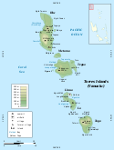
| Karte der Torres-Inseln Toga im Bild ganz unten | ||
Toga, auch South Island und (auf Lo-Toga) [tɔɣə] genannt, ist eine 18,8 km² große Insel des pazifischen Inselstaats Vanuatu. Sie ist die südlichste der Torres-Inseln, die politisch zur vanuatuischen Provinz Torba zählen.
Toga hatte im Jahr 2009 276 Einwohner. Der Hauptort ist Litew. Der Gipfel des Mount Lemeura erreicht eine Höhe von 240 m.
Auf dieser Seite verwendete Medien
Autor/Urheber:
- Torres_Islands-fr.svg: Mutichou
- derivative work: Womtelo (talk)
- Original source for placenames: Womtelo
Map of Torres Islands, Vanuatu in English.
Autor/Urheber: Eric Gaba (Sting - fr:Sting), Lizenz: CC BY-SA 3.0
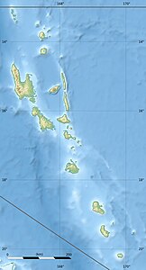
Blank physical map of Vanuatu in Oceania, for geo-location purpose.
Autor/Urheber: Sentinel-2 cloudless 2016 by EOX IT Services GmbH is licensed under a Creative Commons Attribution 4.0 International License., Lizenz: CC BY-SA 4.0
Toga Island, Torres Islands, Sentinel-2


