The Ridgeway
| The Ridgeway | |
|---|---|
 Bei Grim’s Ditch | |
| Daten | |
| Länge | 139 km |
| Lage | zentrales England |
| Markierungszeichen | stilisierte aufrechte weiße Eichel auf braunem Grund |
| Startpunkt | Overton Hill (Wiltshire) 51° 25′ 0″ N, 1° 50′ 0″ W |
| Zielpunkt | Ivinghoe Beacon 51° 50′ 31″ N, 0° 36′ 29″ W |
| Typ | Fernwanderweg |
| Höchster Punkt | Liddington Castle, 276 m |
| Schwierigkeitsgrad | leicht |
| Jahreszeit | ganzjährig |
| Aussichtspunkte | Ivinghoe Beacon, Liddington Castle, Uffington Castle |
| Besonderheiten | Folgt dem Kamm der North Wessex Downs und der Chiltern Hills |
The Ridgeway, englisch für Bergkamm und Weg, ist eine Altstraße im südlichen England. Der Weg erstreckt sich über eine Länge von 135 km, beginnt in Overton Hill (Wiltshire) im Westen und endet in Ivinghoe Beacon (Buckinghamshire) im Osten.
Heute ist die Strecke als The Ridgeway National Trail ausgewiesen. Entlang dieser Strecke befinden sich eine Reihe von Sehenswürdigkeiten aus der Steinzeit, Bronzezeit und Eisenzeit, darunter Grim’s Ditch und Liddington Castle sowie das Uffington White Horse und Uffington Castle. Vor 5000 Jahren könnte The Ridgeway ein Teil einer Strecke gewesen sein, die von der Küste von Dorset bis The Wash in Norfolk führte.
Fotografien
 Der Weg bei Ivinghoe Beacon
 Wegweiser
 (c) Adrian King, CC BY-SA 2.0Zwischen Ludwell und Win Green
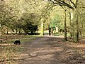 (c) Chris Reynolds, CC BY-SA 2.0Bei Moneybury Hill
Literatur
- Anthony Burton: The Ridgeway (= National Trail Guide.). Aurum Press, London 2005, ISBN 1-84513-063-4.
- National Trails Office: Ridgeway Information Pack – Set of leaflets about the history, geology and wildlife of The Ridgeway.
- John R. L. Anderson, Fay Godwin: The Oldest Road. An Exploration of the Ridgeway. Whittet Books Ltd, London 1987, ISBN 0-905483-52-9.
Weblinks
Commons: Ridgeway National Trail – Sammlung von Bildern, Videos und Audiodateien
- The Ridgeway National Trail
- The Pegasus Archive: The Ridgeway
- BBC: The Ridgeway
- The friends of the Ridgeway
- Imogen Herrad: Zu Fuß in die Steinzeit: Der Ridgeway Fernwanderweg. Mitschnitt eines Beitrags in der Sendung radioReisen auf Bayern 2 ab Minute 35:33,Sendungsinfos ( vom 15. Februar 2017 im Internet Archive)
Auf dieser Seite verwendete Medien
OOjs UI icon mapPin-progressive.svg
(c) OOjs UI Team and other contributors, MIT
An icon from the OOjs UI MediaWiki lib.
(c) OOjs UI Team and other contributors, MIT
An icon from the OOjs UI MediaWiki lib.

The Wessex Ridgway - geograph.org.uk - 776132.jpg
(c) Adrian King, CC BY-SA 2.0
The Wessex Ridgway Section between Ludwell and Win Green
(c) Adrian King, CC BY-SA 2.0
The Wessex Ridgway Section between Ludwell and Win Green
Ridgeway mongwell.jpg
The Ridgeway in Grim's Ditch near Mongewell, with Common Bluebells (Hyacinthoides non-scripta) in flower
The Ridgeway in Grim's Ditch near Mongewell, with Common Bluebells (Hyacinthoides non-scripta) in flower

Ridgeway National Trail signpost.JPG
Autor/Urheber: UKgeofan, Lizenz: CC BY-SA 3.0
Plaswood signpost at Overton Hill Wiltshire. The start point of the Ridgeway National Trail.
Autor/Urheber: UKgeofan, Lizenz: CC BY-SA 3.0
Plaswood signpost at Overton Hill Wiltshire. The start point of the Ridgeway National Trail.
Acorn Britain National Trails Symbol.svg
Eichel-Symbol zur Routenführung der National Trails in Großbritanien
Eichel-Symbol zur Routenführung der National Trails in Großbritanien

The Ridgway Footpath on Moneybury Hill, Ashridge - geograph.org.uk - 1480173.jpg
(c) Chris Reynolds, CC BY-SA 2.0
The Ridgway Footpath on Moneybury Hill, Ashridge. Some of the smaller branches of the Candelabra Tree 1185031 are just visible on left, while the prehistoric barrow is just round the corner 1185061. The Beech tree that fell nearly 6 months later 1480158 landed on the spot where I was standing when I took this picture.
Ivinghoe Beacon seen from The Ridgeway.jpg
Autor/Urheber: Pointillist, Lizenz: CC BY-SA 3.0
Ivinghoe Beacon seen looking north from The Ridgeway. Photographed for Wikipedia by Pointillist and contributed under the cc-by-sa 3.0 license.
Autor/Urheber: Pointillist, Lizenz: CC BY-SA 3.0
Ivinghoe Beacon seen looking north from The Ridgeway. Photographed for Wikipedia by Pointillist and contributed under the cc-by-sa 3.0 license.