The Cheviot
| The Cheviot | ||
|---|---|---|
(c) Stuart Meek, CC BY-SA 2.0 The Cheviot (im Hintergrund) und Coldburn Hill (im Vordergrund) | ||
| Höhe | 852 m ASL | |
| Lage | Northumberland, England | |
| Gebirge | Cheviot Hills | |
| Koordinaten | 55° 28′ 15″ N, 2° 8′ 40″ W | |
| Typ | Marylin | |
The Cheviot ist die höchste Erhebung der Cheviot Hills in Northumberland, England. Der Berg mit einer Schartenhöhe von 556 Metern liegt im Northumberland-Nationalpark.
Ein Abstecher des Pennine Way führt auf das flache Gipfelplateau des Berges, der die letzte Erhebung vor dem nördlichen Ende des Weges in Kirk Yetholm darstellt. Auf dem Gipfel befindet sich ein Trigonometrischer Punkt.
Auf dieser Seite verwendete Medien
(c) Stuart Meek, CC BY-SA 2.0
The Cheviot. Looking south over Coldburn Hill to The Cheviot. Within 20 minutes of taking this picture the cloud seen above Cheviot would engulf everything above 1000 foot.
Autor/Urheber: Nilfanion, Lizenz: CC BY-SA 3.0
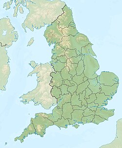
Relief map of England, UK.
Equirectangular map projection on WGS 84 datum, with N/S stretched 170%
Geographic limits:
- West: 6.75W
- East: 2.0E
- North: 56.0N
- South: 49.75N


