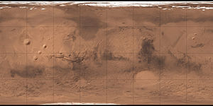
Tharsis Tholus
| Vulkan auf dem Mars | ||
|---|---|---|
| Tharsis Tholus | ||
 | ||
| 2001 Mars Odyssey THEMIS tagsüber Infrarot Mosaik von Tharsis Tholus | ||
| Position | 13° 15′ N, 90° 41′ W | |
| Ausdehnung | 149 km | |
| Höhe | 8930 m | |
Der Tharsis Tholus ist ein erloschener, schildförmiger Vulkan mittlerer Größe in der Tharsis-Region auf dem Mars. Sein Durchmesser beträgt etwa 150 km und seine Höhe beträgt 8,93 km.[1] Er erhielt seinen Namen im Jahr 1973.[2]
Literatur
- Peter Grego: Mars and How to Observe It. Springer Science & Business Media, New York 2012, ISBN 1461423023.
Weblinks
- DLR: Der Marsvulkan Tharsis Tholus 4. November 2011
Einzelnachweise
- ↑ Peter Grego: Mars and How to Observe It. Seite 63 & 106.
- ↑ Tharsis Tholus im Gazetteer of Planetary Nomenclature der IAU (WGPSN) / USGS
Auf dieser Seite verwendete Medien
THEMIS daytime infrared image mosaic showing the volcano Tharsis Tholus in the eastern part of the Tharsis region of Mars.
Carte de Mars reconstituée à partir des mesures de Mars Global Surveyor (MOLA) et des observations de Viking.
(c) ESA/DLR/FU Berlin (G. Neukum), CC BY-SA 3.0 igo
Tharsis Tholis towers 8 km above the surrounding terrain with a base that stretches 155 x 125 km and a central caldera measuring 32 x 34 km. The image was created using a Digital Terrain Model (DTM) obtained from the High Resolution Stereo Camera on ESA’s Mars Express spacecraft. Elevation data from the DTM is colour coded: purple indicates the lowest lying regions and beige the highest. The scale is in metres. In these images, the relief has been exaggerated by a factor of three.


