Teluk Schomburgk
| Teluk Schomburgk Schomburgk Bay | ||
|---|---|---|
 Schomburgk Bay mit der nördlichen Begrenzung durch Jambongan Island | ||
| Gewässer | Sulusee | |
| Landmasse | Borneo | |
| Geographische Lage | 6° 35′ N, 117° 26′ O | |
| Breite | ca. 10 km | |
| Tiefe | ca 11 km | |
| Fläche | 100 km² | |
| Inseln | Pulau Jambongan (nördliche Begrenzung der Bucht) | |
Die Schomburgk Bay (malaiisch Teluk Schomburgk) ist eine Bucht an der Nordküste der Insel Borneo. Sie gehört zum malaysischen Bundesstaat Sabah und öffnet sich zur Sulusee. Verwaltungstechnisch gehört sie zum Distrikt Beluran in der Sandakan Division.[1]
Geografie
Die Bucht umfasst eine Fläche von ca. 100 km². Die zum Festland gehörende Küstenlinie ist dicht mit Mangrovensümpfe bewaldet. Die Nordseite der Bucht wird durch die Insel Jambongan Island begrenzt. Eine schmale Wasserstraße, die jedoch wegen der geringen Wassertiefe nicht für die reguläre Schifffahrt geeignet ist, verbindet die Bucht mit der Paitan Bay.[2]
Geschichte
Die Bucht wurde offensichtlich nach Carl Schomburgk, einem Geschäftspartner von William Clarke Cowie benannt. Cowie stand ab 1872 in einer Geschäftsbeziehung mit dem Sultan von Sulu (er schmuggelte für ihn Waffen durch die spanische Seeblockade) und hatte im gleichen Jahr mit Schomburgk und Ross die Labuan Trading Company gegründet. Der Name Schomburgk Bay findet sich erstmals auf einer von der North Borneo Chartered Company herausgegebenen Karte von Britisch-Nordborneo aus dem Jahr 1899.[3]
Weblinks
- Karte von Britisch-Nordborneo, 1899
Einzelnachweise
- ↑ Administrative District Boundary and Local Authority Area. In:Census 2010 für Sabah. ( des vom 27. Februar 2012 im Internet Archive) Info: Der Archivlink wurde automatisch eingesetzt und noch nicht geprüft. Bitte prüfe Original- und Archivlink gemäß Anleitung und entferne dann diesen Hinweis. (PDF; 1,9 MB) Amt für Statistik, Malaysia, S. 153.
- ↑ Sailing Directions (Enroute) – Borneo, Jawa, Sulawesi and NUsa Tenggara. (PDF; 630 kB) United States Navy Publication 163, 2002, Kapitel 10 Nr. 10.67; abgerufen am 6. Februar 2012
- ↑ Views of British North Borneo. North Borneo Chartered Company, London 1899; Textarchiv – Internet Archive
Auf dieser Seite verwendete Medien
Autor/Urheber: Uwe Dedering, Lizenz: CC BY-SA 3.0
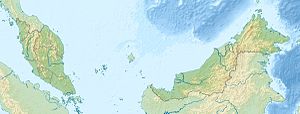
Location map of Malaysia.
Equirectangular projection. Strechted by 100.0%. Geographic limits of the map:
* N: 8.0° N
* S: 0.0° N
* W: 99.0° E
* E: 120.0° E
Made with Natural Earth. Free vector and raster map data @ naturalearthdata.com.
Flag of the Malaysian state Sabah. Based on a GIF from a government website, colors from a photo. Drawn by Mysid. The flag was adopted September 16, 1988.
- The mountain on the left is Mount Kinabalu.
Per the Constitution of the State of Sabah:
"The State Flag is in a rectangular shape and is in the proportion of 1:2. The canton which extends at the head half way to the fly and 2/3 at the hoist to the foot is in Icicle Blue (C1T9) as the background to a graphic silhouette of Mount Kinabalu which is in Royal Blue (B10) positioned at ¼ of the height of the canton from end to end. The fly of the flag is divided equally into three bands of colours the foot division of which extends right to the hoist. The top band is in Zircon Blue (C5T5) the second band is in white and the third band is in Chili Red (S6R4)."Jambongan Island (cropped from a bigger photo)


