Swona
| Swona | |
|---|---|
| Swona von South Ronaldsay aus gesehen | |
| Gewässer | Nordsee |
| Inselgruppe | Orkneyinseln |
| Geographische Lage | 58° 44′ 32″ N, 3° 3′ 26″ W |
Contains Ordnance Survey data © Crown copyright and database right, CC BY-SA 3.0 | |
| Länge | 2 km |
| Breite | 1 km |
| Fläche | 92 ha |
| Höchste Erhebung | Warbister Hill 41 m |
| Einwohner | unbewohnt |
| Ordnance-Survey-Kartenblatt (1959) | |
Swona (altnordisch Swefney, „Schweine-Insel“) ist die südlichste ehemals bewohnte Insel der Orkney, wobei die Südspitze von South Ronaldsay weiter nach Süden reicht. Sie liegt südwestlich Burwick auf Höhe der Südspitze von South Ronaldsay. Die gefährlichen Gezeitensprünge und der Nebel im Pentland Firth haben die Küsten der Insel, insbesondere vor Nutzung des Radars, zum Schiffsfriedhof gemacht. Automatische Leuchttürme stehen daher an beiden Enden der Insel.
Für Wild und verwilderte Haustiere ist die Insel ein reizvolles Eiland. Dessen Gras besteht im Sommer aus einem Floor von Wildblumen. Dass die Insel bereits prähistorisch bewohnt war, zeigt ein Passage Tomb des Orkney-Cromarty-Typs (OC) an. Es hatte eine kurze, am Meer gelegene Kammer, die durch Erosion bedroht ist.
Swona war wegen seiner fruchtbarer Böden auch in der Wikingerzeit besiedelt. Überliefert ist ein Mann namens Grim, dessen Söhne Asbjorn und Margad Gefolgsleute Sweyn Asleifssons waren. Kurz vor dem Julfest des Jahres 1133 n. Chr. wurde Sweyns Vater Olaf von Olvir Rosta und seinen Männern getötet, die sein Haus in Duncansby niederbrannten. Sweyn der später zu einem berühmten Krieger wurde (The Ultimate Viking) und die Söhne Grims entkamen auf ihre Heimatinsel Swona.
Die Insel, vor der auch ein Schiff in Seenot geriet auf dem Robert Louis Stevenson mitreiste, wurde 1974 von den letzten Bewohnern verlassen und steht weitgehend unter Naturschutz. Sie wird von dem jetzigen Besitzer nicht genutzt.
Literatur
- Hamish Haswell-Smith: The Scottish Islands. A comprehensive guide to every Scottish Island. Canongate, Edinburgh 2004, ISBN 1-84195-454-3.
Weblinks
Auf dieser Seite verwendete Medien
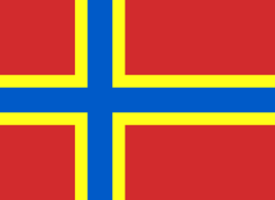
2007 Flag of Orkney
My own vector of the official flag of the Isles of Orkney, Scotland, created using Inkscape. This version is based upon the official version designed by Duncan Tullock of Birsay and voted for by the people of Orkney and approved by the Court of the Lord Lyon in 2007 from a short list of 5 designs. It is a Nordic Cross, in keeping with the flag's unofficial predecesor the Cross of St Magnus, and for which, according to Mr Tullock, "Orkney has always been represented by red, so that was an obvious choice. The yellow symbolizes the royal standards of both Scotland and Norway and blue is for Scotland, and also for the sea that surrounds us".
OS map covering the southern part of the Orkney Islands, the Pentland Firth, and the adjacent coast of NE Scotland, at a scale of 1:63,360 or one inch to one mile.
Contains Ordnance Survey data © Crown copyright and database right, CC BY-SA 3.0
Swona in Orkney
(c) Kelisi aus der englischsprachigen Wikipedia, CC BY-SA 3.0
A map of the Pentland Firth, northern Scotland, showing various towns and villages on the British mainland and in Orkney, as well as physical features, including islands in the Firth. This map's source is here, with the uploader's modifications, and the GMT homepage says that the tools are released under the GNU General Public License.
The Island of Swona, situated in the Pentland Firth. Picture by William Annal.


