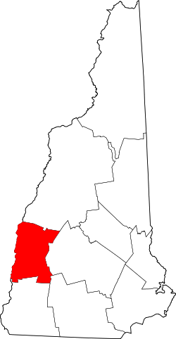
Sullivan County (New Hampshire)
| Verwaltung | |
|---|---|
| US-Bundesstaat: | New Hampshire |
| Verwaltungssitz: | Newport |
| Gründung: | 1827 |
| Gebildet aus: | Cheshire County |
| Demographie | |
| Einwohner: | 43.063 (Stand: 2020) |
| Bevölkerungsdichte: | 30,96 Einwohner/km2 |
| Geographie | |
| Fläche gesamt: | 1429 km² |
| Wasserfläche: | 38 km² |
| Karte | |
| Website: www.sullivancountynh.gov | |
Sullivan County[1] ist ein County im US-Bundesstaat New Hampshire. Der Verwaltungssitz (County Seat) ist Newport. Mit Stand von 2020 hatte Sullivan County 43.063 Einwohner.[2]
Geschichte
Das Sullivan County wurde 1827 in Newport aus dem nördlichen Teil des Cheshire Countys gebildet. Benannt wurde es nach John Sullivan, einem General der US-Armee während des Unabhängigkeitskrieges.
Im Sullivan County liegt ein National Historical Park, der Saint-Gaudens National Historical Park. Ein weiterer Ort im County hat den Status einer National Historic Landmark, der Salmon P. Chase Birthplace.[3] 67 Bauwerke und Stätten des Countys sind insgesamt im National Register of Historic Places eingetragen (Stand 14. Februar 2018).[4]
Bevölkerungsentwicklung
| Jahr | 1980 | 1990 | 2000 | 2010 | 2020 |
|---|---|---|---|---|---|
| Einwohner | 36.097 | 38.592 | 40.458 | 43.742 | 43.063 |
Geographie
Das County erstreckt sich über eine Fläche von 1.429 Quadratkilometern; davon sind 38 Quadratkilometer Wasserflächen.
- Nachbar-Counties
- Grafton County, Norden
- Merrimack County, Osten
- Hillsborough County, Südosten
- Cheshire County, Süden
- Windham County (Vermont), Südwesten
- Windsor County (Vermont), Westen
Städte und Gemeinden
Sullivan County teilt sich in eine City und 14 Towns; beide Begriffe werden ins Deutsche mit Stadt übersetzt. Die Angaben hinter den Ortsnamen sind die Einwohnerzahlen der Volkszählung von 2020.
- City
- Claremont, 12.949
- Towns
|
|
Weblinks
Einzelnachweise
- ↑ GNIS-ID: 873183. Abgerufen am 22. Februar 2011 (englisch).
- ↑ Decennial Census 2020. US Census Bureau, abgerufen am 4. Oktober 2021.
- ↑ Listing of National Historic Landmarks by State: New Hampshire. National Park Service, abgerufen am 14. Februar 2018.
- ↑ Suchmaske Datenbank im National Register Information System. National Park Service, abgerufen am 14. Februar 2018.
Koordinaten: 43° 20′ N, 72° 15′ W
Auf dieser Seite verwendete Medien
This is a locator map showing Sullivan County in New Hampshire. For more information, see Commons:United States county locator maps.
Discover the beautiful home, studios and gardens of Augustus Saint-Gaudens, one of America’s greatest sculptors. Over 100 of his artworks can be seen in the galleries, from heroic public monuments to expressive portrait reliefs, and the gold coins which changed the look of American coinage.


