Stryj (Fluss)
| Stryj Стрий | ||
(c) Alex Zelenko, CC BY-SA 4.0 | ||
| Daten | ||
| Lage | Oblast Lwiw (Ukraine) | |
| Flusssystem | Dnister | |
| Abfluss über | Dnister → Schwarzes Meer | |
| Quellgebiet | Waldkarpaten 48° 55′ 57″ N, 23° 8′ 15″ O | |
| Mündung | DnisterKoordinaten: 49° 23′ 49″ N, 24° 12′ 36″ O 49° 23′ 49″ N, 24° 12′ 36″ O
| |
| Länge | 232 km[1] | |
| Einzugsgebiet | 3055 km²[1] | |
| Abfluss[1] Lage: 17 km oberhalb der Mündung | MQ | 45,2 m³/s |
| Linke Nebenflüsse | Jablunka | |
| Rechte Nebenflüsse | Opir, Kruschelnyzja, Rybnyk | |
| Mittelstädte | Stryj | |
| Kleinstädte | Skole, Turka, Schydatschiw | |
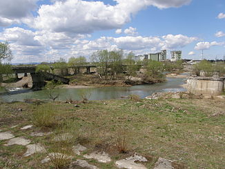
 Der Stryj in der Stadt Stryj | ||
 Stryi und oberer Dnister | ||
Der Stryj (ukrainisch Стрий) ist ein rechter Nebenfluss des Dnister.
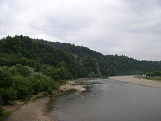
An seinem Ufer liegt die gleichnamige ukrainische Stadt Stryj. Der Stryj entspringt in den Waldkarpaten. Im Delta der Flüsse Stryj und Opir befindet sich der „natsional'ny park Skolivs'ki Beskydy“ (bei Skole). Danach durchfließt der Fluss die gleichnamige Stadt Stryj und fließt weiter durch Schydatschiw. Kurz darauf mündet der Stryj in den Dnister.
Die Länge der Stryj beträgt ca. 232 km. Der Fluss hat ein Einzugsgebiet von rund 3055 km². Der mittlere Abfluss 17 km oberhalb der Mündung beträgt 45,2 m³/s.[1] Bei Hochwasser erreicht der Stryj Abflüsse von bis zu 890 m³/s.[1]
Weblinks
Einzelnachweise
Auf dieser Seite verwendete Medien
This is a map showing the Upper Dniestr River Basin, including its main tributary, the Stryi River, in the southwestern half of the Lviv Oblast in western Ukraine. It also shows the average annual precipitation by millimeters and inches for the region, and places the administrative centers of each of the raions in this area on the map. It includes and inset indicating where this is in relation to the rest of Ukraine, and provides the names of the closest villages to the Stryi River's head and mouth. I created this map, using Microsoft Paint, version 7.0, and borrowing data from Google Earth, and the 21st European Regional Conference 2005 - 15-19 May 2005 - Frankfurt (Oder) and Slubice - Germany and Poland report on "Floods Modeling in the Upper Dnister River Valley", by Ivan Kovalchuk, Andriy Mykhnovych, Volker Ehlert, Jörg Steidl, in conjunction with the Leibniz Centre for Agricultural Landscape Research (ZALF), Germany, and held at the Ivan Franko National University of L’viv, Ukraine, page4. URL: http://www.zalf.de/icid/ICID_ERC2005/HTML/ERC2005PDF/Topic_2/Kovalchuk.pdf


