State Parks in Missouri
Dies ist eine Liste der State Parks und Historic Sites im US-Bundesstaat Missouri. Sowohl State Parks als auch Historic Sites werden von der Division of State Parks of the Missouri Department of Natural Resources verwaltet.
| Name | Gründung |
|---|---|
| Arrow Rock State Historic Site | 1923 |
| Babler State Park | 1937 |
| Sam A. Baker State Park | 1926 |
| Battle of Athens State Historic Site | 1975 |
| Battle of Carthage State Historic Site | 1990 |
| Battle of Lexington State Historic Site | 1958 |
| Bennett Spring State Park | 1923 |
| Thomas Hart Benton Home and Studio State Historic Site | 1977 |
| Big Lake State Park | 1932 |
| Big Oak Tree State Park | 1937 |
| Big Sugar Creek State Park | 1992 |
| Bollinger Mill State Historic Site | 1967 |
| Nathan Boone Homestead State Historic Site | 1991 |
| Boone's Lick State Historic Site | 1960 |
| Bothwell Lodge State Historic Site | 1974 |
| Castlewood State Park | 1974 |
| Clark's Hill/Norton State Historic Site | 2002 |
| Confederate Memorial State Historic Site | 1952 |
| Crowder State Park | 1938 |
| Cuivre River State Park | 1946 |
| Current River State Park | 2008 |
| Deutschheim State Historic Site | 1978 |
| Dillard Mill State Historic Site | 1977 |
| Gov. Daniel Dunklin's Grave State Historic Site | 1965 |
| Elephant Rocks State Park | 1967 |
| Felix Vallé House State Historic Site } | 1970 |
| Finger Lakes State Park | 1973 |
| First Missouri State Capitol State Historic Site | 1960 |
| Fort Davidson State Historic Site | 1968 |
| Gen. John J. Pershing Boyhood Home State Historic Site | 1952 |
| Graham Cave State Park | 1964 |
| Grand Gulf State Park | 1984 |
| Ha Ha Tonka State Park | 1978 |
| Harry S Truman Birthplace State Historic Site | 1957 |
| Harry S Truman State Park | 1976 |
| Hawn State Park | 1955 |
| Hunter-Dawson State Historic Site | 1967 |
| Iliniwek Village State Historic Site | 1992 |
| Jefferson Landing State Historic Site | 1976 |
| Jewell Cemetery State Historic Site | 1970 |
| Johnson's Shut-Ins State Park | 1955 |
| Jones-Confluence Point State Park | 2001 |
| Katy Trail State Park | 1990 |
| Knob Noster State Park | 1946 |
| Lake of the Ozarks State Park | 1946 |
| Lake Wappapello State Park | 1956 |
| Lewis and Clark State Park | 1934 |
| Locust Creek Covered Bridge State Historic Site | 1968 |
| Long Branch State Park | 1983 |
| Mark Twain Birthplace State Historic Site | 1924 |
| Mark Twain State Park | 1924 |
| Mastodon State Historic Site | 1976 |
| Meramec State Park | 1927 |
| Missouri Mines State Historic Site | 1976 |
| Missouri State Capitol | 1826 |
| Missouri State Museum | 1978 |
| Montauk State Park | 1926 |
| Morris State Park | 2000 |
| Onondaga Cave State Park | 1982 |
| Osage Village State Historic Site | 1984 |
| Pershing State Park | 1937 |
| Pomme de Terre State Park | 1960 |
| Prairie State Park | 1980 |
| Roaring River State Park | 1928 |
| Robertsville State Park | 1979 |
| Rock Bridge Memorial State Park | 1967 |
| Route 66 State Park | 1997 |
| St. Francois State Park | 1964 |
| St. Joe State Park | 1976 |
| Sandy Creek Covered Bridge State Historic Site | 1968 |
| Sappington Cemetery State Historic Site | 1970 |
| Scott Joplin House State Historic Site | 1983 |
| Stockton State Park | 1969 |
| Table Rock State Park | 1959 |
| Taum Sauk Mountain State Park | 1991 |
| Thousand Hills State Park | 1952 |
| Towosahgy State Historic Site | 1967 |
| Trail of Tears State Park | 1957 |
| Union Covered Bridge State Historic Site | 1967 |
| Van Meter State Park | 1932 |
| Wakonda State Park | 1960 |
| Wallace State Park | 1932 |
| Washington State Park | 1932 |
| Watkins Woolen Mill State Park | 1964 |
| Watkins Woolen Mill State Historic Site | 1964 |
| Weston Bend State Park | 1980 |
Weblinks
Auf dieser Seite verwendete Medien
Autor/Urheber: Kevin Saff, Lizenz: CC BY-SA 2.0
Scott Joplin House, 2658A Delmar Boulevard, St. Louis, Missouri
Missouri Mines State Historic Site, St. Francois County, Missouri. .
Autor/Urheber: Der ursprünglich hochladende Benutzer war Americasroof in der Wikipedia auf Englisch, Lizenz: CC BY-SA 2.5
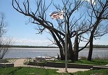
Monument to the Great Flood of 1993 at Jones-Confluence Point State Park at the confluence of the Missouri River and Mississippi River in St. Charles County. The flag says the water reached the top of the pole at an elevation of 438.2 feet. Photo by poster in April 2007. The Mississippi is on the left and the Missouri is on the right.
Autor/Urheber: Kbh3rd, Lizenz: CC BY-SA 3.0
Sandy Creek Covered Bridge in Jefferson County, Missouri. Contrast and saturation have been modified; otherwise the image is exactly as recorded by the camera.
Autor/Urheber: Der ursprünglich hochladende Benutzer war Kbh3rd in der Wikipedia auf Englisch, Lizenz: CC-BY-SA-3.0
Description: Cyclists crossing a bridge on eastern part of the Katy Trail in Missouri. This bridge crosses the Femme Osage Creek near its outlet into the Missouri River. It is encountered about mile marker 57.4, near Defiance. Source: Photographed on November 7, 1999 by Kbh3rd.
Autor/Urheber: Kbh3rd, Lizenz: CC BY-SA 3.0
Graham Cave is a Native American archaeological site near Mineola, Missouri in Montgomery County. The entrance of the sandstone cave forms a broad arch 120 feet (37 m) wide and 16 feet (5 m) high. Extending about 100 feet (30 m) into the hillside, the cave protects an historically important Pre-Columbian achaeological site from the ancient Dalton and Archaic period dating back to as early as 10,000 years ago. This image is a panoramic composite of four photographs taken with a Kodak P850 digital camera. The panorama was created with the software program "hugin".
Autor/Urheber: Paul Knittel from St. Louis, United States, Lizenz: CC BY 2.0
The "Castle" at Ha Ha Tonka State Park
Autor/Urheber: Wikipedian Kbh3rd, Lizenz: CC-BY-SA-3.0
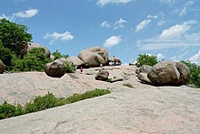
Paisaje granítico en Missouri.
Autor/Urheber: James Carr, Lizenz: CC BY 2.0
Party Cove, Lake of the Ozarks, Missouri.
Autor/Urheber: Rklawton, Lizenz: CC BY-SA 2.5
Stalactiflat, Fisher Cave, Meramec State Park, Missouri.
Autor/Urheber: Kbh3rd, Lizenz: CC BY 3.0
The shut-ins at Johnson's Shut-ins State Park in Missouri in autumn. This panoramic image was stitched from 29 images and rendered with a Panini projection. The water level and flow volume are lower than normal in this picture due to several months of below-average rainfall.
(c) Blambo aus der englischsprachigen Wikipedia, CC-BY-SA-3.0
Pickle Creek at Hawn State Park in Ste. Genevieve, Missouri (USA).
Autor/Urheber: dfellow, Lizenz: CC BY 2.0
en:Roaring River State Park in en:Missouri
(c) I, Kbh3rd, CC-BY-SA-3.0
Grand Gulf State Park in Missouri. The stream flowing into this cave at the bottom of Grand Gulf, a huge Ponor, resurfaces at Mammoth Spring, Arkansas.
(c) Anela aus der englischsprachigen Wikipedia, CC-BY-SA-3.0
Tents at the Fort Davidson Living History event, September 30, 2006.
Photo by Valerie Holifield
https://www.flickr.com/photos/anela/260426214/


