Simejis
| Simejis | ||
| Сімеїз | ||
 |
| |
| Basisdaten | ||
|---|---|---|
| Oblast: | Autonome Republik Krim | |
| Rajon: | Stadtkreis von Jalta | |
| Höhe: | 55 m | |
| Fläche: | 1,6 km² | |
| Einwohner: | 3.950 (1.1.2011) | |
| Bevölkerungsdichte: | 2.469 Einwohner je km² | |
| Postleitzahlen: | 98680 | |
| Vorwahl: | +380 654 | |
| Geographische Lage: | 44° 24′ N, 34° 0′ O | |
| KATOTTH: | UA01200270010034991 | |
| KOATUU: | 0111949300 | |
| Verwaltungsgliederung: | 6 Siedlungen städtischen Typs, 1 Selo | |
| Adresse: | вул. Зоряна 2 98680 смт. Сімеїз | |
| Statistische Informationen | ||
Simejis (ukrainisch Сімеїз; russisch СимеизSimeis) ist eine Siedlung städtischen Typs auf der Halbinsel Krim.

Geografie
Der Ort liegt direkt am Schwarzen Meer im Südosten der Krim. Zusammen mit den fünf Siedlungen städtischen Typs Berehowe (Берегове), Holuba Satoka (Голуба Затока), Kaziweli (Кацівелі), Parkowe (Паркове) und Ponysiwka (Понизівка) sowie dem Dorf Opolsnewe (Оползневе) bildet Simejis die gleichnamige Siedlungsratsgemeinde.
Geschichte
In der näheren Umgebung gibt es Dolmen und Befestigungsanlagen, die bis ins frühe Mittelalter datiert sind. Zu diesem Zeitpunkt wurde das Gebiet vom byzantinischen Reich kontrolliert. Ein damaliges Kloster kann der Stadt den heutigen Namen gegeben haben. Als das byzantinische Reich sich nach und nach verkleinerte, fiel das Gebiet unter die Kontrolle von Genua und gehörte später zum osmanischen Reich. Nach dem Weggang der christlichen Bevölkerung im Jahr 1778 war Stadt fast entvölkert.
1828 übernahm der Unternehmer Iwan Akimowitsch Malzow die Stadt und erweiterte diese zu einer Obstplantage. Seine Nachkommen bauten diese mit Parks und Villen-Anlagen zu einem Resort aus. Nach der Oktoberrevolution wurde alles verstaatlicht und Sanatorien für Tuberkulosekranke erbaut. In der Hochsaison 1927 besuchten rund 10.000 Personen die Stadt.
Während des Zweiten Weltkrieges wurde die Stadt von den Deutschen besetzt und im April 1944 von der Roten Armee befreit. Bis 1955 erlebte die Stadt einen Neubeginn.
Weblinks
- Offizielle Webseite (Memento vom 15. November 2013 im Internet Archive)
- Bilder von Simejis
Auf dieser Seite verwendete Medien
(c) Karte: NordNordWest, Lizenz: Creative Commons by-sa-3.0 de
Positionskarte der Ukraine
Autor/Urheber: Vyacheslav Argenberg from Rostov-on-Don, Russian Federation, Lizenz: CC BY 2.0
22-m radio telescope for mm and cm radio waves. Located at the foot of mount Koshka (Cat) in Katsiveli (near Simeiz). Belongs to the Crimean Astrophysical Observatory, the Department of Radioastronomy.
RT-22 operation is supported by control system, consisting of two encoders with accuracy about 3 arcsec (rms), personal computer, CAMAC, quartz time standard, electric engines and other needed equipment and software. The fast RT-22 movement is supported by 2 engines with 20 kW power each, they are used for rapid change of the pointing or to move RT-22 from one source to another. 2 kW engines are used for tracking of the source.
Diameter: 22 m. Surface tolerance: 0.25 mm. Wavelength limit: 2 mm.
The radiotelescope is able to observe only single circular polarization which can be selected by investigator. Radiotelescope has a feed horn which allows to observe at the wavelength 13 and 3.6 cm simultaneously. The radiotelescope operation is supported by a control system, which consists of two encoders with accuracy of positioning 3 arcsec (rms), computer IBM-486, CAMAC, quartz time standard, electric engines and other equipment and software. 2 engines with 20 kW power each provide the fast radiotelescope motion and they are used for rapid change of the pointing or for radiotelescope motion from one source to another. Another two 2 kW engines are used for slow tracking of the source.
The control system of the radiotelescope provides the possibility to point the antenna and to track observed source in two regimes: autonomous and automatic. Operator sets the coordinates of the targeted source using keyboard of the computer when the system works in autonomous regime. All modes of the radiotelescope operation: antenna motion, radiometer readings, data recording are given from the special host computer in automatic regime.
The radiotelescope doesn't have a cover sheet (radome). Low frequencies equipment and recording system are located in the laboratory building in 30 meters apart from the radiotelescope.
The Department provides observing facilities for astronomers of international community and for its own staff. The following projects currently run:
1. Very Long Baseline Interferometry (VLBI). 2. Multi-wavelength monitoring of Active Galactic Nuclei (AGN). 3. Solar and stellar activity investigations.
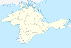
4. Molecular lines observations at mm wavelengths.Positionskarte der umstrittenen Autonomen Republik Krim (Ukraine)/Republik Krim (Russland)
Das Wappen der Autonome Republik Krim, das 1992 genehmigt wurde (später auch von der Republik Krim übernommen)
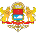
Герб посёлка городского типа Симеиз Ялтинского городского совета Крыма Украины (дизайн О.Маскевич).


