Shivamogga
| Shivamogga | ||
|---|---|---|
| Staat: | ||
| Bundesstaat: | Karnataka | |
| Distrikt: | Shivamogga | |
| Lage: | 13° 56′ N, 75° 35′ O | |
| Höhe: | 587 m | |
| Fläche: | 70,01 km² | |
| Einwohner: | 322.428 (2011)[1] | |
| Bevölkerungs- dichte: | 4605 Ew./km² | |
| Website: | www.shimogacity.mrc.gov.in | |
 | ||
Shivamogga (Kannada ಶಿವಮೊಗ್ಗ Śivamogga []) ist eine Stadt im südwestindischen Bundesstaat Karnataka. Bis 2014 hieß sie offiziell Shimoga. Dieser Name ist noch an vielen Stellen im Gebrauch.
Sie liegt im Westen Karnatakas am Ufer des Flusses Tunga, der sich wenig später mit dem Bhadra zum Tungabhadra vereint. Mit rund 322.000 Einwohnern (Volkszählung 2011) ist Shivamogga die zehntgrößte Stadt Karnatakas. Die Stadt ist Verwaltungssitz des Distrikts Shivamogga.[2]
Der frühere Name Shimoga war eine seit der British Raj anglisierte Form von Shivamogga, was wiederum herkömmlich vom Sanskrit-Begriff Shivamukha („Gesicht Shivas“) hergeleitet wird. Anlässlich des fünfzigsten Jahrestags der Gründung Karnatakas im Jahr 2006 beschloss die Regierung des Bundesstaates nach einem Vorschlag des Schriftstellers U. R. Ananthamurthy, die englischen Namen von 13 Städten in Karnataka in ihre Kannada-Namensformen zu ändern. Hierdurch wurde Shimoga in Shivamogga umbenannt. Die indische Zentralregierung unter Premierminister Manmohan Singh stimmte der Namensänderung zunächst nicht zu.[3] Erst unter der bei der 2014 neu gewählten Regierung von Premierminister Narendra Modi trat die Umbenennung am 1. November 2014 offiziell in Kraft.[4]
Sehenswürdigkeiten in und um Shivamogga
- Shivappa Nayaka’s Palast
- Kote Seetharamanjaneya, ein Tempel
- der Gajanur-Damm
- Koodli, Zusammenfluss von Tunga und Bhadra, ab dort Tungabhadraa
- Tyavarekoppa Lion and Tiger Safari, Safaripark
- Sakkare Bayalu, Elefantentrainingscamp, an der Straße nach Thirthahalli
- Shivastatue in Harakere
- Mandagadde Bird Sanctuary, Vogelschau
- Guddekal mit dem Subrahmanyatempel
- Gudde Mardi, Aussichtspunkt
Weblinks
Einzelnachweise
- ↑ Census of India 2011: Provisional Population Totals. Cities having population 1 lakh and above. (PDF; 151 kB).
- ↑ Die alte Homepageshimoga.nic.in ( des vom 13. Mai 2012 im Internet Archive) Info: Der Archivlink wurde automatisch eingesetzt und noch nicht geprüft. Bitte prüfe Original- und Archivlink gemäß Anleitung und entferne dann diesen Hinweis. leitet weiter zu Shivamogga.
- ↑ S. Rajendran: Centre mum on ‘Bengaluru’,. The Hindu, 18. Dezember 2007, archiviert vom (nicht mehr online verfügbar) am 19. Dezember 2007; abgerufen am 30. Oktober 2015 (englisch). Info: Der Archivlink wurde automatisch eingesetzt und noch nicht geprüft. Bitte prüfe Original- und Archivlink gemäß Anleitung und entferne dann diesen Hinweis.
- ↑ Mugdha Variyar: Bangalore, Mysore, Other Karnataka Cities to be Renamed on 1 November. International Business Times, 18. Oktober 2014, abgerufen am 30. Oktober 2015 (englisch).
Auf dieser Seite verwendete Medien
Autor/Urheber: AshwiniKalantri, Lizenz: CC BY-SA 3.0
Location map of India with Indian claimed territories in grey. Equirectangular projection. Strechted by 106.0%. Geographic limits of the map: * N: 37.5° N * S: 5.0° N * W: 67.0° E * E: 99.0° E Made with Natural Earth. Free vector and raster map data @ naturalearthdata.com.
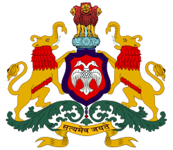
This is the state emblem of Karnataka, India and as such is the official Emblem of Government of Karnataka state in India. The centre is a red shield charged with a white two-headed bird, "Ganda Berunda" and fringed in blue. Crested above it, four red-maned, yellow lions stand back-to-back facing four directions (only three are visible) on a blue circular abacus with a blue frieze carrying sculptures in high relief of a galloping horse on the left, a Dharmachakra in centre, a bull on the right, and the outlines of Dharmachakras on the extreme left and right as part of Sarnath's Ashoka Pillar. The shield is flanked on either side by red-maned, yellow lion-elephant supporters (mythical creatures believed to be upholders of righteousness stronger than lions and elephants) standing on a green, leafy compartment. Below the compartment lies written in stylized Devanāgarī, the national motto of India, "ಸತ್ಯಮೇವ ಜಯತೆ" (Satyameva Jayate, Sanskrit for "Truth Alone Triumphs"). This emblem is adapted from the royal emblem of Mysore and is carried on all the official correspondences made by Government of Karnataka.


