Sewardgletscher
| Sewardgletscher | ||
|---|---|---|
 Die weiße Fläche am oberen Bildrand sowie der Auslassgletscher in der Bildmitte gehören zum Sewardgletscher. Unten im Bild befindet sich der Malaspinagletscher. | ||
| Lage | Yukon (Kanada), Alaska (USA) | |
| Gebirge | Eliaskette | |
| Typ | Auslassgletscher | |
| Länge | 82 km | |
| Fläche | ca. 1300 km² | |
| Höhenbereich | 2080 m – 670 m | |
| Breite | max. 20 km | |
| Koordinaten | 60° 24′ N, 140° 16′ W | |
| Entwässerung | Malaspinagletscher → Golf von Alaska | |
 Im Vordergrund Mount Logan, rechts im Hintergrund Mount Saint Elias, dazwischen strömt der Sewardgletscher nach Osten (im Bild nach links). | ||
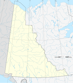
Der Sewardgletscher liegt in der Eliaskette. Er befindet sich größtenteils in Yukon (Kanada). Lediglich ein kleinerer Bereich im Südosten gehört zu Alaska (USA).
Er wurde nach dem US-amerikanischen Politiker und Außenminister William Henry Seward benannt.[1]
Geografie
Der 82 km lange Sewardgletscher bedeckt eine etwa 1300 km² Fläche, die sich zwischen den Gebirgsmassiven von Mount Logan im Norden und Mount Saint Elias im Süden erstreckt. Im Westen unweit der US-amerikanischen Grenze stößt er auf einer Höhe von 2080 m an den Columbus-Gletscher, der das Gebiet in westlicher Richtung entwässert. Der Sewardgletscher strömt anfangs 50 km in östlicher Richtung, wobei er eine Breite von bis zu 20 km aufweist. Anschließend wendet er sich nach Süden. Als etwa 5 km breiter Auslassgletscher fällt er bis auf eine Höhe von 670 m ab, bevor er in den Malaspinagletscher übergeht, der schließlich in den Golf von Alaska mündet.
Weblinks
- Sewardgletscher. In: Geographic Names Information System. United States Geological Survey, United States Department of the Interior (englisch).
Einzelnachweise
Auf dieser Seite verwendete Medien
Autor/Urheber:
- Canada_Yukon_location_map-albers_proj.svg: Flappiefh
- derivative work: NordNordWest
Positionskarte des Yukon-Territoriums, Kanada
Autor/Urheber: Jack French from San Francisco, USA, Lizenz: CC BY 2.0
Mount Logan & Mount Saint Elias shot from 36000 feet Happened to wake up while flying over this mountain range on a beautifully clear day.
(Previously misidentified as a picture of the Alaska Range, hence the filename. Actually the Saint Elias Mountains; more specifically, Mount Logan (foreground) from the north, with Mount Saint Elias right background, and the Malaspina Glacier and the Gulf of Alaska beyond.)The ice of a piedmont glacier spills from a steep valley onto a relatively flat plain, where it spreads out unconstrained like pancake batter. Elephant Foot Glacier in northeastern Greenland is an excellent example; it is particularly noted for its symmetry. But the largest piedmont glacier in North America (and possibly the world) is Malaspina in southeastern Alaska.
On September 24, 2014, the Operational Land Imager (OLI) on Landsat 8 acquired this image of Malaspina Glacier. The main source of ice comes from Seward Glacier, located at the top-center of this image. The Agassiz and Libbey glaciers are visible on the left side, and the Hayden and Marvine glaciers are on the right.
The brown lines on the ice are moraines—areas where soil, rock, and other debris have been scraped up by the glacier and deposited at its sides. Where two glaciers flow together, the moraines merge to form a medial moraine. Glaciers that flow at a steady speed tend to have moraines that are relatively straight.
But what causes the dizzying pattern of curves, zigzags, and loops of Malaspina’s moraines? Glaciers in this area of Alaska periodically “surge,”meaning they lurch forward quickly for one to several years. As a result of this irregular flow, the moraines at the edges and between glaciers can become folded, compressed, and sheared to form the characteristic loops seen on Malaspina. For instance, a surge in 1986 displaced moraines on the east side of Malaspina by as much as 5 kilometers (3 miles).
NASA Earth Observatory image by Jesse Allen, using Landsat data from the U.S. Geological Survey. Caption by Kathryn Hansen.
Credit: NASA Earth Observatory
NASA Goddard Space Flight Center enables NASA’s mission through four scientific endeavors: Earth Science, Heliophysics, Solar System Exploration, and Astrophysics. Goddard plays a leading role in NASA’s accomplishments by contributing compelling scientific knowledge to advance the Agency’s mission.
Follow us on Twitter
Like us on Facebook
Find us on Instagram


