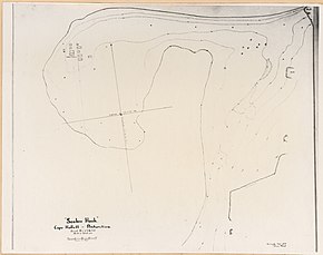
Seabee Hook
| Seabee Hook | ||
 Topografische Karte der Hallett-Halbinsel (Mitte rechts) mit dem Seabee Hook nahe dem Kap Hallett | ||
| Geographische Lage | ||
| Koordinaten | 72° 19′ S, 170° 13′ O | |
| Lage | Viktorialand, Ostantarktika | |
| Küste | Borchgrevink-Küste | |
| Gewässer | Moubray Bay | |
| Gewässer 2 | Edisto Inlet | |
 | ||
Der Seabee Hook ist eine flache, hakenförmige Landspitze aus grober Vulkanasche an der Borchgrevink-Küste des ostantarktischen Viktorialands. Sie liegt 800 m westlich eines hohen und felsigen Bergkamms, der das Kap Hallett am nördlichen Ausläufer der Hallett-Halbinsel bildet.
Teilnehmer der ersten Operation Deep Freeze der United States Navy nahmen im Januar 1956 eine Vermessung von Bord des Eisbrechers USCGC Edisto vor. Benannt ist die Landspitze nach der englischsprachigen phonetischen Kurzform von „construction battalions“, den Bautrupps der US Navy.
Weblinks
- Seabee Hook. In: Geographic Names Information System. United States Geological Survey, United States Department of the Interior, archiviert vom (englisch).
- Seabee Hook auf geographic.org (englisch)
Auf dieser Seite verwendete Medien
Autor/Urheber: Alexrk2, Lizenz: CC BY-SA 3.0
Physische Positionskarte Antarktis, Mittabstandstreue Azimutalprojektion
plan of Hallett Station near Cape Hallett, Victoria Land, Ross Dependency, East Antarctica
1:250,000-scale topographic reconnaissance map of the Cape Hallet area from 159°-162°E to 71°-72°S in Antarctica, including the Tucker Glacier. Mapped, edited and published by the U.S. Geological Survey in cooperation with the National Science Foundation.


