Rockingham County (New Hampshire)
 Rockingham County Courthouse | |
| Verwaltung | |
|---|---|
| US-Bundesstaat: | New Hampshire |
| Verwaltungssitz: | Exeter, Brentwood |
| Gründung: | 1769 |
| Demographie | |
| Einwohner: | 314.176 (Stand: 2020) |
| Bevölkerungsdichte: | 174,54 Einwohner/km2 |
| Geographie | |
| Fläche gesamt: | 2056 km² |
| Wasserfläche: | 256 km² |
| Karte | |
| Website: www.rockinghamcountynh.org | |
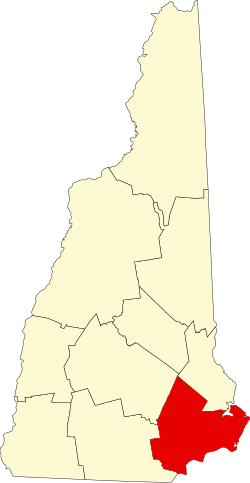
Rockingham County[1] ist ein County im Bundesstaat New Hampshire der Vereinigten Staaten mit 314.176 Einwohnern im Jahr 2020.[2] Der Verwaltungssitz (County Seat) ist Exeter. Teile der Verwaltung sind auch in Brentwood ansässig. Benannt ist es nach Charles Watson-Wentworth, 2. Marquess of Rockingham.
Geschichte
Zwölf Orte im County haben den Status einer National Historic Landmark.[3] 121 Bauwerke und Stätten des Countys sind insgesamt im National Register of Historic Places eingetragen (Stand 15. Februar 2018).[4]
Bevölkerungsentwicklung
| Jahr | 1980 | 1990 | 2000 | 2010 | 2020 |
|---|---|---|---|---|---|
| Einwohner | 190.047 | 245.845 | 277.359 | 295.223 | 314.176 |
Geographie
Das County hat eine Fläche von 2056 Quadratkilometern. Davon sind 256 Quadratkilometer (12,5 Prozent) Wasserflächen.
- Nachbar-Counties
- Strafford County, Norden
- York County (Maine), Nordosten
- Essex County (Massachusetts), Süden
- Hillsborough County, Westen
- Merrimack County, Nordwesten
Städte und Gemeinden
Rockingham County teilt sich in eine city und 36 towns, beide Begriffe werden im Deutschen mit Stadt übersetzt. Angegeben sind die Einwohnerzahlen der Volkszählung von 2020.[2]
- Cities
- Portsmouth, 21.956
- Towns
|
|
|
Weblinks
Einzelnachweise
- ↑ GNIS-ID: 873181. Abgerufen am 22. Februar 2011 (englisch).
- ↑ a b Decennial Census 2020. US Census Bureau, abgerufen am 4. Oktober 2021.
- ↑ Listing of National Historic Landmarks by State: New Hampshire. National Park Service, abgerufen am 15. Februar 2018.
- ↑ Suchmaske Datenbank im National Register Information System. National Park Service, abgerufen am 15. Februar 2018.
Koordinaten: 42° 59′ N, 71° 5′ W
Auf dieser Seite verwendete Medien
This is a locator map showing Rockingham County in New Hampshire. For more information, see Commons:United States county locator maps.
Autor/Urheber: John Phelan, Lizenz: CC BY-SA 3.0
Rockingham County Courthouse, Brentwood New Hampshire


