Rio Verde (Arizona)
| Rio Verde | |
|---|---|
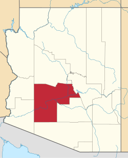
Lage im County und in Arizona | |
| Basisdaten | |
| Staat: | Vereinigte Staaten |
| Bundesstaat: | Arizona |
| County: | Maricopa County |
| Koordinaten: | 33° 43′ N, 111° 41′ W |
| Zeitzone: | Mountain Standard Time (UTC−7) |
| Einwohner: | 2.210 (Stand: 2020) |
| Haushalte: | 1.282 (Stand: 2020) |
| Fläche: | 14,0 km² (ca. 5 mi²) davon 14,0 km² (ca. 5 mi²) Land |
| Bevölkerungsdichte: | 158 Einwohner je km² |
| Höhe: | 493 m |
| Postleitzahl: | 85263 |
| Vorwahl: | +1 480 |
| FIPS: | 04-60250 |
| GNIS-ID: | 0037065 |
Rio Verde ist ein Census-designated place im Maricopa County im US-Bundesstaat Arizona. Das U.S. Census Bureau hat bei der Volkszählung 2020 eine Einwohnerzahl von 2.210[1] ermittelt.
Rio Verde hat eine Fläche von 14 km². Die Bevölkerungsdichte beträgt 158 Einwohnern pro km². Die Koordinaten sind 33°43'20" Nord, 111°40'36" West.
Einzelnachweise
- ↑ Explore Census Data Rio Verde CDP, Arizona. Abgerufen am 23. Oktober 2022.
Auf dieser Seite verwendete Medien
This map shows the incorporated areas and Indian reservation boundaries in Maricopa County, Arizona, along with water bodies and major highways and roads. Rio Verde is highlighted in red. Other incorporated cities are shown in gray, planning area borders for these cities and Indian reservation borders are shown as solid black lines. Changes from Previous Version: Updated the maps to include water bodies and to make "less boring" than the plain black/white/gray maps. Format was updated to match standards laid out by WikiProject Maps/Conventions. Map data is based on data from the following Webpage: Maricopa County Interactive GIS Map. I created this map in Inkscape.


