Ressort (Suriname)

Als Ressort (Gebiet) werden in Suriname Verwaltungseinheiten bezeichnet, in die ein Distrikt unterteilt ist. Die 10 Distrikte von Suriname sind in insgesamt 63 Ressorts gegliedert.
Innerhalb des Hauptstadtdistriktes Paramaribo bestehen die Ressorts vor allem aus Stadtteilen, in den anderen Distrikten aus einer größeren zusammenhängenden Fläche, aus Dörfern, Ortschaften und alten Plantagen. Durchschnittlich ist ein Ressort rund 2.600 km² groß und hat circa 8.000 Einwohner. Obwohl alle Ressorts in Paramaribo von ihrer Fläche her klein sind, ist die Anzahl der Einwohner per Ressort hier im Allgemeinen wesentlich höher als im dünn besiedelten Binnenland.
Die Regionale Verwaltung wird im Grundgesetz von Suriname ab Artikel 159 geregelt. Hiernach ist der Ressortrat formell das höchste Organ eines Ressorts. Die Ratsmitglieder werden wie die Mitglieder des Distriktsrates und die Abgeordneten der Nationalversammlung von Suriname (De Nationale Assemblée) für einen Zeitraum von fünf Jahren gewählt.
Die 63 Ressorts nach Distrikten
 |
|  |
| |
 |
|  | ||
 |
|  |
| |
 |
|  |
| |
 |
|  |
|
Weblinks
- Dezentralisation in Suriname, u. a. Finanzierungspläne von Projekten in den Distrikten und Ressorts (niederländisch, englisch)
Auf dieser Seite verwendete Medien
Autor/Urheber: SurinameCentral, Lizenz: CC BY-SA 4.0
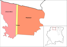
Map of the resorts of the Nickerie district in Suriname
Autor/Urheber: SurinameCentral, Lizenz: CC BY-SA 4.0
Map of the resorts of the Saramacca district in Suriname
Autor/Urheber: SurinameCentral, Lizenz: CC BY-SA 4.0
Map of the resorts of the Coronie district in Suriname
Autor/Urheber: SurinameCentral, Lizenz: CC BY-SA 4.0
Map of the resorts of the Brokopondo district in Suriname
Autor/Urheber: SurinameCentral, Lizenz: CC BY-SA 4.0
Map of the resorts of the Wanica district in Suriname
Autor/Urheber: SurinameCentral, Lizenz: CC BY-SA 4.0
Map of the resorts of the Marowijne district in Suriname
Autor/Urheber: SurinameCentral, Lizenz: CC BY-SA 4.0
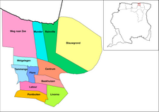
Map of the resorts of the Commewijne district in Suriname
Autor/Urheber: SurinameCentral, Lizenz: CC BY-SA 4.0
Map of the resorts of Paramaribo in Suriname
Autor/Urheber: SurinameCentral, Lizenz: CC BY-SA 4.0
Map of Suriname showing all the resorts. The resort of Paramaca in Sipaliwini is now Added along with the Disputed areas. Others maps did not show the resort of Paramaca and the disputed areas were left out. this is a neutral version of that map.
Autor/Urheber: SurinameCentral, Lizenz: CC BY-SA 4.0
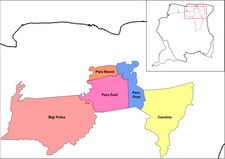
Map of the resorts of the Para district in Suriname
Autor/Urheber: SurinameCentral, Lizenz: CC BY-SA 4.0
Map of the resorts of the Sipaliwini district in Suriname. The disputed areas are shown in a neutral manner.


