Rabe (Marskrater)
| Marskrater Rabe | ||
|---|---|---|
 | ||
| Position | 43° 37′ S, 34° 55′ O | |
| Durchmesser | 107 km | |
| Eponym | Wilhelm F. Rabe | |
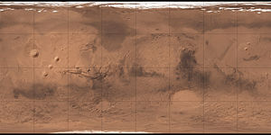
Der Krater Rabe befindet sich im südlichen Hochland des Mars. Er misst etwa 107 km im Durchmesser und wurde nach Wilhelm F. Rabe benannt.
Siehe auch
Weblinks
Auf dieser Seite verwendete Medien
Autor/Urheber: European Space Agency, Lizenz: CC BY-SA 3.0 igo
Rabe Crater is a 108 km-wide impact crater with an intricately shaped dune field. The dune material likely comprises locally eroded sediments that have been shaped by prevailing winds. Other smaller craters in the region also contain these dark deposits. One relatively young and deep crater can be seen in the upper left; as well as the dark material, channels and grooves are clearly visible in its crater walls.
The images used for this mosaic were taken by the High Resolution Stereo Camera on ESA’s Mars Express on 7 December 2005 (orbit 2441) and 9 January 2014 (orbit 12736). The scene is located at 35°E/44°S, about 320 km west of the giant Hellas impact basin in the southern highlands of Mars. The image resolution is about 15 m per pixel. North is at right (a map).
Credit: ESA/DLR/FU Berlin, CC BY-SA 3.0 IGO
Copyright Notice:
This work is licenced under the Creative Commons Attribution-ShareAlike 3.0 IGO (CC BY-SA 3.0 IGO) licence. The user is allowed to reproduce, distribute, adapt, translate and publicly perform this publication, without explicit permission, provided that the content is accompanied by an acknowledgement that the source is credited as 'ESA/DLR/FU Berlin’, a direct link to the licence text is provided and that it is clearly indicated if changes were made to the original content. Adaptation/translation/derivatives must be distributed under the same licence terms as this publication. To view a copy of this license, please visit creativecommons.org/licenses/by-sa/3.0/igo/Carte de Mars reconstituée à partir des mesures de Mars Global Surveyor (MOLA) et des observations de Viking.


