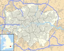
Purley (London)
Koordinaten: 51° 20′ N, 0° 7′ W
Purley ist ein Stadtteil im Londoner Borough of Croydon und liegt ca. 20 km vom Stadtzentrum entfernt im Süden Londons. Purley hat ca. 72.000 Einwohner.
Purley gehörte bis 1965 zur Grafschaft Surrey. Im suburbanen Bereich der Agglomeration London gelegen, war Purley während der 1920er und 1930er Jahre durch ein rasantes Wachstum geprägt, da eine weitläufige Bebauung und eine landschaftlich ansprechende Umgebung hier zu finden waren. 1965 wurde Purley als Teil des District of Coulsdon and Purley nach Greater London eingemeindet.
Purley war vor dem Zweiten Weltkrieg der Wohnort von Joachim von Ribbentrop während seiner Amtszeit als Deutscher Botschafter im Vereinigten Königreich.
Weblinks
Auf dieser Seite verwendete Medien
Contains Ordnance Survey data © Crown copyright and database right, CC BY-SA 3.0
Map of Greater London, UK with the following information shown:
- Administrative borders
- Coastline, lakes and rivers
- Roads and railways
- Urban areas
Equirectangular map projection on WGS 84 datum, with N/S stretched 160%
Geographic limits:
- West: 0.57W
- East: 0.37E
- North: 51.72N
- South: 51.25N

