Pulau Sangai
| Pulau Sangai | ||
|---|---|---|
Photo by CEphoto, Uwe Aranas or alternatively © CEphoto, Uwe Aranas, CC BY-SA 3.0 | ||
| Gewässer | Sulusee | |
| Geographische Lage | 5° 45′ 27″ N, 118° 1′ 14″ O | |
| Länge | 330 m | |
| Breite | 110 m | |
| Fläche | 3 ha | |
| Höchste Erhebung | 15 m | |
Pulau Sangai, auch Pulau Shanghai genannt, ist eine zu Malaysia gehörende Insel in der Sulusee und liegt im nördlichen Teil der Sandakan-Bucht, 500 Meter östlich von Pulau Timbang.[1]
Beschreibung
Die etwa 3 Hektar große Insel[Anm. 1] erstreckt sich über eine Länge von 330 Metern und ist bis zu 110 Meter breit. Die Insel ist komplett bewaldet und erhebt sich bis zu 15 Meter aus dem Meer. Im Südwesten liegt ein Fischerdorf.
Weblinks
Einzelnachweise
- ↑ Staatliches Vermessungsamt Malaysia (JUPEM): Topographische Karte 1:50 000, Blatt 37 "Sandakan"; Ausgabe 1-PPNM, 2002
Anmerkungen
- ↑ Der Wert wurde annähernd durch Flächenbestimmung der Satellitenaufnahme von google-Maps ermittelt
Auf dieser Seite verwendete Medien
Autor/Urheber: Uwe Dedering, Lizenz: CC BY-SA 3.0
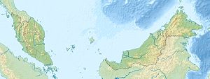
Location map of Malaysia.
Equirectangular projection. Strechted by 100.0%. Geographic limits of the map:
* N: 8.0° N
* S: 0.0° N
* W: 99.0° E
* E: 120.0° E
Made with Natural Earth. Free vector and raster map data @ naturalearthdata.com.
Photo by CEphoto, Uwe Aranas or alternatively © CEphoto, Uwe Aranas, CC BY-SA 3.0
Sandakan, Sabah: Pulau Sangai in Sandakan Bay, seen from Kampung Bahagian
Flag of the Malaysian state Sabah. Based on a GIF from a government website, colors from a photo. Drawn by Mysid. The flag was adopted September 16, 1988.
- The mountain on the left is Mount Kinabalu.
Per the Constitution of the State of Sabah:
"The State Flag is in a rectangular shape and is in the proportion of 1:2. The canton which extends at the head half way to the fly and 2/3 at the hoist to the foot is in Icicle Blue (C1T9) as the background to a graphic silhouette of Mount Kinabalu which is in Royal Blue (B10) positioned at ¼ of the height of the canton from end to end. The fly of the flag is divided equally into three bands of colours the foot division of which extends right to the hoist. The top band is in Zircon Blue (C5T5) the second band is in white and the third band is in Chili Red (S6R4)."


