Pulau Mantanani
| Pulau Mantanani | ||
|---|---|---|
| Gewässer | Südchinesisches Meer | |
| Geographische Lage | 6° 42′ N, 116° 21′ O | |
| Anzahl der Inseln | 3 | |
| Hauptinsel | Mantanani Besar | |
| Gesamte Landfläche | 4 km² | |
Die Mantanani-Inseln (malay.: Pulau Mantanani) sind eine zu Malaysia gehörende Inselgruppe im Südchinesischen Meer nordwestlich von Borneo. Sie liegen etwa zwei Kilometer vor der Küste bei Kota Belud im malaysischen Bundesstaat Sabah.
Die größte Insel ist Mantanani Besar, 3 km lang und bis zu 1,5 km breit, mit einem größeren und einem kleineren Dorf. Etwas westlich davon liegt die kleine, runde und unbewohnte Felsinsel Lungisan. 3 km weiter im Westen liegt das langgestreckte, unbewohnte Mantanani Kecil, 2,7 km lang, sehr schmal und unbewohnt. Die Hauptinsel wird von Touristen besucht, die Sporttauchen sowie Vögel und insbesondere Dugongs beobachten.
Mantanani Besar ist von Kota Belud mit der Fähre zu erreichen.[1]
Geschichte
Die North Borneo Chartered Company versuchte ab 1881 in Nord-Borneo eine Kolonie zu etablieren, erweiterte dieses Gebiet und erwarb im April 1885 die Mantani-Inseln. 1888 wurde Nord-Borneo ein Protektorat von Großbritannien. Die Verwaltung blieb bei der British North Borneo Company; die englische Krone behielt sich lediglich die Außenpolitik vor.
Einzelnachweise
Auf dieser Seite verwendete Medien
Autor/Urheber: Uwe Dedering, Lizenz: CC BY-SA 3.0
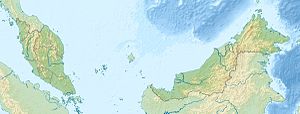
Location map of Malaysia.
Equirectangular projection. Strechted by 100.0%. Geographic limits of the map:
* N: 8.0° N
* S: 0.0° N
* W: 99.0° E
* E: 120.0° E
Made with Natural Earth. Free vector and raster map data @ naturalearthdata.com.
Flag of the Malaysian state Sabah. Based on a GIF from a government website, colors from a photo. Drawn by Mysid. The flag was adopted September 16, 1988.
- The mountain on the left is Mount Kinabalu.
Per the Constitution of the State of Sabah:
"The State Flag is in a rectangular shape and is in the proportion of 1:2. The canton which extends at the head half way to the fly and 2/3 at the hoist to the foot is in Icicle Blue (C1T9) as the background to a graphic silhouette of Mount Kinabalu which is in Royal Blue (B10) positioned at ¼ of the height of the canton from end to end. The fly of the flag is divided equally into three bands of colours the foot division of which extends right to the hoist. The top band is in Zircon Blue (C5T5) the second band is in white and the third band is in Chili Red (S6R4)."

