Pulau Batik
| Pulau Batik | ||
|---|---|---|
 | ||
| Gewässer | Celebessee | |
| Geographische Lage | 4° 43′ N, 118° 27′ O | |
| Länge | 4,9 km | |
| Breite | 2 km | |
| Fläche | 3,4 | |
| Höchste Erhebung | 245 m | |
| Einwohner | 10 | |
Pulau Batik ist eine zu Malaysia gehörende Insel in der zur Celebessee offenen Darvel Bay. Die dicht bewaldete Insel liegt etwa 11 Kilometer östlich von Kunak. Die unregelmäßig geformte Insel erstreckt sich in Ost-West-Richtung etwa 3,5 Kilometer und in Nord-Süd-Richtung etwa 2 Kilometer.[Anm. 1] Von der Küste steigt die Insel allseitig an und erreicht eine Höhe von bis zu 245 m. Die Insel ist im Süden durch eine schmale Meerenge von der Insel Pulau Timbun Mata getrennt.[1]
Regenwaldschutzgebiet
Die Insel ist seit dem 1. Januar 1984 als Regenwaldschutzgebiet (Virgin Jungle Reserve) ausgewiesen.[2] Am östlichen Zipfel der Insel befindet sich eine Polizeistation.
Tauchtourismus
Das küstennahe Gewässer vor der Südostseite der Insel wird seit einiger Zeit als Tauchgebiet beworben. Die Tauchplätze befinden sich in Sichtweite der Polizeistation.[3]
Anmerkungen
- ↑ Die Werte wurden annähernd durch Auswertung der Satellitenaufnahme von google-Maps ermittelt.
Einzelnachweise
- ↑ Sailing Directions (Enroute) - Borneo, Jawa, Sulawesi and NUsa Tenggara. (Memento des vom 4. März 2016 im Internet Archive) Info: Der Archivlink wurde automatisch eingesetzt und noch nicht geprüft. Bitte prüfe Original- und Archivlink gemäß Anleitung und entferne dann diesen Hinweis. (PDF; 5,8 MB) United States Navy Publication 163, Sektor 10, 2002, S. 287; abgerufen am 24. August 2012
- ↑ Datenbank −Marine Protected Areas. mpaglobal.org; abgerufen am 26. August 2012
- ↑ Batik Island. borneospeedydive.com; abgerufen am 26. August 2012
Auf dieser Seite verwendete Medien
Autor/Urheber: Uwe Dedering, Lizenz: CC BY-SA 3.0
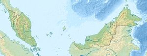
Location map of Malaysia.
Equirectangular projection. Strechted by 100.0%. Geographic limits of the map:
* N: 8.0° N
* S: 0.0° N
* W: 99.0° E
* E: 120.0° E
Made with Natural Earth. Free vector and raster map data @ naturalearthdata.com.
Flag of the Malaysian state Sabah. Based on a GIF from a government website, colors from a photo. Drawn by Mysid. The flag was adopted September 16, 1988.
- The mountain on the left is Mount Kinabalu.
Per the Constitution of the State of Sabah:
"The State Flag is in a rectangular shape and is in the proportion of 1:2. The canton which extends at the head half way to the fly and 2/3 at the hoist to the foot is in Icicle Blue (C1T9) as the background to a graphic silhouette of Mount Kinabalu which is in Royal Blue (B10) positioned at ¼ of the height of the canton from end to end. The fly of the flag is divided equally into three bands of colours the foot division of which extends right to the hoist. The top band is in Zircon Blue (C5T5) the second band is in white and the third band is in Chili Red (S6R4)."Autor/Urheber: Cccefalon; Pushpin: McSush, Lizenz: CC BY-SA 3.0
Sabah: Scheme of Islands in the Darvel Bay with Pushpin Marker for Pulau Batik


