Provinzen von Simbabwe

Simbabwe ist in zehn Provinzen unterteilt, von denen zwei als Metropolprovinzen („metropolitan provinces“) bezeichnet werden.[1]
| Name | Verwaltungs- sitz | Einwohner (2022)[2] | Fläche (km²)[3] | Bevölkerungs- dichte (Ew./km²)[2] | Karte |
|---|---|---|---|---|---|
| Provinz Bulawayo | Bulawayo | 665.952 | 479 | 1390 |  |
| Provinz Harare | Harare | 2.427.231 | 872 | 2783 |  |
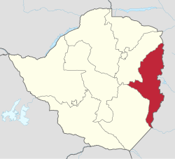
| Provinz Manicaland | Mutare | 2.037.703 | 36.459 | 56 |  |
| Provinz Mashonaland Central | Bindura | 1.384.891 | 28.347 | 49 |  |
| Provinz Mashonaland East | Marondera | 1.731.173 | 32.230 | 54 |  |
| Provinz Mashonaland West | Chinhoyi | 1.893.584 | 57.441 | 33 |  |
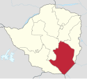
| Provinz Masvingo | Masvingo | 1.638.528 | 56.566 | 29 |  |
| Provinz Matabeleland North | Lupane | 827.645 | 75.025 | 11 | |
| Provinz Matabeleland South | Gwanda | 760.345 | 54.172 | 14 |  |
| Provinz Midlands | Gweru | 1.811.905 | 49.166 | 37 |  |
| Simbabwe gesamt | Harare | 15.178.957 | 390.757 | 39 |
Weblinks
Einzelnachweise
- ↑ Provinces. In: Official Government of Zimbabwe Web Portal. Abgerufen am 9. April 2021.
- ↑ a b Statistisches Amt Simbabwe, Seite 6
- ↑ Census 2012 – Preliminary Report. Nationale Statistikbehörde Simbabwes, abgerufen am 7. August 2018 (englisch).
Auf dieser Seite verwendete Medien
Autor/Urheber:
- Zimbabwe adm location map.svg: NNW
- this file: Furfur
Verwaltungsgliederung von Simbabwe: Lage von Masvingo.
Autor/Urheber:
- Zimbabwe adm location map.svg: NNW
- this file: Furfur
Verwaltungsgliederung von Simbabwe: Lage von Harare
Autor/Urheber:
- Zimbabwe adm location map.svg: NNW
- this file: Furfur
Verwaltungsgliederung von Simbabwe: Lage von Bulawayo.
Autor/Urheber:
- Zimbabwe adm location map.svg: NNW
- this file: Furfur
Verwaltungsgliederung von Simbabwe: Lage von Matabeleland North.
Autor/Urheber:
- Zimbabwe adm location map.svg: NNW
- this file: Furfur
Verwaltungsgliederung von Simbabwe: Lage von Manicaland South.
Autor/Urheber:
- Zimbabwe adm location map.svg: NNW
- this file: Furfur
Verwaltungsgliederung von Simbabwe: Lage von Midlands.
Autor/Urheber:
- Zimbabwe adm location map.svg: NNW
- this file: Furfur
Verwaltungsgliederung von Simbabwe: Lage von Mashonaland East.
Autor/Urheber:
- Zimbabwe adm location map.svg: NNW
- this file: Furfur
Verwaltungsgliederung von Simbabwe: Lage von Mashonaland West.
Autor/Urheber:
- Zimbabwe adm location map.svg: NNW
- this file: Furfur
Verwaltungsgliederung von Simbabwe: Lage von Mashonaland Central.
Autor/Urheber:
- Zimbabwe adm location map.svg: NNW
- this file: Furfur
Verwaltungsgliederung von Simbabwe.
Autor/Urheber:
- Zimbabwe adm location map.svg: NNW
- this file: Furfur
Verwaltungsgliederung von Simbabwe: Lage von Matabeleland South.


