Portal:Antarktis/Exzellentes Bild

Alle Bilder, die zur Auswahl stehen:


(c) vector version Masur, CC BY-SA 2.5
(c) Pismire, CC BY-SA 3.0


Auf dieser Seite verwendete Medien
Colony of aptenodytes patagonicus.jpg
(c) Pismire, CC BY-SA 3.0
Große Kolonie (rund 60.000 Brutpaare) von Königspinguinen (Aptenodytes patagonicus) bei Salisbury Plain in Südgeorgien.
(c) Pismire, CC BY-SA 3.0
Große Kolonie (rund 60.000 Brutpaare) von Königspinguinen (Aptenodytes patagonicus) bei Salisbury Plain in Südgeorgien.
Amundsen-Scott marsstation ray h edit.jpg
A full moon and 25 second exposure allowed sufficient light into this photo taken at Amundsen-Scott South Pole Station during the long Antarctic night. The new station can be seen at far left, power plant in the center and the old mechanic's garage in the lower right. Red lights are used outside during the winter darkness as their spectrum does not pollute the sky, allowing scientists to conduct astrophysical studies without artificial light interference. There is a background of green light. This is the Aurora Australis, which dances through the sky virtually all the time during the long Antarctic night (winter).The photo's surreal appearance makes the station look like a futuristic Mars Station.
A full moon and 25 second exposure allowed sufficient light into this photo taken at Amundsen-Scott South Pole Station during the long Antarctic night. The new station can be seen at far left, power plant in the center and the old mechanic's garage in the lower right. Red lights are used outside during the winter darkness as their spectrum does not pollute the sky, allowing scientists to conduct astrophysical studies without artificial light interference. There is a background of green light. This is the Aurora Australis, which dances through the sky virtually all the time during the long Antarctic night (winter).The photo's surreal appearance makes the station look like a futuristic Mars Station.
Amundsen-in-ice.jpg
Roald Amundsen ved Svartskog, Bunnefjorden, 7. mars 1909
Roald Amundsen ved Svartskog, Bunnefjorden, 7. mars 1909
Fryxellsee Opt.jpg
Antarctica: The blue ice covering Lake Fryxell, in the Transantarctic Mountains, comes from glacial meltwater from the Canada Glacier and other smaller glaciers. The freshwater stays on top of the lake and freezes, sealing in briny water below.
Antarctica: The blue ice covering Lake Fryxell, in the Transantarctic Mountains, comes from glacial meltwater from the Canada Glacier and other smaller glaciers. The freshwater stays on top of the lake and freezes, sealing in briny water below.
Falkland Islands topographic map-en.svg
Autor/Urheber: , Lizenz: CC BY-SA 3.0
The Falkland Islands are an archipelago in the South Atlantic Ocean, located 300 miles off the coast of Argentina. They consist of two main islands, East Falkland and West Falkland, together with about 700 smaller islands. Stanley, on East Falkland, is the capital and largest city. The islands are a self-governing Overseas Territory of the United Kingdom.
Mt Herschel, Antarctica, Jan 2006.jpg
Autor/Urheber: Andrew Mandemaker, Lizenz: CC BY-SA 2.5
Mt Herschel (3335m asl) from Cape Hallet with Seabee Hook penguin colony in Foreground. Antarctica.
Autor/Urheber: Andrew Mandemaker, Lizenz: CC BY-SA 2.5
Mt Herschel (3335m asl) from Cape Hallet with Seabee Hook penguin colony in Foreground. Antarctica.
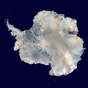
Antarctica 6400px from Blue Marble.jpg
Antarctica. An orthographic projection of NASA's Blue Marble data set (1 km resolution global satellite composite). "MODIS observations of polar sea ice were combined with observations of Antarctica made by the National Oceanic and Atmospheric Administration’s AVHRR sensor—the Advanced Very High Resolution Radiometer." Image was generated using a custom C program for handling the Blue Marble files, with orthographic projection formulas from MathWorld.
Note: this image has been manually modified to fill in an area of black pixels in the ocean, in the upper right quadrant. The black pixels are presumed to be due to missing data in the land/sea mask used in making the original Blue Marble image.
Coat of arms of the British Antarctic Territory.svg
(c) vector version Masur, CC BY-SA 2.5
Coat of arms of the British Antarctic Territory.
(c) vector version Masur, CC BY-SA 2.5
Coat of arms of the British Antarctic Territory.
Underwater mcmurdo sound.jpg
Dieser Bereich einer Eiswand und des Ozeanbodens bei Explorer's Cover, New Harbor, McMurdo-Sund grenzt an eine ferngesteuerte Foto-Anlage. Eine Unterwasser-Kamera ist mit Einrichtungen an Land verkabelt, die Bilder per Funk in das Internet übertragen.
Dieser Bereich einer Eiswand und des Ozeanbodens bei Explorer's Cover, New Harbor, McMurdo-Sund grenzt an eine ferngesteuerte Foto-Anlage. Eine Unterwasser-Kamera ist mit Einrichtungen an Land verkabelt, die Bilder per Funk in das Internet übertragen.
Im Wesentlichen sind folgende Arten zu sehen:
- die Kammmuschel Adamussium colbecki
- der Seeigel Sterechinus neumayeri
- der stängelförmige Schwamm Homaxinella balfourensis
- der Schlangenstern Ophionotus victoriae
- Colossendeiden unbekannter Artzugehörigkeit (Colossendeis sp.)


