Plan de Turgot

Der Plan de Turgot (französisch, deutsch Plan von Turgot) ist eine detailgetreue Darstellung der Stadt Paris, die 1734 bis 1736 auf Anregung des von 1729 bis 1740 amtierenden Prévôt des marchands de Paris Michel-Étienne Turgot (1690–1751) entstand.

Aufbau des Kartenwerkes
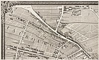
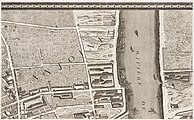
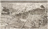
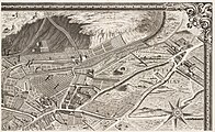
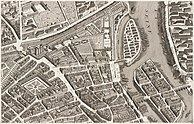
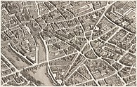
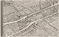
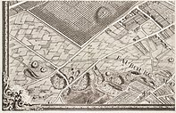
Turgots Plan von Paris wurde im Jahre 1739 als Atlas veröffentlicht. Die insgesamt zwanzig Tafeln zeigen in nicht überlappenden isometrischen Darstellungen die französische Hauptstadt in der Sicht nach Südosten. Der Plan Turgot hat den Maßstab von ca. 1:400. In originalgetreuer Wiedergabe sind die Gebäude, die Straßen und Plätze sowie die Gärten und Parkanlagen der Stadt zu sehen.
Jede Tafel besteht aus einem rechteckigen Bild von 50 cm Höhe und 80 cm Breite, das im Atlas in der Mitte gefaltet war. Der aus den Tafeln zusammengesetzte Gesamtplan ist 250,5 cm hoch und 322,5 cm breit. Der Atlas umfasst in etwa das Gebiet der heutigen ersten 11 Arrondissements von Paris.
Entstehungs- und Fertigungsgeschichte
Der französische Architekt und Kartograph Louis Bretez († 1736) durfte die Villen, Häuser und Gärten betreten, um Maß zu nehmen und sie zu erfassen. Er arbeitete an dem Projekt zwei Jahre, von 1734 bis 1736. Im Jahre 1736 begann Claude Lucas (1685–1765), Graveur und Mitglied der Académie des Sciences damit, nach den 21 gezeichneten Vorlagen die Drucktafeln zu stechen. Der Plan erschien 1739.
 |  |  |  |
 |  |  |  |
 |  |  |  |
 |  |  |  |
 |  |  | |
Literatur
- Jean Boutier: Les plans de Paris des origines (1493 à la fin du XVIIIe, étude), cartobibliographie et catalogue collectif, Paris, BNF, (2002) S. 252–256
- Jean-Yves Sarazin: Le Paris des Lumières d’après le plan de Turgot (1734–1739), mit Alfred Fierro, Paris, RMN, (2005) S. 144
- Le plan de Paris dit de Turgot, Édition 2005, fac-similé, Paris, RMN-Chapitre.com, accompagné d’une notice de 16 p. cosignée Jean-Yves Sarazin et Laure Beaumont-Maillet.
Weblinks
- Turgot's Plan de Paris, David Rumsey Historical Map Collection (82079 × 65656 pixels)
- Plan Turgot - Planche n° 15 - Palais-Royal, Louvre et Tuileries. 2008, archiviert vom am 5. März 2016; abgerufen am 13. Mai 2021 (französisch).
- Michel Turgot (1690-1751), Plan de Paris, vingt doubles planches et un plan général, d’après les dessins de Louis Bretez. Archiviert vom am 25. September 2017; abgerufen am 13. Mai 2021 (französisch).
- Digitalisat des Planes in den Digitalen Sammlungen der Herzogin Anna Amalia Bibliothek
Auf dieser Seite verwendete Medien
Turgot map of Paris, a highly accurate and detailed map of the city of Paris as it appeared in 1734–1736.
Turgot map of Paris, a highly accurate and detailed map of the city of Paris as it appeared in 1734–1736.
Turgot map of Paris, a highly accurate and detailed map of the city of Paris as it appeared in 1734–1736.
Turgot map of Paris, a highly accurate and detailed map of the city of Paris as it appeared in 1734–1736.
Turgot map of Paris, a highly accurate and detailed map of the city of Paris as it appeared in 1734–1736.
Turgot map of Paris, a highly accurate and detailed map of the city of Paris as it appeared in 1734–1736.
Turgot map of Paris, a highly accurate and detailed map of the city of Paris as it appeared in 1734–1736.
Turgot map of Paris, a highly accurate and detailed map of the city of Paris as it appeared in 1734–1736.
Turgot map of Paris, a highly accurate and detailed map of the city of Paris as it appeared in 1734–1736.
Autor/Urheber: Louis-Michel van Loo , Lizenz: CC BY-SA 3.0
Turgot map of Paris, a highly accurate and detailed map of the city of Paris as it appeared in 1734–1736.
Turgot map of Paris, a highly accurate and detailed map of the city of Paris as it appeared in 1734–1736.
Turgot map of Paris, a highly accurate and detailed map of the city of Paris as it appeared in 1734–1736.
Turgot map of Paris, a highly accurate and detailed map of the city of Paris as it appeared in 1734–1736.
Turgot map of Paris, a highly accurate and detailed map of the city of Paris as it appeared in 1734–1736.
Turgot map of Paris, a highly accurate and detailed map of the city of Paris as it appeared in 1734–1736.
Turgot map of Paris, a highly accurate and detailed map of the city of Paris as it appeared in 1734–1736.
Turgot map of Paris, a highly accurate and detailed map of the city of Paris as it appeared in 1734–1736.
Turgot map of Paris, a highly accurate and detailed map of the city of Paris as it appeared in 1734–1736.
In marked contrast to the small, single-page city views appearing in late 16th and 17th century town atlases, were large, multi-sheet wall maps and birds eye views published during the 18th century. These richly detailed urban images depicted Europes largest and most important cities, such as London, Dublin, Rome, Vienna, and Paris. Displayed here is one page from a 20-sheet view of Paris, drawn from a birds eye perspective. Commissioned in 1734 by Michel Etienne Turgot, Prevot des Marchands (chief merchant or as we might say today, head of the chamber of commerce), this view was prepared by Louis Bretez, a sculptor, painter, and specialist in perspective. It took him five years to complete and publish this large-scale drawing of Frances capital city. Bretez constructed the drawing as if the city was being viewed from the northwest, looking southeast, with the Seine River running through the middle of his composition. He also places Éle de la Cité and Éle St. Louis, the historic heart of the city, near the center of the image. The twenty sheets are placed together create a dramatic wall map measuring approximately eight by ten feet. Such a presentation, as depicted in the composite reproduction displayed on the wall, captures the grandeur of the imperial city under the reign of Louis XV. Meanwhile, the exquisite detail which Bretez used to render individual buildings is evident in the atlas plate displayed below.
Turgot map of Paris, a highly accurate and detailed map of the city of Paris as it appeared in 1734–1736.


